GIS user technology news

Mobile, Technology, and Business news

  • PRESS
    • Submit PR
    • Top Press
    • Business
    • Software
    • Hardware
    • UAV News
    • Mobile Technology
  • FEATURES
    • Around the Web
    • Social Media Features
    • EXPERTS & Guests
    • Tips
    • Infographics
  • Events
  • CAREERS
  • Advertise
    • Advertise
    • Meet the Editor
    • Submit Press
  • Shop
  • Tradepubs
  • facebook
  • Around the Web
You are here: Home / *BLOG / Google Announces that Google Earth Pro is now free

Google Announces that Google Earth Pro is now free

February 3, 2015 By GISuser

Some good news from Google earth users as the company has made Google Earth “Pro” free…

Google earth pro

This via the Google latlong blog…

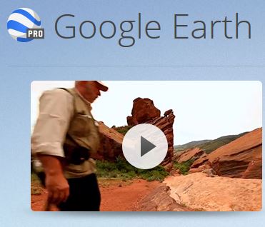
Over the last 10 years, businesses, scientists and hobbyists from all over the world have been using Google Earth Pro for everything from planning hikes to placing solar panels on rooftops. Google Earth Pro has all the easy-to-use features and detailed imagery of Google Earth, along with advanced tools that help you measure 3D buildings, print high-resolution images for presentations or reports, and record HD movies of your virtual flights around the world.

Starting today, even more people will be able to access Google Earth Pro: we’re making it available for free. To see what Earth Pro can do for you—or to just have fun flying around the world—grab a free key and download Earth Pro today. If you’re an existing user, your key will continue to work with no changes required

Source: Google lat long blog

Get Google Earth Pro HERE

See Also: Google Maps Engine depricated

Filed Under: *BLOG, Around the Web, FrontPage Leader, Software Tagged With: Google earth


Editor’s Picks

Ted Florence @Avenza

10 Question GeoGeek Rapidfire – Ted Florence @Avenza

Esri Map Book Illustrates How the US Government Uses GIS

Juniper Systems’ New Rugged Handheld Offers Unparalleled Efficiency for Data-Intensive Application

First Look – Los Angeles Opens the GeoHub – #OpenData for Citizens and Developers

See More Editor's Picks...


GIS jobs


Recent Features

Photographer Touch Reveal the Top Cameras, Lenses, and Photo Editing Tools of 2022

Digitalization and Simulation at the North Pole

Natural Gas District & GIS-Centric Asset Management

5 Ways Technology Is Affecting The Sharing Economy

Spotlight – Township Canada: Explore Canadian Legal Land Descriptions on a Map

More Posts from this Category


Post your link here!

Categories

Recent Posts

  • AI boom: don’t miss out, but avoid the frenzy
  • The Advantages of Hiring a Professional Virtual Event Production Company
  • Understanding the Benefits of HTTPS Over HTTP
  • USGIF Artificial Intelligence and Machine Learning Working Group Publishes New White Paper 
  • How to Choose the Best Accounting Firm in Singapore

RSS Career Tips

  • Four Characteristics of the Best Virtual Employees
  • 28 Tools to Conquer the Social Media Recruiting World
  • 8 Questions Employers Should Ask About Coronavirus
  • Jobcase Launches Free Unemployment Resource Center for Workers Impacted by COVID-19
  • Must-Have Gadgets and Technology for the Remote Office Worker


shop for geogeek swag


RSS Tech pubs

  • Unlocking the Power of Data: An Introduction to Analytics for Auditors
  • Benefits of Private Labeling for Nutrition/Supplement Manufacturing
  • AI and The Modern Marketer

RSS Computers

  • How the Cloud is Reshaping Virtual Desktops
  • Millennials as Brand Advocates - New Research Study Results
  • Vehicles Best Practices Installation Guide

RSS HR Tips

  • The Secret to Getting the Right Hire Using Pre-Employment Assessments for Hospitals and Healthcare--Top Platforms and Pricing
  • Boost Profits and Labor Management with Digital Labor Ops
  • Top Trends in Compensation

RSS Gov Tech

  • How to Overcome the Skills Shortage
  • The Secret Ingredient to Local Government Employee Retention
  • AI in Law: Transforming Legal Practices

RSS UAV news

  • Liverpool welcomes Eurovision with record-breaking drone show by Celestial and Drone show Technology
  • Esri Partner Pollen Systems Provides Advanced Agriculture Analytics to Farms using PrecisionView™ Mobile
  • Draganfly Fulfills Delivery of First Situational Assessment Drone for DSNS Emergency Services Department Ukraine

RSS Geojobs

  • IT Endpoint Technician
  • Help Desk Technician
  • Systems Administrator
Copyright gletham Communications 2011-2022

Go to mobile version