GIS user technology news

News, Business, AI, Technology, IOS, Android, Google, Mobile, GIS, Crypto Currency, Economics

  • Advertising & Sponsored Posts
    • Advertising & Sponsored Posts
    • Submit Press
  • PRESS
    • Submit PR
    • Top Press
    • Business
    • Software
    • Hardware
    • UAV News
    • Mobile Technology
  • FEATURES
    • Around the Web
    • Social Media Features
    • EXPERTS & Guests
    • Tips
    • Infographics
  • Blog
  • Events
  • Shop
  • Tradepubs
  • CAREERS
You are here: Home / * PRESS / Software / Creating Story Maps Just Got Easier with the New Look, ArcGIS StoryMaps Beta

Creating Story Maps Just Got Easier with the New Look, ArcGIS StoryMaps Beta

April 10, 2019 By GISuser

Do you enjoy creating Story Maps? If so, there’s something new for you to explore, the Story Maps Beta. The new, Beta resource offers a completely new experience, new UI and new look and feel of your maps.

You won’t find all the pre-defined templates that you might be used to in the original Story Maps, however, you will find a more modern, block-style editor that enables you to create clean maps that are even more mobile friendly.

The existing Story Maps experience enables users to select from a number of pre-defined templates:

story maps templates

Currently, there’s a number of pre-defined story map templates

I spent a little time testing out the Beta system and was pleasantly surprised. It really is easy and nice to use and the experience is in line with the development of all the ArcGIS apps (like Web AppBuilder and Survey123 etc…). If you’ve authored blogs using the new WordPress Gutenberg experience this will look familiar to you! The story map below is a bit of a trial that shows you a new look Story Map – 

Story Maps are a fabulous way to create compelling data visualizations and are an ideal fit in any company’s marketing mix!
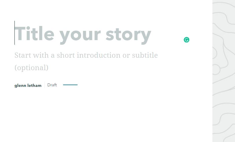
story maps beta

To build your story map simply insert element types into the design area

Finally, I had a chance to build a couple of story maps, one using the “old” system and the story Map Journal template (See first image below – click here to view the story Map). The second image shows a similar Story being told using the new, Beta system. . Which one do you prefer?

Tsunami preparedness story map built with “Old” template


with the new, Beta system

Read more about Story Map BETA HERE

If you’re interested in hearing directly from the team at Esri, be sure to consult this blog post by Allen Carrol. From Allen… “Today marks the dawn of a new era for storytelling with maps. After many months of research, planning, testing, and development, we’ve just launched a beta version of our next-generation storytelling tool. ” The whole story is told in the video below!


Try the story Maps BETA HERE


Just created our first Esri Story Map using the just released #StoryMapsBeta tool – to try out the Beta we put together a little test for #tsunamipreparednessWeek – Victoria BC, Canada Tsunami Resources Story Map https://t.co/dIZuMBuQVy #yyj pic.twitter.com/O16FxG8K7b

— Glenn Letham (@gletham) April 10, 2019

Filed Under: Maps and Cartography, Software, THE EDITOR, Top Text Lead Story Tagged With: arcgis, arcgis online, ESRI, story maps

Top Press

The Global Expansion of Aueshah: A New Era of High Jewelry

April 11, 2026 By GISuser

KARACHI, PAKISTAN. The international luxury market is experiencing a profound shift. Consumers are increasingly rejecting mass-produced goods in favor of rarity, authenticity, and emotional depth. … [Read More...]

State of Data Science Report – AI and Open Source at Work

September 10, 2025 By GISuser

AI and Open Source at Work … [Read More...]

Topcon Announces Landmark Expansion of Topnet Live Network Across USA

January 26, 2025 By GISuser

LIVERMORE, Calif.---Topcon Positioning Systems has announced a significant expansion of its Topnet Live reference station network, introducing 200 new geodetic stations strategically positioned across … [Read More...]

Space Flight Laboratory (SFL) Announces Launch and Deployment of NorSat-4 Maritime Monitoring Microsatellite

January 19, 2025 By GISuser

Seventh Satellite Developed by SFL for Norway … [Read More...]

HERE and BMW Group extend partnership on AI-powered mapping system

January 8, 2025 By GISuser

HERE and BMW Group extend partnership on AI-powered mapping system for automated driving and enhanced road safety … [Read More...]

Canadian-Built RoadEng 12 Uses AI to Find the Best Location for New Resource and Rural Roads

October 17, 2026 By GISuser

Vancouver, BC, Canada, October 15, 2026 – North Vancouver-based Softree Technical Systems today released RoadEng Version 12, used in more than 75 countries to locate and design … [Read More...]

Beyond the Map: How AI Image and Video Generation Is Changing Geospatial Communication

October 14, 2026 By GISuser

Ask anyone who has shipped a GIS project what the hardest part was, and the answer is rarely the spatial analysis. It is almost always the communication. A site suitability … [Read More...]

From Maternity to Everyday Wear: Building a Wardrobe That Grows With You

October 14, 2026 By GISuser

When I think about maternity clothing, I feel the biggest mistake is buying too many things at once. During pregnancy, your body keeps changing, and something that fits well today … [Read More...]

eMMC 5.1 Explained: Features, Performance, and Applications in Modern Devices

October 14, 2026 By GISuser

Storage technology is an essential part of modern computing, influencing how devices store information, launch applications, and manage everyday workloads. Although … [Read More...]

SFL Missions Inc. Confirms Successful Deployment of Two GHGSat Greenhouse Gas Monitoring Microsatellites

October 3, 2026 By GISuser

TORONTO, Ontario, Canada, 2 October 2026 – SFL Missions Inc. confirms the successful launch and deployment of the GHGSat-C18 (Eleanor) and GHGSat-C19 (Aidan) commercial greenhouse … [Read More...]

Copyright gletham Communications 2015 - 2026

Go to mobile version