GISuser.com

GIS and Technology news for mapping professionals

  • PRESS
    • Submit PR
    • Top Press
    • Business
    • GIS, Geo Tech Software
    • Hardware
    • UAV News
    • Mobile Technology
    • Editor’s Top Picks
    • Get TOP Listing!
  • FEATURES
    • GeoGeeksinCars
    • 10 Question Q&A
    • FROM THE EDITOR
    • SPATIAL MEDIA AUTHORS
    • Social Media Features
    • EXPERTS & Guests
    • Listicles and Top 10 Lists
    • Infographics
    • VIDEOS
  • Events
    • Webinars
    • Submit event
    • Event Media Partner
  • CAREERS
    • Career Help Articles
    • People and Career News
    • Work from Home
    • About GeoJobs.BIZ
  • About
    • Advertise
      • Advertise wth GISuser
      • Media Kit Request Form
      • Directory
      • Submit Press
    • Contact GISuser
    • Meet the Editor
    • Social Media
      • AnyGeo Blog
      • GeoGeeks Podcast
      • Social Media Features
      • Like Us
    • SpatialMedia
      • LBSzone
      • LiDAR Magazine
      • Amerisurv
      • SymbianOne
    • RSS feed
  • Blog
  • Shop
  • Cloud Hosting
    • Amazon Cloud Hosting
    • WordPress cloud hosting
    • Dedicated servers USA
    • Linux Shared Hosting
    • Windows Shared Hosting
    • Web Development
    • SSL Certificate
  • Tradepubs
You are here: Home / **Front Page / FrontPage Leader / Esri Map Book Illustrates How the US Government Uses GIS

Esri Map Book Illustrates How the US Government Uses GIS

January 22, 2015 By GISuser

Workbook for Building a More Resilient Future

How the US Government Uses GIS

How the US Government Uses GIS

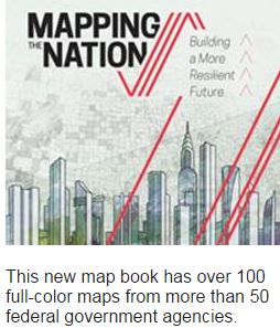
Redlands, California—January 22, 2015—The fifth book in Esri’s Mapping the Nation series, Mapping the Nation: Building a More Resilient Futureis a collection of geographic information system (GIS) mapsthat illustrate how federal government agencies rely on GIS analysis to build stronger, more resilient communities and help make the world a better place.

The print version of the book includes 118 full-color maps produced by more than 50 federal government agencies, including the US Forest Service, US Department of Defense, US Department of Education, and the Bureau of Ocean Energy Management. The digital version of Mapping the Nation offers enhanced and interactive maps and videos showcasing four start-up companies that are using ArcGIS technology in partnership with Esri and the government.

The maps depict how federal employees and officials use GIS to evaluate, plan, and respond to social, economic, and environmental concerns at local, regional, national, and global levels. Topics such as green government, economic recovery and sustainability, and climate protection show how government agencies use GIS to facilitate initiatives, improve transparency, and deliver strong business models.

Mapping the Nation: Building a More Resilient Future is available in print (ISBN: 9781589483910, 108 pages, US$19.99). The book is available at online retailers worldwide, atesri.com/esripress, or by calling 1-800-447-9778. Outside the United States, visit esri.com/esripressorders for complete ordering options, or visit esri.com/distributors to contact your local Esri distributor. Interested retailers can contact Esri Press book distributor Ingram Publisher Services.

Mapping and Apping the Nation 2015, an interactive digital adaptation of the printed map book, is available free of charge from the Esri Bookstore app on Apple iTunes and the Google Play store.

# # #

About Esri Press
Esri Press publishes books on GIS, cartography, and related topics. The complete selection of GIS titles from Esri Press can be found on the web at esri.com/esripress.

About Esri
Since 1969, Esri has been giving customers around the world the power to think and plan geographically. The market leader in GIS, Esri software is used in more than 350,000 organizations worldwide including each of the 200 largest cities in the United States, most national governments, more than two-thirds of Fortune 500 companies, and more than 7,000 colleges and universities. Esri applications, running on more than one million desktops and thousands of Web and enterprise servers, provide the backbone for the world’s mapping and spatial analysis. Esri is the only vendor that provides complete technical solutions for desktop, mobile, server, and Internet platforms. Visit us at www.esri.com.

Related Articles on GISuser:

  • City of Maple Ridge Recognized for Improving Community Engagement with GISCity of Maple Ridge Recognized for Improving Community Engagement with GIS
  • Esri Announces Big Changes to Small Government Enterprise License Agreement ProgramEsri Announces Big Changes to Small Government Enterprise License Agreement Program
  • Feature – Ten Government Workflows that Benefit from Mobilizing MapsFeature – Ten Government Workflows that Benefit from Mobilizing Maps
  • More than 30 Government Technology Solution Providers Preview News before GTEC 2014More than 30 Government Technology Solution Providers Preview News before GTEC 2014
  • Track USA Government Spending by Federal Agency – USA SpendingTrack USA Government Spending by Federal Agency – USA Spending
  • Webinar –  Comparison of 9 Open Data PortalsWebinar – Comparison of 9 Open Data Portals

Filed Under: FrontPage Leader, Government & OpenGov Tagged With: Esri Map Book, Government


Editor’s Picks

Mayor Garcetti And Esri Launch Innovative Platform That Puts Open Data To Work

First Look – Los Angeles Opens the GeoHub – #OpenData for Citizens and Developers

Have Infographics and Data Visualizations Ruined Good Map Design?

Esri Helps Developers Add Geo to Apps at TechCrunch Disrupt NY 2016

First Look – Los Angeles Opens the GeoHub – #OpenData for Citizens and Developers

See More Editor's Picks...

Connect with GISuser

  • Facebook
  • Google+
  • LinkedIn
  • RSS
  • Twitter


GIS jobs

Recent Features

Digitalization and Simulation at the North Pole

Natural Gas District & GIS-Centric Asset Management

5 Ways Technology Is Affecting The Sharing Economy

Spotlight – Township Canada: Explore Canadian Legal Land Descriptions on a Map

GeoGeeksinCars – The one in “Tippy” the right-hand drive Mitsubishi, at DevSummit

More Posts from this Category

Categories


Recent Posts

  • Best Gaming Phones for 2021
  • Everything You Need to Know About Selling on Amazon
  • Trimble Announces Rugged, Lightweight Field Data Controller for Land and Construction Surveying
  • Webinar – How to Solve Algal Blooms in Municipal Water
  • Concept3D Offers Virtual Tour and Mapping Software to Hospitality and Tourism Industry at No Cost

RSS Career Tips

  • Four Characteristics of the Best Virtual Employees
  • Jobcase Launches Free Unemployment Resource Center for Workers Impacted by COVID-19
  • 8 Questions Employers Should Ask About Coronavirus
  • Must-Have Gadgets and Technology for the Remote Office Worker
  • Must-Have Gadgets and Technology for the Remote Office Worker


shop for geogeek swag

RSS Tech pubs

  • The Human Resources Management Kit - 2021 Edition
  • The Essentials for CEOs - 2021 Kit
  • The Essentials of Cloud - 2021 Kit

RSS Computers

  • iPad CTO Kit - including the iPad Tips and Tricks Guide for IT Executives and Managers
  • The Essentials of Information Security Kit: Includes a Free PC Security Handbook - 2nd Edition eBook
  • Windows... On Speed

RSS HR Tips

  • The Human Resources Management Kit - 2021 Edition
  • A Better Alternative to the Antiquated EAPs
  • The Mental Health Pandemic: 2021's Top Employer Trend

RSS Gov Tech

  • Cyberwarfare Requires Speed, Adaptability and Visibility to Win: Enterprises Must Close the IT Operations and Security Gap
  • The New American Workplace Research Kit - Includes a Free $8.50 Book Summary
  • Next-generation Situational Awareness - How Skydio's autonomous drone solutions protect first responders

RSS UAV news

  • Global Commercial Drone Market Expected to Exceed $8.5 Billion By 2027
  • Down to Earth – Drone Lidar Surveying Reality Series Returns
  • Florida Signs Participating Addendum with DroneUp Providing Public Sector Agencies Access to Drone Services

RSS Geojobs

  • An error has occurred, which probably means the feed is down. Try again later.
Copyright Spatial Media LLC 2003 - 2015