Once again another wander around the web and some cool Geo Musings to share in an edition of the Carnival of the GeoSpatialists… cool, fun things from the GeoGeek Community – Enjoy!
URISA WA is now starting to hype this years’ 2012 Washington GIS Conference. The event will take place May 7th-9th, 2012 at the Greater Tacoma Convention and Trade Center. The theme of the event is "Communicating Spatial Knowledge". Currently the event planners are advising folks that paper submissions and presenters are being solicited. From the organizing committee… We are seeking instructors to give educational presentations and workshops on a wide range of GIS topics. All submissions are welcome and will be evaluated as a potential workshop focus. Suggested workshop topics include Transportation, Asset Management, ArcGIS Server application development, Programming, Emergency Services, GIS & Land Surveying, Mobile GIS, Metadata, Desktop GIS Apps, and Mobile GIS Apps. See complete details online HERE and follow the event on twitter @WAURISA
And another URISA tidbit, this time from URISA BC (British Columbia, Canada) as the crew is hosting an interesting full day event on Feb 16, 2012 in Burnaby BC title Open Data, So What? About the event… In this upcoming seminar, we will explore how geospatial technologies are being leveraged through open data, and how they are introduced into our daily lives both as GIS professionals and regular citizens. The event has an impressive lineup of speakers from local government, Esri Canada, local transit, and Open Data experts. All paid registrants attending this seminar will be entered for a chance to win an iPad 2 generously donated by Autodesk! See http://www.urisabc.org/gis_geoenabling_event.html
More Cloud for WeoGeo – This one is fresh from the WeoGeo blog as the crew has added even more cloud functionality to their services (See the latest release notes here – http://www.weogeo.com/developer_doc/Release_Notes.html). According to James, the new functionality means that users ordering data can have their very own data library in the cloud, meaning you have access to the data when and where you want or need it. They remind us that starting a library is possible for free, giving you 100mb of free data storage. Complete details provided in this blog post
European Cold Snap – Indeed winter has been a wild ride this year with smokin hot temperatures in many parts of the USA, tornado outbreaks in January, and a deep freeze in Europe! an interesting graphic has hit the NASA Earth Obs. Image of the day site showing the extent of the deep freeze in Europe. An amazing image as it seems that Siberia has extended her reach all the way to the Atlantic coast! See the map here

WhereCamp Hits Florida – Yes indeed, the popular WhereCamp format, along with an Ignite Spatial event is hitting Tampa Florida area this week-end Feb 10-12. Organized by the team at Spatial Networks this geeky event looks to spread some Geo awesomeness and GeoGlobalDomination to Southern Florida. Good luck to the gang and enjoy! See the event website here
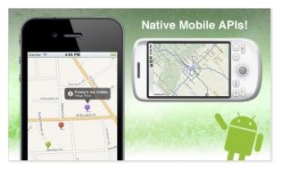
Mapquest APIs – Kudos to Mapquest for quietly rolling out a couple of new APIs for mobile developers. Via their Dev blog the company has announced new tools for developers building for iOS and Android. The APIs enable developers to create advanced routing, incorporate geocoding, use shape and image overlays and more. See more on the Mapquest dev blog and/or follow @mapquestTech
Academic Dishonesty in Canada? Yes indeed, that’s the catchy title to a blog post from the GIS in Canada blog where the team explains the need to outrun the competition is motivating a wild rush to produce more publications in less time… "the outcomes are dire including: mutual suspicion that constricts the free flow research of ideas, incomplete and sloppy scholarship enabled by quick online and other publications, and the systematic evolution of "clusters" that act as faux-gatekeepers." An interesting read HERE
The B.C. Atlas of Wellness – I have to share details of this fabulous publication. The "Atlas" is the brainchild of Dr. Peter Keller and colleagues from the University of Victoria (Keller is well known in the Canadian GIS industry and is a long time prof at U. Vic). The Atlas does an amazing job at displaying a vast amount of data and sharing some interesting variables. Conveyed in visually appealing maps and table, The Atlas is an interesting read for anyone in the Province interested in mapping health, wellness, education, and lifestyles. A truly impressive example of what one can do with publicly available data. FYI, yours truly studies GIS at U. Vic under Dr Keller in the 90s! See http://www.geog.uvic.ca/wellness/
Can I tout my own blog? If so and you happen to be a photography nut like yours truly then be sure to check out details of an impressive, new, rugged, affordable camera from Pentax. The new 16 megapixel WG-2 GPS is dustproof, waterproof, shock proof, provides HD video data capture, has a GPS module, and even has a very cool digital microscope with macro LED. Oh, and if you can believe this is starts at around $399 – see more details and specs here
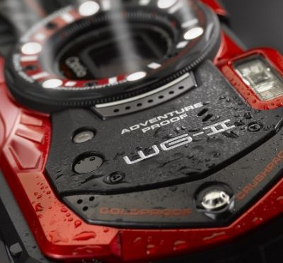
WG-2 GPS with 1080p Video
Speaking of photography, if it interest you at all you might also enjoy my fun, personal Photo/Photog blog that I maintain on Blogger, see http://mybcpics.blogspot.com/
More interesting things we picked up on:
Brian Sullivan (@taliesn) shared a pointer to an interesting FCC map that reveals US cellular/wireless dead zones
From PDX, Justin Houk @GeoPDX tipped us off to an interesting story about a a small tech firm that invited developer applicants to apply for a job via API – how clever!
The Sanborn Map Company Twitter @Sanbornmap shared a story on Mashable describing how Pinterest has become a hot social ticket for retailers – a great info graphic
See Also: