GIS user technology news

News, Business, AI, Technology, IOS, Android, Google, Mobile, GIS, Crypto Currency, Economics

  • Advertising & Sponsored Posts
    • Advertising & Sponsored Posts
    • Submit Press
  • PRESS
    • Submit PR
    • Top Press
    • Business
    • Software
    • Hardware
    • UAV News
    • Mobile Technology
  • FEATURES
    • Around the Web
    • Social Media Features
    • EXPERTS & Guests
    • Tips
    • Infographics
  • Around the Web
  • Events
  • Shop
  • Tradepubs
  • CAREERS
You are here: Home / *BLOG / Explaining Open Source Geotech and OpenGeo Components

Explaining Open Source Geotech and OpenGeo Components

March 26, 2015 By GISuser

Some great questions have been answered in a recent blog post from the OpenGeo crew. The meaty article takes a close look at the OpenGeo Suite as well as a look at the individual, OpenGeo Components. For the non-developer type like yours truly, this is an excellent and must read if you think there’s any chance you might be considering  a move to open source solutions in your mapping workflows.

Explaining Open Source Geotech and OpenGeo Components

Explaining Open Source Geotech and OpenGeo Components

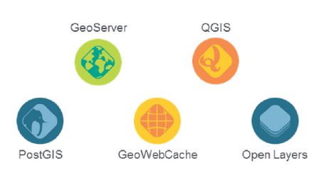
From the article… all of the components of the OpenGeo suite are open-source software projects with a community of developers behind them.

  • PostGIS – a spatial database extender for the PostgreSQL object-relational database. It adds support for geographic objects allowing location queries to be run in SQL (http://postgis.net/). TIP – see this video
  • GeoServer – GeoServer is an open source server for sharing geospatial data (http://geoserver.org/).
  • GeoWebCache – a Java web application used to cache map tiles coming from a variety of sources such as OGC Web Map Service (http://geowebcache.org/).
  • QGIS – a free and open source desktop Geographic Information System (http://www2.qgis.org/en/site/) TIP – see this how to video
  • OpenLayers – A high-performance, feature-packed library for all your web mapping needs (http://openlayers.org/)

While the specific open-source license for each varies slightly, they are all considered Free and Open Source Software (FOSS) applications without any license fees or royalties.

Great stuff! Continue reading the entire post HERE

More reading:

  • See also this video playlist from FOSS4GNA for some valuable tips!
  • A quick guide for new developers

[Tweet “Explaining Open Source Geotech and OpenGeo Components”]


Filed Under: *BLOG, Around the Web, Government & OpenGov, THE EDITOR, Tips, Top Press Tagged With: Open Source, OpenGeo, tip

Editor’s Picks

Using Lidar to Classify Landslides

Using Lidar to Classify Landslides

AutoCAD for Mac 2015 and AutoCAD LT for Mac 2015 Now Available

Have Infographics and Data Visualizations Ruined Good Map Design?

20th INTERGEO opens in Berlin!

See More Editor's Picks...

Recent Posts

  • Ultimate Guide to UGG Boots Women: Style, Comfort, and Care Tips
  • ChatGPT and Claude Built My Company’s 500+ Prompt Library — Team Productivity 10X
  • How to Become a Certified ADHD Assessor: Training and Requirements
  • What’s the Difference Between NID Prelims and Mains? Creativedge Breaks It Down
  • Coffee and Diabetes: What the Research Really Says
  • Sota Video AI: Where Real-World Motion Meets Cinematic Mastery
  • What Is an Interest Rate Increase? 
  • Playzee Casino Canada — clear, candid, and built for players
  • PartyCasino Canada: a straight-up take for players who like things clear
  • Kitchen Remodels and Additions: The Ultimate Upgrade for Modern Living

Recent Features

Space Flight Laboratory (SFL) Announces Successful Launch & Deployment of HawkEye 360’s Cluster 11

FOSS4G NA 2024: The Premier Open Source Geospatial Conference Returns to St. Louis, September 9-11

Photographer Touch Reveal the Top Cameras, Lenses, and Photo Editing Tools of 2022

Digitalization and Simulation at the North Pole

Natural Gas District & GIS-Centric Asset Management

More Posts from this Category

Categories

RSS Career Tips

  • Four Characteristics of the Best Virtual Employees
  • 28 Tools to Conquer the Social Media Recruiting World
  • 8 Questions Employers Should Ask About Coronavirus
  • Jobcase Launches Free Unemployment Resource Center for Workers Impacted by COVID-19
  • Must-Have Gadgets and Technology for the Remote Office Worker


featured podcast

RSS Tech pubs

  • The Ultimate Guide to Paying Out Tips
  • The Smart Pay Playbook
  • The Complete Guide to Cloud ERP Solutions

RSS Computers

  • How the Cloud is Reshaping Virtual Desktops
  • Millennials as Brand Advocates - New Research Study Results
  • Vehicles Best Practices Installation Guide

RSS HR Tips

  • AWS GovCloud (US) Celebrates 10th Anniversary and a Decade of Digital Transformation in the Federal Government
  • Exploring the Impact of COVID-19 on Customer Behavior
  • The Pivot to 100% Remote Training in the Contact Center

RSS Gov Tech

  • 10 Legal Jobs You Can Get Without a Law Degree
  • J.D. Power Examines How the Inflation Reduction Act Reshapes EV Landscape
  • Making Telehealth Work for You: The Ultimate Guide

Copyright Spatial Media LLC 2003 - 2015

Go to mobile version