
PORTLAND, Ore. – Skyward, A Verizon company, has signed a Memorandum of Agreement (MOA) with the Federal Aviation Administration (FAA) to test cellular-connected drones. This announcement reaffirms that drone technology like the software developed by Skyward is one of the innovations needed to empower cellular-connected drones to unlock complex operations like beyond visual line of […]
SBG Systems to host a webinar entitled “PPK for UAV Photogrammetry, THE optimal workflow to reduce GCP and maximize ROI – featuring DJI Phantom 4 RTK”

Carrières-sur-Seine, France, June 17th 2021 – SBG Systems organizes a webinar as they announce new features dedicated to UAV photogrammetry for its popular INS/GNSS PPK software called Qinertia. The webinar will explain how Qinertia can dramatically reduce GCP need and maximize ROI with an optimal workflow demonstrated with a DJI Phantom 4 RTK.
NOAA scientists use drones to see tornado damage in remote areas

After deadly tornadoes struck the Southeast in March, NOAA researchers for the first time successfully captured aerial photos and video of storm damage from hard-to-reach locations using remote-controlled, uncrewed aircraft.
DroneSense Introduces Mobile Streaming and Asset Tracking
DroneSense adds powerful features designed to provide better situational awareness to improve public safety outcomes.
Sony Expands Functionality of Camera Remote SDK and Increases Range of Compatible Models

Sony is announcing a key upgrade to its camera SDK. It’s particularly relevant to drones, e-commerce companies, mapping firms, traffic / security firms
Parrot and Rapid Imaging brings AR situational awareness to professional drone users

Advanced geospatial augmented reality overlays now compatible with ANAFI platform drones
UAS Magazine Announces 2021 UAS Summit & Expo

Produced by UAS Magazine, UAS Summit will provide attendees with a comprehensive overview of the current state of the unmanned aircraft systems industry.
Parrot and High Lander enhance drone fleet automation
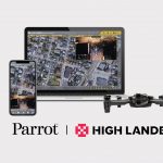
Parrot drones professional users benefit from an advanced control during complex fleet operations
NASA’s Mars Helicopter to Make First Flight Attempt Sunday

NASA’s Ingenuity Mars Helicopter is two days away from making humanity’s first attempt at powered, controlled flight of an aircraft on another planet.
Virtual Surveyor Introduces Dropbox Integration for Easy Collaboration and File Access from Anywhere

AARSCHOT, Belgium, 6 April 2021 – Virtual Surveyor has introduced Dropbox integration in Version 8.0 of its popular drone surveying software. This means Virtual Surveyor users can now access their project files from anywhere while enjoying easy and affordable collaboration with team members and file sharing with external clients – even in low-bandwidth situations.