GIS user technology news

News, Business, AI, Technology, IOS, Android, Google, Mobile, GIS, Crypto Currency, Economics

  • Advertising & Sponsored Posts
    • Advertising & Sponsored Posts
    • Submit Press
  • PRESS
    • Submit PR
    • Top Press
    • Business
    • Software
    • Hardware
    • UAV News
    • Mobile Technology
  • FEATURES
    • Around the Web
    • Social Media Features
    • EXPERTS & Guests
    • Tips
    • Infographics
  • Blog
  • Events
  • Shop
  • Tradepubs
  • CAREERS
You are here: Home / Archives for NOAA

NOAA awards $4.4 million for research on sea level rise and flooding

November 6, 2019 By GISuser

Multiyear awards to help coastal communities improve resilience

Filed Under: Business, Environment, Top Press Tagged With: contract, NOAA

NOAA increases chance for above-normal hurricane season

August 15, 2019 By GISuser

The end of El Nino could boost Atlantic hurricane activity

Filed Under: Environment, Top Text Lead Story Tagged With: hurricane, NOAA

2019 Atlantic hurricane season expected to worsen

August 13, 2019 By GISuser

New predictions prompt C Spire to redouble efforts to maintain service in the worst conditions

Filed Under: Environment Tagged With: hurricane, NOAA

NOAA Shares, February 2019 ranked fifth hottest on record for the globe

March 25, 2019 By GISuser

NOAA February 2019 ranked fifth hottest on record for the globe

March 18, 2019 – We recently concluded the second full month of 2019, and already the year to date has turned out on the warm side.

Filed Under: Environment Tagged With: NOAA, Weather

Rains to From Tropical Storm Harvey Continue over Texas, Louisiana

August 28, 2017 By GISuser

This infrared imagery from GOES-16 shows Tropical Storm Harvey earlier this morning, Monday, August 28, 2017.

Filed Under: Environment Tagged With: harvey, hurricane, NOAA, Texas

NOAA Picks Black Swift Technologies’ sUAS for Nighttime Fire Observation eXperiment (NightFOX)

August 1, 2017 By GISuser

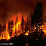
Aircraft to Provide Wildfire Measurements in Support of FIREX and Fire Weather Forecasting

Filed Under: Emergency Response, Environment, Top Press, UAV/UAS Tagged With: blackswift, NOAA, UAV

GOES-R heads to orbit, will improve weather forecasting

November 21, 2016 By GISuser

November 19, 2016 GOES-R, the first of NOAA’s highly advanced geostationary weather satellites, lifted off from Cape Canaveral, Florida, at 6:42 p.m. EST Nov 19. The satellite will boost the nation’s weather observation network and NOAA’s prediction capabilities, leading to more accurate and timely forecasts, watches and warnings.

Filed Under: Earth Imaging - Remote Sensing, Top Press Tagged With: GOES, GOES-R, NOAA

Aerojet Rocketdyne Supports Launch of NOAA’s Next-Generation Geostationary Weather Satellite

November 21, 2016 By GISuser

SACRAMENTO, Calif., Nov. 19, 2016 Aerojet Rocketdyne, a subsidiary of Aerojet Rocketdyne Holdings, Inc. (NYSE:AJRD), successfully supported the launch of the next-generation Geostationary Operational Environmental Satellite-R Series (GOES-R) for the National Oceanic and Atmospheric Administration (NOAA) and NASA.

Filed Under: Earth Imaging - Remote Sensing Tagged With: Geostationary Weather Satellite, NOAA

Esri Becomes Ambassador of NOAA and NWS Weather-Ready Nation

September 27, 2016 By Editor

GIS Role in NOAA Weather Data Portal Key to Designation

Filed Under: Business, Environment, Top Press Tagged With: climate, ESRI, NOAA

Quantum Spatial to Provide NOAA with Unmanned Aerial LiDAR and Imagery Acquisition Services

September 8, 2016 By GISuser

Data to Help NOAA Cost-Effectively Analyze Imagery and Elevation Data for National Estuarine Research Reserves

Filed Under: Business, LiDAR Tagged With: lidar, NOAA

« Previous Page
Next Page »

Recent Industry News

Aerial Surveys Int’l and Global Marketing Insights to Present GEOINT 2026 Workshop on Multi-Domain Geospatial Fusion for Automated Infrastructure Monitoring

April 24, 2026 By GISuser

Why Timing Matters More Than You Think With Spray Seal (And Why People Often Get It Slightly Wrong)

April 22, 2026 By GISuser

The Quiet Planning Stage Most People Don’t See When Building a Pool in Brisbane

April 22, 2026 By GISuser

Best Equipment Labels for Industrial Use: Ranked Systems That Survive Real-World Conditions

April 17, 2026 By GISuser

Hot News

State of Data Science Report – AI and Open Source at Work

HERE and AWS Collaborate on New HERE AI Mapping Solutions

Virtual Surveyor Adds Productivity Tools to Mid-Level Smart Drone Surveying Software Plan

Categories

Copyright gletham Communications 2015 - 2026

Go to mobile version