Hexagon AB, a global leader in sensor, software and autonomous solutions, today announced that HxGN LIVE Global 2021, its digital solutions conference, will go forward as planned as an in-person event at The Venetian in Las Vegas, Nevada, USA from 15-18 June.
Hexagon Selected for Innovate UK Rail Infrastructure Artificial Intelligence Project
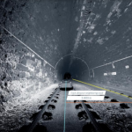
Norcross, Ga., September 1, 2020) — Innovate UK, the country’s innovation agency, has selected Hexagon’s Geospatial division to conduct a research project that will result in faster and higher-precision mapping of railway infrastructure through the use of artificial intelligence. The project is funded by Network Rail, the owner and operator of Great Britain’s railway infrastructure, […]
GNSS RTK rover with Visual Positioning increases safety, simplifies surveying
New GS18 I GNSS RTK rover with Visual Positioning can measure what you see
Hexagon adds powerful visual positioning technology to best-in-class survey-grade GNSS RTK rover
Hexagon AB, a global leader in sensors, software and autonomous solutions, today introduced the Leica GS18 I, a versatile, survey-grade GNSS RTK rover so powerful it enables you to measure what you see. It comes equipped with all the innovative functionality of the Leica GS18 T – Hexagon’s calibration-free, tilt-compensating GNSS solution immune to magnetic disturbances […]
HxGN Content Program updates 3 million square kilometres of aerial data in U.S., Europe in 2020

WASHINGTON, D.C., USA (23 June 2020) — Hexagon’s Geosystems division announced today the HxGN Content Program, the largest library of high-accuracy airborne data, is updating 3 million square kilometres in 2020 of high-accuracy four-band orthophotos, digital surface models (DSM) and stereo imagery across the United States and Europe.
Estonian Railways selects Hexagon to automate and digitize operations

Railway solutions power asset management and infrastructure maintenance
Hexagon Unveils Luciad 2020

Latest release delivers even faster and more powerful 3D visualization and analysis capabilities
Hexagon strengthens HxGN Content Program with acquisition of COWI’s mapping business
Hexagon AB, a global leader in sensor, software and autonomous solutions, today announced the signing of an agreement to acquire COWI’s aerial mapping business.
Hexagon Unveils M.App X 2020 for Enhanced Imagery Intelligence

Latest release delivers 3D display modes and accelerated visualization and analysis
Hexagon strengthens its suite of natural hazard monitoring and alarm solutions with the acquisition of Geopraevent
Hexagon AB, a global leader in sensor, software and autonomous solutions, today announced the acquisition of Geopraevent AG, a leading provider of natural hazard monitoring and alarm systems for the early detection and warning of dangerous events such as landslides, rockfalls, and avalanches.