GIS user technology news

News, Business, AI, Technology, IOS, Android, Google, Mobile, GIS, Crypto Currency, Economics

  • Advertising & Sponsored Posts
    • Advertising & Sponsored Posts
    • Submit Press
  • PRESS
    • Submit PR
    • Top Press
    • Business
    • Software
    • Hardware
    • UAV News
    • Mobile Technology
  • FEATURES
    • Around the Web
    • Social Media Features
    • EXPERTS & Guests
    • Tips
    • Infographics
  • Around the Web
  • Events
  • Shop
  • Tradepubs
  • CAREERS
You are here: Home / Archives for GIS

Geographical Information System Tackles Climate Change

May 2, 2019 By GISuser

Geographical Information System Tackles Climate Change

A GIS is designed to manipulate, analyze, capture, store, manage, and present all types of geographical information. It has become the common application to analyze spatial information regarding climate change. The nature of the geographical system implies that spatial data analysis will occur using this system.

Filed Under: Environment, EXPERTS Tagged With: climate, environment, GIS

Feature – Epic Win: Using GIS and Gaming to Save the World

September 3, 2015 By Troy Lambert

Balancing protection of the environment and the needs of a particular community is kind of like a game. Each decision affects one, the other, or both, and opens up a new set of alternatives. The answers are not always right or wrong. but instead are subjective. The more innovative the answer, the more likely it […]

Filed Under: Developer, EXPERTS, Top Features, Top Press Tagged With: developer, games, gaming, GIS

Esri Wants to Make 3D GIS Easy for Google Earth Clients With ArcGIS Earth

June 25, 2015 By GISuser

Esri Wants to Make 3D GIS Easy for Google Earth Clients With ArcGIS Earth

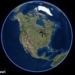
Something on the Esri blogs this week giving us a clue as to what we can expect to see on the main stage at ESRIUC this July – ArcGIS Earth – Esri’s new effort to support the transition to an ESRI solution from the Google Earth Pro environment.

Filed Under: Around the Web, Software, Top Press Tagged With: 3D, arcgis earth, ESRI, esriuc, GIS, google earth pro, Mapping

9th International Symposium on Mobile Mapping Technology (MMT 2015)

May 24, 2015 By GISuser

C:\Users\HP\Downloads\The 9th International Symposium on Mobile Mapping Technology (MMT 2015).jpg

The 9th International Symposium on Mobile Mapping Technology (MMT 2015) will be hosted by the School of Civil and Environmental Engineering, UNSW Australia, in the beautiful harbourside city of Sydney, Australia, from Wednesday the 9th to Friday the 11th December 2015.

Filed Under: Events Tagged With: Australia, event, GIS, Mapping, Mobile Mapping Technology, Symposium

New Book from Esri Teaches Geographic Information System Research Methods

April 21, 2015 By GISuser

New Book from Esri Teaches Geographic Information System Research Methods

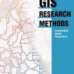
Incorporate Spatial Thinking into Scientific Research

Filed Under: EDU Tagged With: ESRI, GIS, Research Methods

Bentley Announces Forthcoming Releases of WaterCAD and WaterGEMS

January 12, 2015 By GISuser

Bentley Announces Forthcoming Releases of WaterCAD and WaterGEMS

Users of Bentley’s WaterCAD and WaterGEMS V8i products will be able to take advantage of extended information mobility across water system planning, design, and operations with the release of the SELECTseries 6 versions of these products in the first half of 2015.

Filed Under: Software, Top Press, UTILITIES Tagged With: Bentley, GIS, WaterCAD, WaterGEMS

Mapplet 7.1, Field Mapplet 7.1 and MapLibrary are now compatible with ArcGIS 10.2.1

July 30, 2014 By Editor

Spatial Wave’s New Releases, Mapplet 7.1, Field Mapplet 7.1 and MapLibrary are now compatible with ArcGIS 10.2.1

Filed Under: GIS, Geo Tech Software Tagged With: Field Mapplet 7.1 and MapLibrary are now compatible with ArcGIS 10.2.1, Geo Tech Software, GIS, Mapplet 7.1, News

CartoDB Enterprise: next-generation GIS cloud solution for groups

July 29, 2014 By Editor

The best GIS cloud tool now ready to be used by groups in the enterprise – CartoDB Enterprise enables geo-collaboration for groups. Share datasets, collaborate on visualizations, grant access to specific people on your organization, or the world

Filed Under: GIS, Geo Tech Software Tagged With: CartoDB Enterprise: next-generation GIS cloud solution for groups, Geo Tech Software, GIS, News

3DRV: Driven by Design Road Tour Takes Nationwide Pulse on 3D Technologies

July 28, 2014 By Editor

SAN FRANCISCO– After two months on the road, the 3DRV: Driven by Design road tour has begun to uncover the variety of ways that companies and individuals are using 3D design, reality capture, and fabrication technologies to shape the world around them. TJ McCue, host of the 3DRV tour and author, is also raising awareness about 3D […]

Filed Under: GIS, Geo Tech Software Tagged With: 3DRV: Driven by Design Road Tour Takes Nationwide Pulse on 3D Technologies, Geo Tech Software, GIS, News

Bringing the power of Maps Coordinate to Google Maps Engine Pro

July 25, 2014 By Editor

This comes via the Google Maps team… Last fall, we launched Maps Engine Pro to give businesses and individual users an easy-to-use tool for collaborative map creation. Using Maps Engine Pro, you can create rich, multi-layered maps, share information with stakeholders and make decisions more collaboratively. Starting today, all Maps Engine Pro users will also […]

Filed Under: GIS, Geo Tech Software Tagged With: Bringing the power of Maps Coordinate to Google Maps Engine Pro, Geo Tech Software, GIS, News

« Previous Page
Next Page »

Recent Posts

  • The Hidden Shield: How Invisible Watermarking Protects Digital Content
  • Dual Diagnosis: Why Treating Co-Occurring Mental Health and Addiction Together Is Essential for Recovery
  • Why Search Engine Optimisation Is Essential For Modern Digital Marketing
  • How to Find Safe, Affordable Access to GLP-1 Medications in 2025
  • Powerful Bonus Features Supporting Steady Progress Throughout Engaging Casino Play
  • The Power of Analytics: Turning Consumer Insights into Action
  • Cost Distribution of Hiring a Moving Company in Dubai
  • Oxyhydrogen Brazing in HVAC Systems: Fast, Clean, and Precise Copper Tube Connections
  • Moto G 5G Screen Replacement Cost: Complete Guide
  • When Local Cravings Meet Instant Convenience

Recent Features

Space Flight Laboratory (SFL) Announces Successful Launch & Deployment of HawkEye 360’s Cluster 11

FOSS4G NA 2024: The Premier Open Source Geospatial Conference Returns to St. Louis, September 9-11

Photographer Touch Reveal the Top Cameras, Lenses, and Photo Editing Tools of 2022

Digitalization and Simulation at the North Pole

Natural Gas District & GIS-Centric Asset Management

More Posts from this Category

Categories

RSS Career Tips

  • Four Characteristics of the Best Virtual Employees
  • 28 Tools to Conquer the Social Media Recruiting World
  • 8 Questions Employers Should Ask About Coronavirus
  • Jobcase Launches Free Unemployment Resource Center for Workers Impacted by COVID-19
  • Must-Have Gadgets and Technology for the Remote Office Worker


featured podcast

RSS Tech pubs

  • Breaking Silos and Building the Grid of the Future
  • From Risk to Readiness: How to Plan Around Interconnection Uncertainty
  • Data Center Location Strategy

RSS Computers

  • How the Cloud is Reshaping Virtual Desktops
  • Millennials as Brand Advocates - New Research Study Results
  • Vehicles Best Practices Installation Guide

RSS HR Tips

  • AWS GovCloud (US) Celebrates 10th Anniversary and a Decade of Digital Transformation in the Federal Government
  • Exploring the Impact of COVID-19 on Customer Behavior
  • The Pivot to 100% Remote Training in the Contact Center

RSS Gov Tech

  • 10 Legal Jobs You Can Get Without a Law Degree
  • J.D. Power Examines How the Inflation Reduction Act Reshapes EV Landscape
  • Making Telehealth Work for You: The Ultimate Guide

Copyright Spatial Media LLC 2003 - 2015

Go to mobile version