GIS user technology news

News, Business, AI, Technology, IOS, Android, Google, Mobile, GIS, Crypto Currency, Economics

  • Advertising & Sponsored Posts
    • Advertising & Sponsored Posts
    • Submit Press
  • PRESS
    • Submit PR
    • Top Press
    • Business
    • Software
    • Hardware
    • UAV News
    • Mobile Technology
  • FEATURES
    • Around the Web
    • Social Media Features
    • EXPERTS & Guests
    • Tips
    • Infographics
  • Blog
  • Events
  • Shop
  • Tradepubs
  • CAREERS
You are here: Home / Archives for coronavirus

UN to Offer Free Access to Smart Mapping Software During Global Pandemic

April 15, 2020 By GISuser

United Nations Department of Economic and Social Affairs Statistics

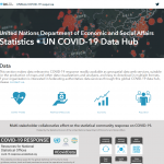
Esri and United Nations Team to Provide Countries with COVID-19 Data Resources

Filed Under: Business, Emergency Response, Software, Top Text Lead Story Tagged With: arcgis, coronavirus, ESRI, UN

Esri Partners with MCH Strategic Data to Provide School Closure, Reopening, and Instructional Plan Data

April 13, 2020 By GISuser

esri geodev meetup

Information on US Education Affected by COVID-19 Available on New Dashboard

Filed Under: Business, EDU, Software Tagged With: arcgis, coronavirus, Education, ESRI

Esri and FEMA Provide Free Access to Data and Mapping Technology in Response to COVID-19

April 13, 2020 By GISuser

esri geodev meetup

Advanced Software Solutions to Aid Non-Federal Governmental Entities

Filed Under: Business, Emergency Response Tagged With: coronavirus, COVID-19

Southern States Most at Risk for Coronavirus Peak?

April 7, 2020 By GISuser

BestPlaces.net, a small firm in Portland Oregon, has released several data sets to help health professionals and policymakers gain insights into how severely COVID-19 might impact counties, metro areas and states.  BestPlaces has amassed an unparalleled collection of data on every city, town, state, metro area, county and zip code in the U.S. and is […]

Filed Under: Emergency Response, Environment, Maps and Cartography Tagged With: coronavirus

COVID-19 Lost Loved Ones and Recovery Stories Project from GISCorps

April 6, 2020 By GISuser

COVID-19 Lost Loved Ones and Recovery Stories Project

A message from the GIScorps volunteers:

Filed Under: Emergency Response, Maps and Cartography, Top Press Tagged With: coronavirus

Maptitude Continues to Provide Students & Educators Free Software through Coronavirus Closures

April 5, 2020 By GISuser

NEWTON, MASSACHUSETTS (USA) – The Maptitude Team today announced continuing free access to Maptitude mapping software and learning resources for students and educators. Access to the popular Maptitude GIS (Geographic Information System) supports K-12 and higher education students who can no longer access school computers during the COVID19 pandemic.

Filed Under: Software Tagged With: coronavirus, Maptitude

3M Response to Defense Production Act Order

April 3, 2020 By GISuser

ST. PAUL, Minn.–(BUSINESS WIRE)–3M issued the following statement in response to the announcements issued by the White House last evening:

Filed Under: Business Tagged With: 3M, coronavirus

The ArcGIS Online Implementation Guide from Esri Canada

March 29, 2020 By GISuser

COVID-19 Resources

As the COVID-19 resources build and grow, Esri Canada has done a good job maintaining their public page. Recently they also added a page of helpful tips and assistance, including this getting started resource guide.

Filed Under: Emergency Response, Government & OpenGov Tagged With: coronavirus, covid19, help, Maps

What Are Companies’ Legal Obligations Around Coronavirus?

March 18, 2020 By GISuser

Eight factors leaders should consider.

Filed Under: Research Tagged With: coronavirus

Announcement Regarding the 2020 GIS/Valuation Technologies Conference in Louisville

March 13, 2020 By GISuser

March 13, 2020 – In recognition of the growing health risks worldwide posed by the Coronavirus (COVID-19) and decisions by governments and businesses to curtail activities over the next few weeks, it is with great regret that we inform you that IAAO and URISA have decided to cancel the 2020 GIS/Valuation Technologies Conference, scheduled to take place […]

Filed Under: Events Tagged With: coronavirus, events

« Previous Page
Next Page »

Recent Industry News

The First 90 Days Tell the Truth: What Hospitality Fitouts Reveal After Opening

March 27, 2026 By GISuser

Beyond the Blur: How Frosted Glass Film Is Quietly Redefining Modern Melbourne Spaces

March 27, 2026 By GISuser

The Early Build Decisions That Quietly Shape Life in Your Home Years Later

March 27, 2026 By GISuser

The Complete Guide to Buying Xxxxxxxxl Size Cxx Clothing: Fit, Comfort and Style Tips 

March 16, 2026 By GISuser

Hot News

State of Data Science Report – AI and Open Source at Work

HERE and AWS Collaborate on New HERE AI Mapping Solutions

Virtual Surveyor Adds Productivity Tools to Mid-Level Smart Drone Surveying Software Plan

Categories

Copyright gletham Communications 2015 - 2026

Go to mobile version