GISuser.com

GIS and Technology news for mapping professionals

  • PRESS
    • Submit PR
    • Top Press
    • Business
    • Software
    • Hardware
    • UAV News
    • Mobile Technology
  • FEATURES
    • Around the Web
    • Social Media Features
    • EXPERTS & Guests
    • Tips
    • Infographics
  • Events
  • CAREERS
  • Advertise
    • Advertise
  • Blog
  • Shop
  • Tradepubs
You are here: Home / Archives for COVID-19

British Red Cross turns to digital mapping to help meet increased demand for support due to Covid-19

May 18, 2021 By Editor

British Red Cross turns to digital mapping to help meet increased demand for support due to Covid-19

18 May 2021 – The British Red Cross has created new mapping tools using Esri GIS, which are being used by the Voluntary and Community Sector Emergencies Partnership (VCSEP) and its network of over 250 organisations, to improve collaboration as it responds to the Covid-19 crisis.

Filed Under: Business, Emergency Response, Featured TOP PR, Maps and Cartography Tagged With: COVID-19, UK

I Got Vaccinated! Story Map Shares the Who & Where of #COVID-19 Vaccinations

January 22, 2021 By GISuser

A good story(map) story tip via our friend Joseph Kerski of Esri… “Our health team at Esri worked with GISCorps who is hosting this application where people can share their vaccination stories and approving submissions.”

Filed Under: Business, Emergency Response, Maps and Cartography Tagged With: arcgis, COVID-19, ESRI, storymap

CoronavirusOutbreakMap.com COVID-19 Memorial Honoring Those Dead From COVID-19

November 25, 2020 By Editor

covid map

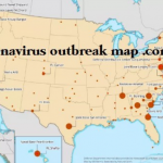
NEW YORK, Nov. 25, 2020  — With the millions of people that have died from COVID-19, CoronavirusOutbreakMap.com is honoring everyone that has died from COVID-19. 

Filed Under: Emergency Response, Maps and Cartography Tagged With: covid, COVID-19

USGIF White Paper: Geospatial Intelligence & AI/ML Progress During a Pandemic

November 9, 2020 By Editor

usgif

Foundation released white paper on how the IC has adapted a topic impacting the challenges of COVID-19

Filed Under: Business, Emergency Response, Research Tagged With: COVID-19, research, USGIF

Covid-19 – a catalyst for doing things differently

August 3, 2020 By GISuser

Cambridge, UK, 3rd August 2020, (www.1spatial.com) 1Spatial, a global leader in Location Master Data Management (LMDM) software and solutions has worked with Geomni UK in creating a traffic light system to determine pavement width to support social distancing during the COVID-19 pandemic.

Filed Under: Business Tagged With: COVID-19

Esri and United Nations Create COVID-19 Population Vulnerability Dashboard

July 28, 2020 By GISuser

New Tool Will Help Public Health Organizations Use Census Data to Fight Pandemic

Filed Under: Emergency Response, Government & OpenGov, Top Text Lead Story Tagged With: COVID-19, dashboard, ESRI, UN

Covid-19 Essentials Expo India 2020

July 21, 2020 By GISuser

Trade fair and exhibitions are key mediums for manufacturers and exporters not only to connect with new buyers, but also in getting new orders.

Filed Under: Emergency Response, Webinars Tagged With: COVID-19

New Survey Reveals Growing Acceptance Around COVID-19 Contact Tracing and Exposure Notification Apps

July 7, 2020 By GISuser

June 2020 Survey Reveals 77% Would Want To Be Notified Via Mobile Alert If Someone They Came In Contact With Contracted COVID-19

Filed Under: Business Tagged With: COVID-19

Post-COVID-19 Office Access Control Technologies

June 16, 2020 By GISuser

Post-COVID-19 Office Access Control Technologies

As the lockdown continues, business owners and managers are busy planning how to prepare the workplace for the post-COVID-19 world. Many of us are working from home right now and are likely to continue doing that. Those who return to offices can expect to see more rigorous cleaning and disinfection routines, frequent hand washing and […]

Filed Under: Business, EXPERTS Tagged With: COVID-19, workplace

Co-Located Events AEC Next, SPAR 3D, and Geo Week Pivot to Virtual Content Series for 2020

June 9, 2020 By GISuser

Portland, ME (USA) – June 9, 2020 – AEC Next, SPAR 3D Expo and Conference, International Lidar Mapping Forum (ILMF) and Geo Week, scheduled for a July event in Chicago, are pivoting to a series of virtual content for 2020. The change was necessitated by the ongoing health and safety issues stemming from the COVID-19 pandemic.

Filed Under: Events Tagged With: COVID-19, events

Next Page »

Feed

  • RSS


GIS jobs


Recent Features

Digitalization and Simulation at the North Pole

Natural Gas District & GIS-Centric Asset Management

5 Ways Technology Is Affecting The Sharing Economy

Spotlight – Township Canada: Explore Canadian Legal Land Descriptions on a Map

GeoGeeksinCars – The one in “Tippy” the right-hand drive Mitsubishi, at DevSummit

More Posts from this Category

Categories

Recent Posts

  • Esri Announces Winners of the 2022 ArcGIS Online Competition
  • KBC WhatsApp Lottery Winner 2022 List – KBC Head Office Number +19188444477 – KBC Sim Card Lucky Draw 2022
  • Animation explainer for a trading application
  • Ordnance Survey supports the British Heart Foundation’s national database of defibrillators
  • Why are AI and Machine Learning Important?

RSS Career Tips

  • Four Characteristics of the Best Virtual Employees
  • 8 Questions Employers Should Ask About Coronavirus
  • Jobcase Launches Free Unemployment Resource Center for Workers Impacted by COVID-19
  • Must-Have Gadgets and Technology for the Remote Office Worker
  • Must-Have Gadgets and Technology for the Remote Office Worker


shop for geogeek swag

RSS Tech pubs

  • Breaking the Code: How Low Code Is Changing Development
  • The Essentials of IT Management - 2022 Kit
  • Achieve a 25-50% reduction in payment postings and charge entry expenses

RSS Computers

  • The Essentials of Information Security Kit: Includes a Free PC Security Handbook - 2nd Edition eBook
  • The Idiot's Ultimate Guide to Build Your Own PC
  • Windows... On Speed

RSS HR Tips

  • At Work: The 2022 Workplace Trends Report
  • The 2022 Guide To Creating A Great Visitor Experience
  • Enterprise Executives Say Hybrid Work is Here to Stay

RSS Gov Tech

  • The Bipartisan Infrastructure Bill: How you can win more bids
  • How Connected Vehicle Data Can Transform Public Sector Decision-Making
  • Getting started with personalization at scale

RSS UAV news

  • Draganfly Deploys Versatile Situational Assessment Drones to Ukraine
  • Ocean Specialists Inc. Launches “USVs as a Service” Business Line
  • UAS Drone Subsidiary, Duke Robotics’, Sniper Drone showcased at a leading International Airshow in the Asia Pacific Region

RSS Geojobs

  • IT Endpoint Lead
Copyright Spatial Media LLC 2003 - 2015