
Exceptional Real-Time Data and Enterprise Solutions Recognized at Annual User Conference
Esri and Facebook Collaborate to Release New OpenStreetMap-Ready Datasets

Updated ArcGIS Map Layers and New Map With AI Tools Are Now Available for OSM Mappers
Esri Announces New Additions to ArcGIS Platform at Virtual User Conference

New Location Datasets and an All-in-One Field App Included in 2020 Updates
CyberTech is First Esri Partner to be Awarded ArcGIS Cloud Services Specialty Designation

OAK BROOK, Ill., June 8, 2020 — CyberTech Systems and Software Inc. today announced CyberTech’s recognition as an ArcGIS Cloud Services Specialty partner with location intelligence world leader Esri. CyberTech is the first Esri partner to achieve this designation. This designation signifies CyberTech’s valued expertise in supporting the Esri Geospatial Cloud. With this milestone, CyberTech becomes a trusted partner for […]
Bay Park Data Solutions Announces Custom COVID-19 specific health surveys for essential workers and customers

Now offering COVID-19 specific health surveys for essential workers and customers – We have been working with Southern California remodeling and construction companies to help them provide peace of mind to their customers, employees, and trade workers during this unprecedented Coronavirus pandemic.
Exprodat, the Esri software oil and gas specialist, has released an enhanced version of its Exploration Analyst software for ArcGIS Pro.

This updated version of the popular software that allows oil and gas geologists and geophysicists to make better exploration decisions provides a range of new tools and features which further enhance these critical workflows.
UN to Offer Free Access to Smart Mapping Software During Global Pandemic
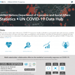
Esri and United Nations Team to Provide Countries with COVID-19 Data Resources
Spring blossoms in the City of Victoria – Victoria, Canada Launches Cherry Blossom Map
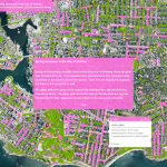
The City of Victoria has rolled out its annual map of blooming cherry and plum trees throughout the region. The interactive map pinpoints different types of blossoming trees across the city depending on the time of year. (Source: CFAX1070)
Esri Partners with MCH Strategic Data to Provide School Closure, Reopening, and Instructional Plan Data

Information on US Education Affected by COVID-19 Available on New Dashboard
Esri Offers Students Free Access to Software for Continued Education through Coronavirus Closures

Complimentary Technology and Lessons Support Remote Learning during COVID-19 Outbreak