GIS user technology news

News, Business, AI, Technology, IOS, Android, Google, Mobile, GIS, Crypto Currency, Economics

  • Advertising & Sponsored Posts
    • Advertising & Sponsored Posts
    • Submit Press
  • PRESS
    • Submit PR
    • Top Press
    • Business
    • Software
    • Hardware
    • UAV News
    • Mobile Technology
  • FEATURES
    • Around the Web
    • Social Media Features
    • EXPERTS & Guests
    • Tips
    • Infographics
  • Blog
  • Events
  • Shop
  • Tradepubs
  • CAREERS
You are here: Home / Archives for 000 Sq. Kilometers of Coastal Oregon Lidar Data Released

Using robots and GIS for spatial data collection

February 18, 2019 By GISuser

Spatial information refers to the activity of locating and collecting data about places and events that take place on the surface of Earth.

Filed Under: Business, DATA Tagged With: 000 Sq. Kilometers of Coastal Oregon Lidar Data Released, AI, data collection, robots

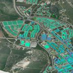
10,000 Sq. Kilometers of Coastal Oregon Lidar Data Released

February 6, 2012 By Editor

OpenTopography is pleased to announce the availability of more than 10,000 km2 of lidar point cloud data from coastal Oregon.  These data, totaling more than 100 billion lidar returns, cover the full extent of the Oregon coast, from the California border to the mouth of the Columbia River.  The data were collected by the Oregon […]

Filed Under: LiDAR Tagged With: 000 Sq. Kilometers of Coastal Oregon Lidar Data Released, 10, LiDAR, News

Recent Industry News

Milwaukee M18FHZ-0 Hackzall Reciprocating Saw – For hardcore cutting in a compact size

June 19, 2026 By GISuser

How Enterprises Are Using AI to Automate 80% of Customer Interactions With Voice Agents

June 16, 2026 By GISuser

Why On Cloud Shoes Are Worth the Price in Mexico

June 16, 2026 By GISuser

Jinghong vs XAG Agricultural Drones: A Comprehensive Comparison Guide

June 16, 2026 By GISuser

Hot News

State of Data Science Report – AI and Open Source at Work

HERE and AWS Collaborate on New HERE AI Mapping Solutions

Virtual Surveyor Adds Productivity Tools to Mid-Level Smart Drone Surveying Software Plan

Categories

Copyright gletham Communications 2015 - 2026

Go to mobile version