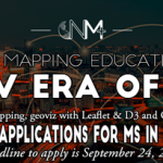
The University of Kentucky Department of Geography and New Maps Plus are excited to announce the opening of applications for the Master of Science in Digital Mapping!
University of North Alabama Online GIS Analyst Certificate Program

University of North Alabama Offers Online GIS Analyst Certificate Program – This certificate program consists of seven courses which can be completed within one year.
LiDAR Workshop in San Diego on July 12

Blue Marble Geographics is hosting a one-day LiDAR workshop in San Diego on July 12.
USGIF Partners with Boundless to Provide Educational Opportunities for GEOINT Community

Boundless to offer training and education for USGIF-accredited colleges and universities
Esri Publishes Study Guide for the ArcGIS Desktop Associate Exam

Book Covers the Key Software Concepts that Certification Candidates Need to Know and the Skills They Need to Have
USGIF Announces First K. Stuart Shea Endowed Scholarship Recipient
Monday morning at USGIF’s GEOINT 2018 Symposium, Sanghui Han was awarded the first ever $15,000 K. Stuart Shea USGIF Endowed Scholarship. Han is pursuing a Ph.D. in imaging science at the Rochester Institute of Technology (RIT) in Rochester, N.Y. USGIFChairman of the Board The Honorable Jeffrey K. Harris presented the award to Han on stage.
New Esri Textbook Teaches the Fundamentals of ArcGIS

Readers Will Learn the Concepts and Skills Needed to Be a Successful ArcGIS Desktop Software User
OceanWise’s Will Girard wins at the 2018 Apprentice of the Year Awards

OceanWise’s Will Girard, who started with the team in September 2016, has won an award in recognition of his high standards of achievement, outstanding commitment and excellent progression at the recent PETA Apprentice of the Year Awards 2018. Will is pictured below receiving his award from the Lord Mayor of Portsmouth.
Students Across Canada Invited to Apply for Shaw Kindness Sticks Youth Grants
Shaw to provide grants of up to $5,000 to student-led projects that promote positivity and inclusivity at their school
Viable Ideas for Furthering Your Education as a Developer
Working in the software industry can be very rewarding, but also very competitive. With more and more people wanting to join, and the increased availability of training materials and other tools for learning on one’s own time, it can be very difficult to stand out and get a foot in.