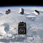
TORONTO, Ontario, Canada, 6 September 2023 – Space Flight Laboratory (SFL) is pleased to announce the SFL-built GHGSat greenhouse gas monitoring microsatellites have achieved sustained detection and measurement of methane emissions at double the design capacity of the satellites. Under contract to GHGSat, SFL developed all nine operational 15-kilogram GHGSat spacecraft on its low-cost, high-performance NEMO microsatellite […]
Imagery, earth imaging and remote sensing
UP42 and ImageSat International (ISI) Partner to Unlock Critical Applications of Geospatial Data
From disaster response to environmental monitoring, operators in essential sectors will have direct access to high-resolution optical imagery.
Capturing Glastonbury Festival – Aerial Image Capture using Phase One Technology

Producing an aerial imagery orthophoto of the 2023 Glastonbury Festival relied on provision of cost effective and environmentally friendly aircraft and camera solution to deliver a photogrammetric solution that successfully navigated aerial imaging options.
CNIG Digitally Reconstructs La Palma Island Landscape after a Devastating Volcanic Eruption

ContextCapture Optimizes Data Processing and Integration, Delivering a Digital Twin to Plan New Infrastructure and Safeguard Citizens
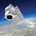
Space Flight Laboratory (SFL) Announces Launch of Nine Satellites Supporting Four Microspace Mission

TORONTO, Ontario, Canada, 15 April 2023 – Space Flight Laboratory (SFL), a developer of complete microspace missions, today announced the launch and successful deployment of nine satellites at 06:48 am UTC on 15 April 2023 (11:48 pm PDT, 14 April 2023). Launched from Vandenberg Space Force Base in California, the SpaceX Transporter-7 ride-sharing mission carried SFL-designed […]
UP42 and Vexcel Team Up to Expand Aerial Imagery and Geospatial Data Portfolio on the Marketplace

High-resolution and Accuracy in 30+ Countries for Utility, AEC, Energy, Insurance, and Telecoms Applications
Maxar Technologies To Be Acquired by Advent International for $6.4 Billion
Transaction will support Maxar to accelerate investment in and development of the Company’s next-generation satellite technologies and data insights for its customers
NASA’s Artemis I Cameras to Offer New Views of Orion, Earth, Moon

During Artemis I, NASA’s Space Launch System (SLS) rocket will send the agency’s Orion spacecraft on a trek 40,000 miles beyond the Moon before returning to Earth. To capture the journey, the rocket and spacecraft are equipped with cameras that will collect valuable engineering data and share a unique perspective of humanity’s return to the Moon.
ESA and GAF AG continue offering free-of-charge access to DSMs, high-resolution and medium-resolution data via the Third Party Mission Scheme
Munich/Neustrelitz, Germany, XX October 2022: ESA and GAF AG will continue to provide free-of-charge access to Digital Surface Models (DSMs), high-resolution (HR) and medium-resolution (MR) data for scientific users. In September 2022 they extended their agreement under ESA’s Third-Party Missions (TPM) Programme regarding the provision of IRS data and DSMs until the end of 2024 […]
Teledyne expands its Genie Nano portfolio with new 10GigE cameras
New series includes industry’s smallest 67 MP camera for high-performance image capture