
Esri Joins List of Companies Creating Value for the World
[WOW Tech] Seen and Heard at #ESRIUC – the new Echosec ArcGIS Integration

If you were in attendance at the 2016 ESRIUC then you likely heard about a little company in the Esri Startup Pavillion called Echosec. Now in year 3 as an esri small business partner, Echosec used the UC as a coming out party to announce their integration with ArcGIS Online
Innovators, Scholars, and Storytellers Celebrated at the Esri Awards
Excellence in the Geospatial Community Acknowledged at Esri User Conference
Faster Access to More Video Formats in New Release of ArcGIS Full Motion Video
Redlands, California—June 30, 2016—Esri’s latest version of ArcGIS Full Motion Video (FMV) presents new capabilities to improve the way analysts and managers interact with videos. ArcGIS FMV allows users to view, organize, and analyze video from drones and other collection platforms.
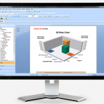
Insights for ArcGIS App Revealed at Esri User Conference

Attendees See and Try a Whole New Way to Interact with Data
Drone2Map 1.0 for ArcGIS Now Available
App Turns Still Images from Drones into Professional 2D and 3D Imagery On Demand
LizardTech to Exhibit at 2016 Esri User Conference
Company will demonstrate compression and instant visualization of geospatial imagery and LiDAR data
Storytelling with Maps Contest Winners Announced at Esri UC

Two New Formats Recently Added to Popular Story Map Apps
SAP® Geographical Enablement Framework Simplifies Spatial Processing of Enterprise Business Data
SAP HANA® Accelerates Spatial Processing and Analytics for Real-Time Insights
Esri Launches National Green Infrastructure Initiative for Planning
Maps, Data Empower Local Communities to Identify, Protect, and Connect Nature’s Network