DENVER, Colorado, 5 February 2024 – TCarta Marine, a global provider of hydrospatial products and services, will conduct a week-long coastal bathymetric mapping workshop for hydrographic surveyors in Jamaica. The workshop will be hosted by the Jamaica National Land Agency (NLA) and funded by The Nippon Foundation-GEBCO Seabed 2030 project.
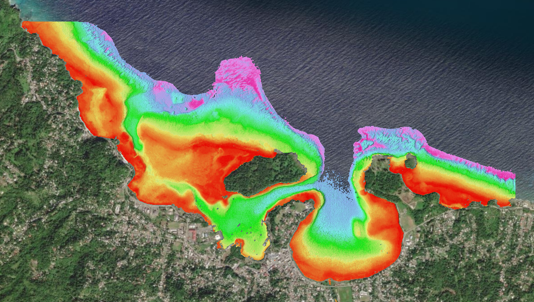
High-resolution satellite derived bathymetry in Port Antonio, Jamaica.
Scheduled for the week of February 5, 2024, at the NLA Surveys & Mapping Division headquarters in Kingston, Jamaica, the workshop will instruct participants in the use of satellite-derived bathymetry (SDB) technology with the TCarta Trident Geoprocessing Toolbox. The software-as-a-service SDB Toolbox operates within Esri ArcGIS Pro and enables users to perform their own extraction of bathymetric measurements from satellite, aerial, and UAV imagery.
“TCarta greatly appreciates Seabed 2030’s continuing commitment to expand hydrographic mapping education around the world,” said TCarta President Kyle Goodrich. “Data sets created in our workshops will be included in the Seabed 2030 global database and will also be used in diverse coastal management projects by Jamaica.”
The Seabed 2030 program was launched by The Nippon Foundation of Japan and the General Bathymetric Chart of the Oceans (GEBCO) program to inspire the complete mapping of the ocean floor by the end of the decade. A flagship program of the UN Ocean Decade, Seabed 2030 will make the data publicly available to support coastal resilience, environmental protection, and other marine applications.
TCarta first introduced Jamaican hydrographers to the SDB Toolbox in a 2022 training session. The Toolbox, which was developed by TCarta with funding from the National Science Foundation, contains a pre-processing tool to allocate calibration and validation in situ source data, two algorithm workflows to derive water depth measurements using Machine Learning and empirical regression, and a statistics estimation tool for quality assurance of derived water depth measurements.
“NLA Jamaica is eager to map the nation’s waters and contribute the data set to Seabed 2030 in time to be included in the 2024 published data,” states Diego Billings, Senior Hydrographic Surveyor for the National Land Agency, “We have already seen the benefits of producing SDB in support of NLA’s operations, and we’re looking forward to building our expertise, so that we can use these tools more flexibly.”
This year’s workshop seeks to produce SDB maps of the entire coastal area of Jamaica, including the environmentally and economically important Pedro Cays. Participants will extract seafloor depth data from multispectral Sentinel-2 satellite imagery and use NASA ICESat-2 LiDAR data for validation. The resulting data sets will include water depth measurements at 10-meter resolution to an average depth of 20 meters.
“The 2024 workshop will be led by hydrographers from TCarta’s Colorado and Jamaica offices,” said Goodrich. “We hope to hold similar SDB coastal mapping workshops in other Caribbean locations later this year and are actively seeking partnerships with hydrographic agencies in the region.”
About TCarta (www.tcarta.com)
With offices in the United States, Jamaica, and Canada, TCarta has built an international business on cost-effectively and safely deriving onshore and offshore data sets using multispectral imagery captured by Earth observation satellites – without negative impact on the natural habitat. TCarta products and services are relied upon by governmental, insurance, oil & gas, environmental, and infrastructure development clients in applications as diverse as natural resource monitoring, tsunami modeling, disaster & hazard response, and hydrologic studies.
The TCarta product lines include high-resolution satellite-derived water depth and seafloor map products as well as 90- and 30-meter GIS-ready bathymetric data aggregated from numerous information sources. TCarta has also recently unveiled the use of ICESat-2 LiDAR data sets for use in SDB validation, and the TCarta Global Satellite Derived Bathymetry (G-SDB) off-the-shelf products. G-SDB is generated with Machine Learning and ICESat-2 laser data at 10m resolution to depths of 30m depending on water clarity.