TORONTO, Ontario, Canada, 22 March 2021 – Dubai Municipality announced the successful launch and deployment of DMSat-1, an atmospheric monitoring microsatellite built by Space Flight Laboratory (SFL). DMSat-1 launched today from the Baikonur Cosmodrome in Kazakhstan aboard a Soyuz rocket.
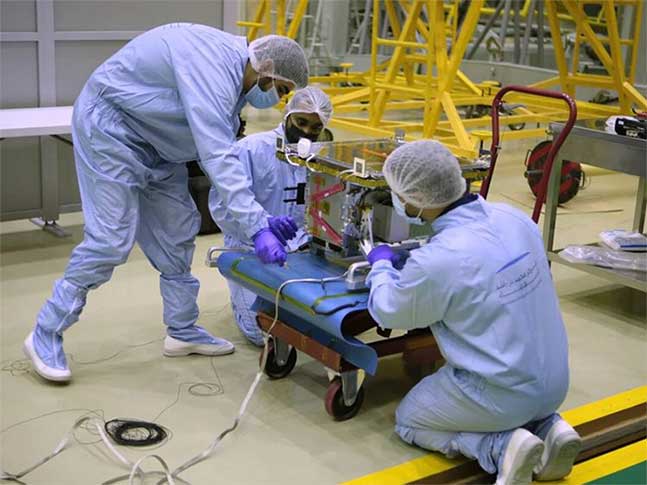
DMSat-1 being prepared for launch. (Courtesy GKLS and MBRSC)
SFL developed DMSat-1 under contract to the Dubai-based Mohammed Bin Rashid Space Centre (MBRSC) in the United Arab Emirates (UAE). The 15-kg microsatellite was built on SFL’s space-proven Next-generation Earth Monitoring and Observation (NEMO) platform.
“We congratulate Dubai on the launch of its first atmospheric monitoring microsatellite,” said SFL Director, Dr. Robert E. Zee. “DMSat-1 will play a key role in monitoring atmospheric aerosols and greenhouse gases for Dubai and the UAE.
SFL was selected to build DMSat-1 for its compact size and performance, including the mission-critical importance of attitude control and precise sensor pointing. SFL has developed high-performance ground target tracking capabilities that enable the small satellite to execute a slewing maneuver in orbit to accurately point its sensors at selected swaths of the atmosphere.
“Our ability to keep low-inertia, relatively inexpensive microsatellites like DMSat-1 pointed accurately and stably in orbit has made atmospheric monitoring missions possible at much lower costs,” said Zee.
DMSat-1 carries two instruments onboard. The primary payload is a multispectral polarimeter that monitors aerosols, which are typically fine particles of liquids and solids in the upper atmosphere often caused by anthropomorphic sources. Aerosols also correlate to natural phenomenon such as dust storms. The secondary payload is a pair of spectrometers for detection of greenhouse gases, such as carbon dioxide and methane.
DMSat-1 is the 16th SFL-built satellite launched in the past seven months. These launches include missions developed for GHGSat Inc. of Montreal, HawkEye 360 of Virginia, Space-SI of Slovenia, and a Toronto-based telecommunications company. Today’s launch also included two communications satellites developed using SFL technology.
SFL is a unique microspace provider that offers a complete suite of nano-, micro- and small satellites – including high-performance, low-cost CubeSats – that satisfy the needs of a broad range of mission types from 3 to 500 kilograms. Dating from 1998, SFL’s heritage of on-orbit successes includes 68 satellites and distinct missions related to Earth observation, atmospheric monitoring, ship tracking, communication, radio frequency (RF) geolocation, technology demonstration, space astronomy, solar physics, space plasma, and other scientific research.
In its 23-year history, SFL has developed CubeSats, nanosatellites, and microsatellites that have achieved more than 140 cumulative years of operation in orbit. These microspace missions have included SFL’s trusted attitude control and, in some cases, formation-flying capabilities. Other core SFL-developed components include modular (scalable) power systems, onboard radios, flight computers, and control software.
About Space Flight Laboratory (SFL) (www.utias-sfl.net)
SFL generates bigger returns from smaller, lower cost satellites. Small satellites built by SFL consistently push the performance envelope and disrupt the traditional cost paradigm. Satellites are built with advanced power systems, stringent attitude control and high-volume data capacity that are striking relative to the budget. SFL arranges launches globally and maintains a mission control center accessing ground stations worldwide. The pioneering and barrier-breaking work of SFL is a key enabler to tomorrow’s cost aggressive satellite constellations. (www.utias-sfl.net)
Download the specification sheet for all SFL platforms here.