 Reposted from 2007… Once again, beginning at 2:00 am MTN on Christmas Eve, you can track Santa Live as he makes his historic journey around the world! This time you can track him using Google Earth and get glimpses of Saint Nick captured with the NORAD Santa Cams. NORAD has been tracking Santa since 1955 (I recall using this fine service when I was a kid, albeit without the help of Google Earth at that time!).
Funded by generous corporate sponsors, these companies enable a fun tracking service by providing computer servers, web site design, video imaging, Santa’s tracking map, and even the toll free telephone number. The NORAD Tracks Santa Program is managed by the NORAD and United States Northern Command Public Affairs Office at Peterson Air Force Base, Colorado.
Sensors
NORAD uses four high-tech systems to track Santa – radar, satellites, Santa Cams and jet fighter aircraft. Detecting Santa all starts with the NORAD radar system called the North Warning System. This powerful radar system has 47 installations strung across the northern border of North America. NORAD makes a point of checking the radar closely for indications of Santa Claus leaving the North Pole on Christmas Eve.
Detection Sensors:
 Satellites – the same satellites that we use in providing warning of possible missile launches aimed at North America.
North Warning Radar – This powerful radar system has 47 installations strung across the northern border of North America.
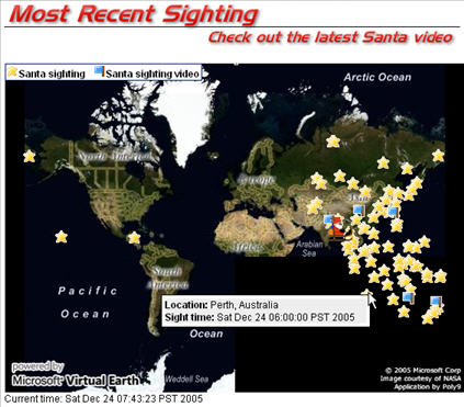
Sanata Cams – NORAD Santa Cams are ultra-cool high-tech high-speed digital cameras that are pre-positioned at many places around the world. NORAD only uses these cameras once a year.
Jet Fighters – Canadian NORAD fighter pilots, flying the CF-18, take off out of Newfoundland to intercept and welcome Santa to North America
Some History
For more than 50 years, NORAD and its predecessor, the Continental Air Defense Command (CONAD) have tracked Santa. The tradition began on Christmas Eve in 1955 after a Colorado Springs-based Sears Roebuck & Co. store advertisement for children to call Santa on a special “hotline” included an inadvertently misprinted telephone number. Instead of Santa, the phone number put kids through to the CONAD Commander-in-Chief’s operations “hotline.” The Director of Operations, Colonel Harry Shoup had his staff check radar data for any indication of Santa making his way south from the North Pole. Indeed there were signs of Santa and children who called were given an update on Santa’s location. Thus, the tradition was born. In 1958, the governments of Canada and the United States created a bi-national air defense command for the North American continent called the North American Air Defense Command, known as NORAD. NORAD inherited the tradition of tracking Santa.
Since that time, Canadian and American men and women who work at NORAD have responded to phone calls from children personally. Additionally, media from all over the world call NORAD on Christmas Eve for updates on Santa’s location. Last year this Website was visited by millions of people who wanted to know Santa’s whereabouts.
Using the North Warning Radar System and “Santa Cams”, NORAD and their partners follow Santa’s every move on his journey.
How it works:
- The moment Santa leaves, NORAD starts tracking him with radar – these are the same satellites that monitor us against a misile attack.
- As Santa approches various regions of the World, a Santa cam will capture some video footage and publish the results on the Internet for all to see. The Santa Cam produces both video and still images.
- The last system used is the NORAD jet fighter. Canadian NORAD fighter pilots, flying the CF-18, take off out of Newfoundland to intercept and welcome Santa to North America.
- Tracking Santa with NORAD Santa will teach children not only about geography and Santa’s Route, they will also learn about the different traditions around the World and the various ways that people celebrate the Christmas Holiday season.


About NORAD
NORAD is the bi-national U.S.-Canadian military organization responsible for the aerospace defense of the United States and Canada. NORAD was created by a 1958 agreement between Canada and the United States. NORAD provides warning of missile and air attack against both of its member nations, safeguards the air sovereignty of North America, and provides air defense forces for defense against an air attack.
The 2007 NORAD Tracks Santa Program is sponsored by the following Partners:
Google, agi, Qwest, e-frontier, Booz Allen Hamilton, Verizon, Avaya, and many others.
The NORAD Tracks Santa Program is managed by the NORAD and United States Northern Command Public Affairs Office at Peterson Air Force Base, Colorado, HQ NORAD/NORTHCOM.
Thanks again to everyone involved for providing this fun resource!
Yours Truly has been a huge fan of NORAD Santa for years. See also the following annual updates that we’ve provided over the years: