GISuser.com

GIS and Technology news for mapping professionals

  • PRESS
    • Submit PR
    • Top Press
    • Business
    • GIS, Geo Tech Software
    • Hardware
    • UAV News
    • Mobile Technology
    • Editor’s Top Picks
    • Get TOP Listing!
  • FEATURES
    • GeoGeeksinCars
    • 10 Question Q&A
    • FROM THE EDITOR
    • SPATIAL MEDIA AUTHORS
    • Social Media Features
    • EXPERTS & Guests
    • Listicles and Top 10 Lists
    • Infographics
    • VIDEOS
  • Events
    • Webinars
    • Submit event
    • Event Media Partner
  • CAREERS
    • Career Help Articles
    • People and Career News
    • Work from Home
    • About GeoJobs.BIZ
  • About
    • Advertise
      • Advertise wth GISuser
      • Media Kit Request Form
      • Directory
      • Submit Press
    • Contact GISuser
    • Meet the Editor
    • Social Media
      • AnyGeo Blog
      • GeoGeeks Podcast
      • Social Media Features
      • Like Us
    • SpatialMedia
      • LBSzone
      • LiDAR Magazine
      • Amerisurv
      • SymbianOne
    • RSS feed
  • Blog
  • Shop
  • Cloud Hosting
    • Amazon Cloud Hosting
    • WordPress cloud hosting
    • Dedicated servers USA
  • Tradepubs
You are here: Home / * PRESS / Environment / Global Earthquake Numbers on Par for 2015

Global Earthquake Numbers on Par for 2015

February 5, 2016 By GISuser

Globally there were 14,588 earthquakes of magnitude 4.0 or greater in 2015.  This worldwide number is on par with prior year averages of about 40 earthquakes per day of magnitude 4.0, or about 14,500 annually.  The 2015 number may change slightly as the final results are completed by seismic analysts at the USGS National Earthquake Information Center in Golden, Colorado.

Global Earthquake Numbers on Par for 2015

In 2015, there were 19 earthquakes worldwide with a magnitude of 7.0 or higher. Since about 1900, the average has been about 18 earthquakes per year.

Earthquakes caused 9,612 deaths worldwide in 2015, a significant increase compared to 664 deaths in 2014. The majority of these fatalities – 8,964 people as reported by the United Nations Office for Coordination of Humanitarian Affairs – are attributed to the magnitude 7.8 earthquake that occurred on April 25 in Nepal. This was followed by another deadly earthquake with magnitude 7.3 on May 12 that killed an additional 218 people in Nepal. Deadly quakes also occurred in Afghanistan, Malaysia and Chile.

The biggest earthquake in the United States, a magnitude 6.9 southwest of Umnak Island, Alaska, occurred on July 27. This occurred in a remote location so there was no damage.  In the central United States, seismicity continued to increase, with 32 earthquakes of magnitude 4.0 and greater in Kansas, Oklahoma and Texas in 2015 compared to 17 in 2014. Moderate earthquakes also occurred in Nevada and Arizona. A magnitude 5.0 east of Challis, Idaho, hit on January 3. In the United States, there were no fatalities caused by earthquakes.

The USGS monitors earthquakes around the world, responds rapidly to events of magnitude 5.0 or greater and for the final catalogs publishes earthquakes with a magnitude of 4.0 or greater. In the United States, earthquakes with magnitude 2.5 or greater are published.

To monitor earthquakes worldwide, the USGS NEIC receives data in real-time from about 1,800 stations in more than 90 countries. These stations include the 150-station Global Seismographic Network, which is jointly supported by the USGS and the National Science Foundation and operated by the USGS in partnership with the Incorporated Research Institutions for Seismology consortium of universities. Domestically, the USGS partners with 11 regional seismic networks operated by universities that provide detailed coverage for the areas of the country with the highest seismic risk.

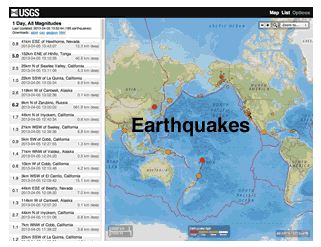
Real-time information about earthquakes around the world can be found at earthquake.usgs.gov. Visit the USGS Significant Earthquakes Archive to see the complete list of notable earthquakes from 2015 and previous years. Read about other natural disasters that occurred in 2015 here.

More than 143 million residents living in the 48 contiguous states may potentially be exposed to damaging ground shaking from earthquakes. When the people living in the earthquake-prone areas of Alaska, Hawaii and U.S. territories are added, this number rises to nearly half of all Americans. The USGS and its partners in the multi-agency National Earthquake Hazard Reduction Program are continually working to improve earthquake monitoring and reporting capabilities via the USGS Advanced National Seismic System.

Related Articles on GISuser:

  • Twitter feed and map provide real-time water, weather and flood forecasting for TexasTwitter feed and map provide real-time water, weather and flood forecasting for Texas
  • Mapping Water Use: Landsat and America’s Water ResourcesMapping Water Use: Landsat and America’s Water Resources
  • Wider Selection of US Topo Maps From USGS Now Available in Avenza’s PDF Maps AppWider Selection of US Topo Maps From USGS Now Available in Avenza’s PDF Maps App
  • USGS: East vs West Coast EarthquakesUSGS: East vs West Coast Earthquakes
  • The USGS national map of onshore wind turbinesThe USGS national map of onshore wind turbines
  • A Decade of Change in America’s Arctic: New Land Cover Data Released for AlaskaA Decade of Change in America’s Arctic: New Land Cover Data Released for Alaska

Filed Under: Environment, FrontPage Leader, Research Tagged With: Global Earthquake, USGS


Editor’s Picks

Career Tips – Common Career Paths for the Student of GIS, an Infographic from USC

CoreLogic Data Reveals Wildfires Pose Big Risk to Nearly 900,000 Western US Homes in 2015

Data Tip – Customized Coverage from LandScan Global Population Database

Mapping Reform: Where are Things Likely to Change?

See More Editor's Picks...

Connect with GISuser

  • Facebook
  • Google+
  • LinkedIn
  • RSS
  • Twitter


GIS jobs

Recent Features

Digitalization and Simulation at the North Pole

Natural Gas District & GIS-Centric Asset Management

5 Ways Technology Is Affecting The Sharing Economy

Spotlight – Township Canada: Explore Canadian Legal Land Descriptions on a Map

GeoGeeksinCars – The one in “Tippy” the right-hand drive Mitsubishi, at DevSummit

More Posts from this Category

Categories


Recent Posts

  • Nighttime Satellite Imagery from @Maxar: Inauguration Celebrations in Washington, DC
  • Covid-19 Killing Robot Used in Pilot Program in Biden’s Wilmington DE
  • New Topcon solution for North America streamlines point creation between Autodesk platforms and robotic total stations
  • Swedish Space Corporation and Airbus Defence and Space Netherlands to Collaborate in Optical Communication
  • OGC GeoTIFF Standard Working Group updates work items; public comment sought on new charter

RSS Career Tips

  • Four Characteristics of the Best Virtual Employees
  • Jobcase Launches Free Unemployment Resource Center for Workers Impacted by COVID-19
  • 8 Questions Employers Should Ask About Coronavirus
  • Must-Have Gadgets and Technology for the Remote Office Worker
  • Must-Have Gadgets and Technology for the Remote Office Worker


shop for geogeek swag

RSS Tech pubs

  • Analytics & Business Intelligence Software Buyer's Kit
  • On-Demand Webinar: A Spreadsheet Experience at Snowflake Scale
  • Realizing the True ROI of Analytics & BI

RSS Computers

  • iPad CTO Kit - including the iPad Tips and Tricks Guide for IT Executives and Managers
  • The Essentials of Information Security Kit: Includes a Free PC Security Handbook - 2nd Edition eBook
  • Windows... On Speed

RSS HR Tips

  • Reconciliation Robots - why use robots to automate accounting processes
  • Are You Ready to Enter a New Era of Health Benefits Planning?
  • 4 Things I Learned Leading Benefits at Salesforce, Lululemon, and Uber

RSS Gov Tech

  • 11 Habits of Successful Law Firms - Updated for the Digital Age
  • Whitepaper | What 300 L&D Leaders Have Learned About Building Data Fluency
  • How Identity and Cloud Governance Enhances NSA Guidance for Improving Cloud Security

RSS UAV news

  • Cobra AntiDrones is developing the concept of a interceptor drone, killer of a loitering munition and strike UAVs similar to the Turkish Bayraktar TB2
  • Webinar – Processing Large Drone Projects Webinar
  • NOAA Awards Black Swift Technologies Contract to Develop GPS-Denied Navigation

RSS Geojobs

  • An error has occurred, which probably means the feed is down. Try again later.
Copyright Spatial Media LLC 2003 - 2015