LIVERMORE, Calif., U.S./ CAPELLE A/D IJSSEL, the Netherlands, Aug. 30, 2018 (GLOBE NEWSWIRE) — Topcon Positioning Group announces new software designed to facilitate data processing workflow for UAV (unmanned aerial vehicle) infrastructure inspection — MAGNET Inspect. The software efficiently manages large UAV data sets to create inspection reports.
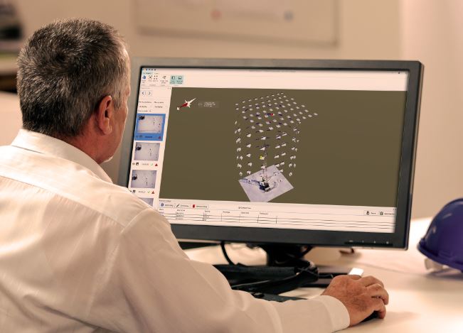
“MAGNET Inspect will work with models from virtually any UAV. When combined with Intel® Falcon™ 8+ Drone – Topcon® Editionand Topcon ContextCapture, powered by Bentley Systems, the software enables operators to efficiently navigate, annotate, and create reports with inspection photos, effectively creating a very strong end-to-end inspection workflow,” said David Ahl, director of software product management. “It is now a key element of the Topcon end-to-end UAV and data processing workflow for inspection projects, which results in increased safety and faster data collection than traditional methods.”
MAGNET Inspect is designed to allow operators to easily visually navigate UAV photos — aligning 3D reality meshes with raw georeferenced images in one location and filtering them based on selected criteria including field of view.
“The software allows operators to easily document the observations and report them. Images from the inspection can be flagged to indicate whether there are structural issues and annotated with built-in free-hand graphical tools. Data reports can then be created to include a preview image and link to high resolution annotated image,” said Ahl.
For more information, visit topconpositioning.com.
About Topcon Positioning Group
Topcon Positioning Group is headquartered in Livermore, California, U.S. (topconpositioning.com). Its European head office is in Capelle a/d IJssel, the Netherlands. Topcon Positioning Group designs, manufactures and distributes precision measurement and workflow solutions for the global construction, geospatial and agriculture markets. Its brands include Topcon, Sokkia, Tierra, Digi-Star, RDS Technology, and NORAC. Topcon Corporation (topcon.com), founded in 1932, is traded on the Tokyo Stock Exchange (7732).