Today (Jan 29, 2016) via livestream, the city of Los Angeles officially announced the launch of their latest OpenData initiative, the GeoHub. The livestream for the media featured Los Angeles Mayor Eric Garcetti and Esri’s Jack Dangermond.

Los Angeles Opens the GeoHub – #OpenData for Citizens and Developers
According to Esri, #GeoHub is a city- and countywide collaboration and data portal, with Location-as-a-Service and DIY mapping tools. GeoHub is an open innovation ecosystem – think of it as Open data made actionable.
Find the media event livestream on Youtube
From the event – According to Eric Garcetti, mayor city of LA, the idea behind Geohub is to “reinvent the way they deliver services and improve the quality of life for residents…” according to the Mayor, “we are open for business”. The city will be bringing greater transparency and greater accountability to the city via the GeoHub. Using a public safety example, Mayor Garcetti commented that through efficient data sharing, all first responders will access to civic data to make critical, real time decisions using live data via the map.
Esri President and CEO, Jack Dangermond discussed his company’s role in providing the back bone/infrastructure for GeoHub. A few noteworthy points:
- Users can find some 500 layers of map based data
- Story maps are used to help understand the city
- The city needed a portal for sharing data, services, maps… to mashup and see things comprehensively
- The importance of not just open data but open APIs
- Maps can be much more transparent than just data
- Using open data to create a community GIS where the community participates
- Streaming real time data into an apps via open APIs – this is what they envision and what developers can expect.

Story maps used to connect with citizens

Jack Dangermond and Los Angeles Mayor Eric Garcetti
Demo:
Using the “Hub” is a breeze. Simply start from the homepage using the “Find Data” search dialog. For example, search “parking“. A number of hits are returned in a friendly to use table (somewhat Socrata-like I’ve heard). In this case there were some 34 results returned. Of interest, I selected park and ride locations. I now have the ability to view data details, view the table structure/view, and charts. I can also click the “Open in ArcGIS” link to view the map directly within ArcGIS Online. finally, options are provided to download the data in a number of formats (SHP, KML, Spreasheet) and there are also a number of downloadable API dataset options, either a GeoJSON download or a link to a GeoService.
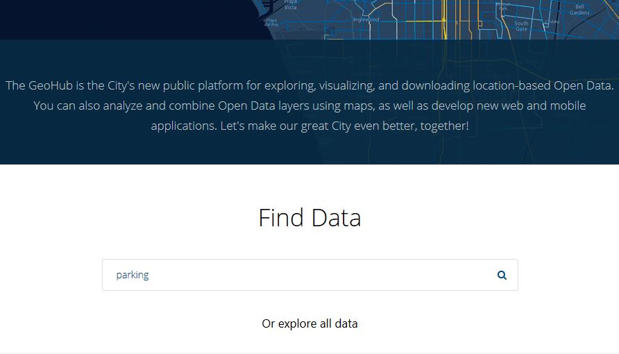
Easy to use – Find Data Search

Data Search results dsplayed in a table
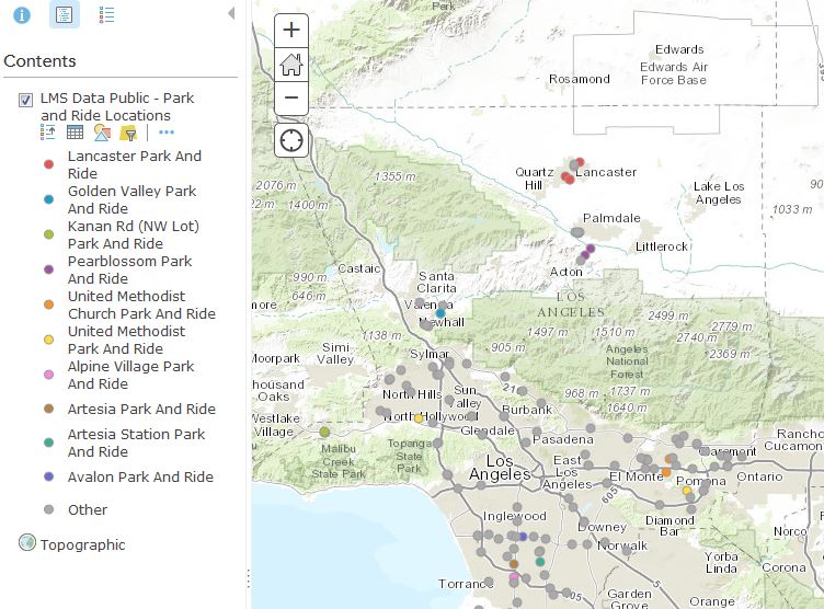
Open Data in ArcGIS