New features significantly reduce IT management costs for utility and telecommunication inspection teams
Cambridge, UK – 9th June, 2016 – Ubisense Group plc (AIM: UBI), a leader in enterprise location intelligence solutions, has released version 2 of myWorld Inspection & Survey, with a host of new features to transform the way utility and telecommunications teams conduct inspections and surveys.
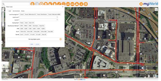
myWorld Inspection & Survey enables field workers to collect inspection data on any mobile device, eliminating paper-based processes and is a dramatic improvement on first generation software solutions. Users now have the flexibility to run the system on iOS, Android or Windows and dynamically push both data and application code updates, significantly reducing IT management costs.
Based on discussions with existing customers, Ubisense has also incorporated a range of new workflow and data capture features to make day to day inspections and management even easier. Users of myWorld Inspection & Survey are now able to:
- Carry out multiple surveys concurrently, significantly improving productivity
- Assign multiple crews or surveyors to a single survey or inspection order, enabling support of a wider range of existing business processes without requiring any product customization
- Support for “dual pass” surveys, in which each survey item needs to be visited twice in order for the survey to be regarded as complete
- Enhanced map filtering, to allow users to only display items relevant to the survey(s) that they are currently working on
- Process checks to automatically turn off surveying when the vehicle speed exceeds a specified value, avoiding accidentally marking something as surveyed incorrectly
Peter Batty, Geospatial CTO at Ubisense, said: “We know that our customers want the flexibility to use any device in the field. We allow them to run iOS, Android or Windows with a single application giving them more flexibility in device selection and future proofing their hardware decisions.”
For more information about myWorld Inspection & Survey please visit http://ubisense.net/en/products/myworld-inspection-survey or contact us on enquiries@ubisense.net
For media requests, please contact Becky Lamont at becky.lamont@ubisense.net
About Ubisense
Ubisense (AIM: UBI), a global leader in enterprise location intelligence solutions, helps manufacturing, communications and utility companies improve operational efficiency and boost profitability. Ubisense location intelligence systems bring clarity to complexity, enabling customers to revolutionize their operational effectiveness in a measurable way. Founded in 2002, Ubisense is headquartered in Cambridge, England, with operations in North America, France, Germany and Japan. For more information visit: www.ubisense.net