GIS user technology news

News, Business, AI, Technology, IOS, Android, Google, Mobile, GIS, Crypto Currency, Economics

  • Advertising & Sponsored Posts
    • Advertising & Sponsored Posts
    • Submit Press
  • PRESS
    • Submit PR
    • Top Press
    • Business
    • Software
    • Hardware
    • UAV News
    • Mobile Technology
  • FEATURES
    • Around the Web
    • Social Media Features
    • EXPERTS & Guests
    • Tips
    • Infographics
  • Around the Web
  • Events
  • Shop
  • Tradepubs
  • CAREERS
You are here: Home / * PRESS / DATA / Boulder County Launches New Geospatial Open Data Platform

Boulder County Launches New Geospatial Open Data Platform

May 19, 2016 By GISuser

New platform offers better tools and improved access to geospatial data

boulder county

Boulder County, Colo. – Today, Boulder County launched a new geographic information system (GIS) open data platform that will give data enthusiasts greater access to valuable county geospatial – mapping – data assets on an interactive site.

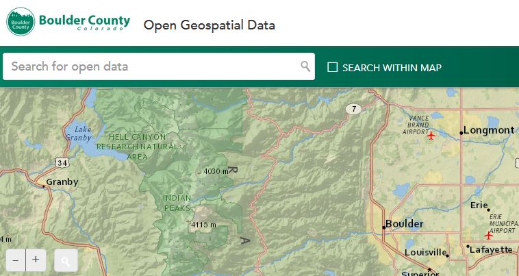
The site, located at http://maps.bouldercounty.org/OpenData, puts GIS data at users’ fingertips. Datasets of interest can be browsed by category or by entering key words in the search box. Users can then interact with the data in the web browser, preview the data before downloading, download subsets of very large datasets, and even create charts. Datasets can be easily shared with others or embedded into websites.

The new platform, which is a tool included within the GIS software the county currently uses, streamlines internal processes by automating the publication of data. GIS data has been available in other forms for download on the county website since 2007.

“Boulder County is excited to launch the new geospatial open data platform so data users will have a better way to access useful datasets produced by the county,” said GIS Program Manager Mark Mullane. “The new platform provides a simple and intuitive user experience so the data can be easily searched, viewed, and filtered all within a web browser.”

Background
The concept of “open data” embraces the idea that public information should be easily accessible to the public online and produced in a standardized format that can be read and utilized by all computers.

This launch marks the second move to improve internal workflows through automated publishing of open data. The first part of this effort launched in March of this year and offered improved access to building permit and development data for unincorporated Boulder County.

Questions or feedback about Boulder County open data sources may be directed to data@bouldercounty.org.

Filed Under: DATA, FrontPage Leader, Government & OpenGov, Top Features, Top Text Lead Story Tagged With: boulder county, Colorado, open data

Editor’s Picks

Data Tip - The US Interagency Elevation Inventory

Data Tip – The US Interagency Elevation Inventory

Former Governor Geringer Leads Panel Calling on Congress and Governors to Make National Spatial Data Infrastructure a High Priority

20th INTERGEO opens in Berlin!

Salary Guide, Tips for Fastest Growing Industries & Top Technology Positions in Demand

See More Editor's Picks...

Recent Posts

  • The Hidden Shield: How Invisible Watermarking Protects Digital Content
  • Dual Diagnosis: Why Treating Co-Occurring Mental Health and Addiction Together Is Essential for Recovery
  • Why Search Engine Optimisation Is Essential For Modern Digital Marketing
  • How to Find Safe, Affordable Access to GLP-1 Medications in 2025
  • Powerful Bonus Features Supporting Steady Progress Throughout Engaging Casino Play
  • The Power of Analytics: Turning Consumer Insights into Action
  • Cost Distribution of Hiring a Moving Company in Dubai
  • Oxyhydrogen Brazing in HVAC Systems: Fast, Clean, and Precise Copper Tube Connections
  • Moto G 5G Screen Replacement Cost: Complete Guide
  • When Local Cravings Meet Instant Convenience

Recent Features

Space Flight Laboratory (SFL) Announces Successful Launch & Deployment of HawkEye 360’s Cluster 11

FOSS4G NA 2024: The Premier Open Source Geospatial Conference Returns to St. Louis, September 9-11

Photographer Touch Reveal the Top Cameras, Lenses, and Photo Editing Tools of 2022

Digitalization and Simulation at the North Pole

Natural Gas District & GIS-Centric Asset Management

More Posts from this Category

Categories

RSS Career Tips

  • Four Characteristics of the Best Virtual Employees
  • 28 Tools to Conquer the Social Media Recruiting World
  • 8 Questions Employers Should Ask About Coronavirus
  • Jobcase Launches Free Unemployment Resource Center for Workers Impacted by COVID-19
  • Must-Have Gadgets and Technology for the Remote Office Worker


featured podcast

RSS Tech pubs

  • Breaking Silos and Building the Grid of the Future
  • From Risk to Readiness: How to Plan Around Interconnection Uncertainty
  • Data Center Location Strategy

RSS Computers

  • How the Cloud is Reshaping Virtual Desktops
  • Millennials as Brand Advocates - New Research Study Results
  • Vehicles Best Practices Installation Guide

RSS HR Tips

  • AWS GovCloud (US) Celebrates 10th Anniversary and a Decade of Digital Transformation in the Federal Government
  • Exploring the Impact of COVID-19 on Customer Behavior
  • The Pivot to 100% Remote Training in the Contact Center

RSS Gov Tech

  • 10 Legal Jobs You Can Get Without a Law Degree
  • J.D. Power Examines How the Inflation Reduction Act Reshapes EV Landscape
  • Making Telehealth Work for You: The Ultimate Guide

Copyright Spatial Media LLC 2003 - 2015

Go to mobile version