GIS user technology news

News, Business, AI, Technology, IOS, Android, Google, Mobile, GIS, Crypto Currency, Economics

  • Advertising & Sponsored Posts
    • Advertising & Sponsored Posts
    • Submit Press
  • PRESS
    • Submit PR
    • Top Press
    • Business
    • Software
    • Hardware
    • UAV News
    • Mobile Technology
  • FEATURES
    • Around the Web
    • Social Media Features
    • EXPERTS & Guests
    • Tips
    • Infographics
  • Around the Web
  • Events
  • Shop
  • Tradepubs
  • CAREERS
You are here: Home / * PRESS / DATA / USGS Lidar Base Specification Version 1.2

USGS Lidar Base Specification Version 1.2

December 2, 2014 By GISuser

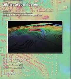
USGS Lidar Base Specification Version 1.2: The USGS National Geospatial Program has announced a new version of the USGS Lidar Base Specification that defines deliverables for nationally consistent lidar data acquisitions.

USGS Lidar Base Specification Version 1.2

The USGS Lidar Base Specification provides a common base specification for all lidar data acquired for the 3D Elevation Program (3DEP) component of The National Map. The primary goal of 3DEP is to systematically collect nationwide 3D elevation data in an 8-year period. http://on.doi.gov/1FJKKte

Details…

The US Geological Survey National Geospatial Program is pleased to announce a new version of the USGS Lidar Base Specification that defines deliverables for nationally consistent lidar data acquisitions.The USGS Lidar Base Specification provides a common base specification for all lidar data acquired for the 3D Elevation Program (3DEP) component of The National Map. The primary goal of 3DEP is to systematically collect nationwide 3D elevation data in an 8-year period.

“Because we are acquiring data nationally for 3DEP with many partners, we need to have a way to ensure all of our requirements are being met, while minimizing the potential for problems with interoperability between various disparate data collections,” said Jason Stoker, Elevation Product and Services Lead for the USGS National Geospatial Program. “The USGS Lidar Base Specification helps everyone understand exactly what data we need and exactly how we need it, so we can be as efficient as possible.  This new version incorporates many of the lessons we have learned since putting together version 1.0, and sets the stage for future quality 3DEP data collections.”

Originally released as a draft in 2010 and formally published in 2012, the USGS–NGP Lidar Base Specification Version 1.0 was quickly embraced as the foundation for numerous state, county, and foreign country lidar specifications. Lidar is a fast-evolving technology, and much has changed in the industry since the final draft of the Lidar Base Specification Version 1.0 was written.

Lidar data have improved in accuracy and spatial resolution, geospatial accuracy standards have been revised by the American Society for Photogrammetry and Remote Sensing (ASPRS), industry standard file formats have been expanded, additional applications for lidar have become accepted, and the need for interoperable data across collections has been realized. This revision to the Lidar Base Specification, known as Version 1.2, addresses those changes and provides continued guidance towards a nationally consistent lidar dataset.
Filed Under: DATA, FrontPage Leader, LiDAR Tagged With: USGS Lidar

Editor’s Picks

Career Tips – Common Career Paths for the Student of GIS, an Infographic from USC

#DevSummit Video – A First Look at Drone2Map for ArcGIS

Esri Map Book Illustrates How the US Government Uses GIS

First Look – Los Angeles Opens the GeoHub – #OpenData for Citizens and Developers

See More Editor's Picks...

Recent Posts

  • Transform Your Fashion Vision Instantly: The Ultimate AI Dress Changer Revolution with Supermaker
  • Why Hiring an Expert Lawyer Is One of the Smartest Decisions You’ll Ever Make
  • Prevent Dog from Jumping Fence: Complete Guide for Safe and Happy Pets
  • Importance of Business Insurance for Global Tech Companies in Dublin
  • How Cloud Infrastructure Became the New Backbone of Business
  • The Growing Role of Data in Driving Smarter Business Decisions
  • Organize Legal Documents With Custom-Fit Personalized Folders 
  • The Ultimate Showdown, Online Casino Tournaments, Their Rewards
  • Pendergast Law’s Guidelines on the Steps Every Rider Should Take After a Crash
  • Top Signs You Need Garage Door Repair in Dubai

Recent Features

Space Flight Laboratory (SFL) Announces Successful Launch & Deployment of HawkEye 360’s Cluster 11

FOSS4G NA 2024: The Premier Open Source Geospatial Conference Returns to St. Louis, September 9-11

Photographer Touch Reveal the Top Cameras, Lenses, and Photo Editing Tools of 2022

Digitalization and Simulation at the North Pole

Natural Gas District & GIS-Centric Asset Management

More Posts from this Category

Categories

RSS Career Tips

  • Four Characteristics of the Best Virtual Employees
  • 28 Tools to Conquer the Social Media Recruiting World
  • 8 Questions Employers Should Ask About Coronavirus
  • Jobcase Launches Free Unemployment Resource Center for Workers Impacted by COVID-19
  • Must-Have Gadgets and Technology for the Remote Office Worker


featured podcast

RSS Tech pubs

  • Life Sciences Cloud Content Migration: Separating Fact from Fiction
  • Agentic AI: From Hype to Action - Webinar Summary
  • What is AI and How Can Law Firms Use it?

RSS Computers

  • How the Cloud is Reshaping Virtual Desktops
  • Millennials as Brand Advocates - New Research Study Results
  • Vehicles Best Practices Installation Guide

RSS HR Tips

  • AWS GovCloud (US) Celebrates 10th Anniversary and a Decade of Digital Transformation in the Federal Government
  • Exploring the Impact of COVID-19 on Customer Behavior
  • The Pivot to 100% Remote Training in the Contact Center

RSS Gov Tech

  • 10 Legal Jobs You Can Get Without a Law Degree
  • J.D. Power Examines How the Inflation Reduction Act Reshapes EV Landscape
  • Making Telehealth Work for You: The Ultimate Guide

Copyright Spatial Media LLC 2003 - 2015

Go to mobile version