GIS user technology news

News, Business, AI, Technology, IOS, Android, Google, Mobile, GIS, Crypto Currency, Economics

  • Advertising & Sponsored Posts
    • Advertising & Sponsored Posts
    • Submit Press
  • PRESS
    • Submit PR
    • Top Press
    • Business
    • Software
    • Hardware
    • UAV News
    • Mobile Technology
  • FEATURES
    • Around the Web
    • Social Media Features
    • EXPERTS & Guests
    • Tips
    • Infographics
  • Blog
  • Events
  • Shop
  • Tradepubs
  • CAREERS
You are here: Home / News / Android Mobile OS / Supergeo to Release SuperSurv 3.1a (Android)

Supergeo to Release SuperSurv 3.1a (Android)

July 2, 2013 By Editor

Supergeo announces that SuperSurv 3.1a (Android) will be released to enhance the connection of SuperGIS Server 3.1a services.

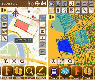
SuperSurv is the mobile GIS for Android devices, which supports field surveyors to overlay layers in tablets or smart phones to collect spatial data, position with GPS, use waypoint guidance, etc. Moreover, the application provides global coordinate system settings and supports to save the collected data of point, line and polygon in SHP, GEO or KML formats for further applications.

Primarily leveraging the connection of SuperGIS Server 3.1a, the newest version, SuperSurv 3.1a, is not only capable of accessing server services, enabling users to edit feature service online to synchronize the updated feature and attribute data with server. In addition, Online Map Tool will be built in SuperSurv 3.1a to support OpenStreetMap and Google Maps as reference basemap for field surveys. To efficiently display the attribute data in different languages in other GIS applications, code page settings will also be added into “Creating a New Layer.”

SuperSurv 3.1a will be released in the near future. To know the updated product information and download free trial, please visit Supergeo website: http://www.supergeotek.com/ProductPage_SuperSurv.aspx, or contact us with e-mail: staff@supergeotek.com.


Filed Under: Android Mobile OS Tagged With: Android Mobile OS, News, Supergeo to Release SuperSurv 3.1a (Android)

Editor’s Picks

OpenAerialMap – The open collection of aerial imagery

Google Announces that Google Earth Pro is now free

Leica RCD30: Better Resolution with More Details for 3D City Modeling

NOAA’s Lake Level Viewer of the Great Lakes

See More Editor's Picks...

About Editor

Glenn is a geographer and a GIS professional with over 20 years experience in the industry. He's the co-founder of GISuser and several other technology web publications.

Recent Industry News

The Drift Between Early Notes and Final Case Files in Abuse-Related Legal Support

April 29, 2026 By GISuser

Aerial Surveys Int’l and Global Marketing Insights to Present GEOINT 2026 Workshop on Multi-Domain Geospatial Fusion for Automated Infrastructure Monitoring

April 24, 2026 By GISuser

Why Timing Matters More Than You Think With Spray Seal (And Why People Often Get It Slightly Wrong)

April 22, 2026 By GISuser

The Quiet Planning Stage Most People Don’t See When Building a Pool in Brisbane

April 22, 2026 By GISuser

Hot News

State of Data Science Report – AI and Open Source at Work

HERE and AWS Collaborate on New HERE AI Mapping Solutions

Virtual Surveyor Adds Productivity Tools to Mid-Level Smart Drone Surveying Software Plan

Categories

Copyright gletham Communications 2015 - 2026

Go to mobile version