 In response to high public demand, NOAA announces a more user-friendly approach to accessing and viewing NOAA electronic navigational charts for non-navigational purposes. The NOAA ENC Direct to GIS Web portal provides comprehensive access to available ENC data in a variety of formats, allowing anyone—from students to coastal resource managers—an opportunity to view and use the data.
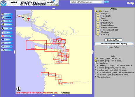
Developed by the NOAA Office of Coast Survey, ENC Direct allows anyone to view NOAA ENC data using an Internet browser from anywhere in the world. For the first time, the public can display data; zoom in and out; turn features on and off; query the features for more information; and most importantly download data in a variety of geographic information systems (GIS) friendly formats. The downloaded data can be formatted for virtually all commercially available GIS systems and used for important national issues such as coastal zone management.
All object classes (layers in the Internet mapping service) that are visible in your browser’s view frame can be extracted and downloaded in a variety of GIS/CAD formats. For improved download speed, NOAA ENC Direct to GIS is designed to provide data in the geographic region of your view frame.
http://nauticalcharts.noaa.gov/csdl/ctp/encdirect_new.htm
For metadata see http://ocs-spatial.ncd.noaa.gov/website/test/encdirect_met.htm
Contact enc.gis@noaa.gov
