Like many of you, I really enjoy using open tools. I’m lucky also because most of the creators of some fine tools and web services will typically provide me with full access to exploit and test their apps. Recently, the gang at Spatial Networks provided me with access to their FulcrumApp mobile data collection tool.
Data collected on mobile via FulcrumApp visualized in CartoDB
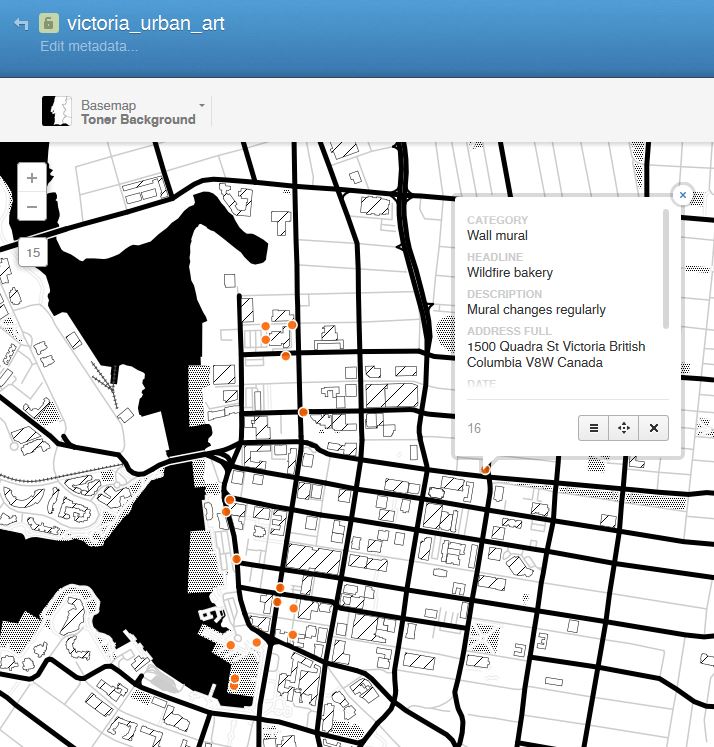
I’m a huge mobile nut so naturally I was petty stoked! Over the past week or so I’ve started a local pet project, cataloging and capturing urban art data and related information. My goal is to build a database providing access to some fabulous works of urban art here in the B.C, Canada Capital city of Victoria. Using the app on my Android mobile handset (a Nexus 4) I’ve been stopping as I pass by urban art, urban furniture, wall art (you may call it graffiti), works of native art, and more. With each record I store my location along with descriptions of the works of art and a photograph.
The process of data collection is fast and simple while the management of the app on the back end is equally simple to navigate, setup and manage. I’ll keep building the app over time, perhaps with the addition of video descriptions in the future and perhaps a migration to a standalone app in the future may be an option. Using tools like FulcrumApp along with OSM data and services like CartoDB can be very robust and affordable solution for those needing to collect data, analyze it, map it and share it over the web – best of all, your data is easily exported and/or shared for use in other environments.
Of interest was a recent announcement by the FulcrumApp crew that they’ve been working on some tighter integration with the very popular (and sexy) CartoDB product – another fine open service that is a favorite of mine to dabble with! Naturally, curiosity got the best of me so I quickly ran to my CartoDB account to test out the import functionality using a GeoJSON dump of my FulcrumApp data. Voila, immediately I had access to my data within CartoDB where it is now available for further manipulation and enhancement, perhaps dropping it into a nice web app or ?? Obviously I still have some testing to do in order to discover and exploit the full capabilities (for example, I need to get the photos and videos to export into CartoDB – that topic is discussed here) but so far its been easy going and loads of fun! Stay tuned for more as I build out my urban art inventory. The big advantage to date is that I now have a fully customizable mobile data collection app that is simply to manage and edit, easy to use, and enables me to quickly collect, store, and share data in real time, with data updates being recorded and stored (either live, over data or later while on WiFi) while the data is also viewable and easily shared in a live webmap (WMS). With the added capabilities of now authoring and serving up the data via CartoDB I now have even more functionality and numerous possibilities for analysis, cartographic display, authoring and sharing.
What Next? I plan to keep growing and collecting urban art data within our city and I’m also thinking that since my local city here doesn’t have an official citizen engagement app available that this could be an affordable solution that could be quickly developed… hmmmm.
CartoDB Webmap
If interested, you can checkout details of the Urban Art data collection project HERE or view the webmap HERE. See also the same data in CartoDB
Read about the FulcrumApp, CartoDB announcement HERE
[Tweet “Mobile Data Collection with FulcrumApp and Moving into CartoDB”]