GIS user technology news

News, Business, AI, Technology, IOS, Android, Google, Mobile, GIS, Crypto Currency, Economics

  • Advertising & Sponsored Posts
    • Advertising & Sponsored Posts
    • Submit Press
  • PRESS
    • Submit PR
    • Top Press
    • Business
    • Software
    • Hardware
    • UAV News
    • Mobile Technology
  • FEATURES
    • Around the Web
    • Social Media Features
    • EXPERTS & Guests
    • Tips
    • Infographics
  • Around the Web
  • Events
  • Shop
  • Tradepubs
  • CAREERS
You are here: Home / * PRESS / Maps and Cartography / Seven tribes create Tribal Story Maps using ArcGIS

Seven tribes create Tribal Story Maps using ArcGIS

August 10, 2016 By GISuser

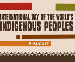
Esri Observes The United Nations’ International Day of the World’s Indigenous People with Tribal Story Map Challenge

2016-08-10 15_54_14-International Day of the World's Indigenous Peoples 9 August

Redlands, California—August 9, 2016—The United Nations’ International Day of the World’s Indigenous People is observed each year to promote and protect the rights of the world’s indigenous population. This year’s theme is right to education, and in honor of this, Esri partnered with seven tribes in a friendly competition to create Story Maps using the ArcGIS platform. The Story Maps bring attention to many different issues that affect tribal nations including climate change, forest resiliency and data sovereignty.

Story Maps are a way to tap into and explore ideas. Through interactive maps, Confederated Tribes of Umatilla,Seneca National, Santa Clara Pueblo, Coeur d’Alene Tribe, Navajo, the Grand Ronde Tribe, and Sisseton Wahpeton Oyate (SWO) shared powerful narratives that educate viewers of the issues at hand.

Joseph Robertson, head of The Impact of Data Sovereignty on American Indian Self-Determination created a story map discussing the impact of data sovereignty on American Indian self-determination. Robertson is pursuing his PhD at South Dakota State University and his dissertation is teaching Tribal governments and stakeholders how to integrate not only GIS data systems, but fully centralized data systems using the Esri platform.

Robertson is changing his computational statistics PhD framework in real time to take advantage of the breakthrough GIS provides for a nation building by using the ArcGIS bridge with R. Now stakeholders can learn the basics of R for statistical learning and also use this approach for higher education. Esri’s technology will also teach tribes about the power of how a fully integrated GIS platform intersects the power of pure spatial statistics and analysis through theory and American Indian Law and Policy.

Regarding his implementation, Joseph Robertson said, “I am confident we can make an impact in showing Indigenous communities what is possible in a data driven world through the eyes of an Indigenous person with the skill set to make this possible.”

Explore the meaning of the International Day of the World’s Indigenous People using this Story Map. Learn more about how Esri helps create a sustainable world for all people, visit go.esri.com/pr-susdev.

# # #


About Esri
Since 1969, Esri has been giving customers around the world the power to think and plan geographically. The market leader in GIS, Esri software is used in more than 350,000 organizations worldwide including each of the 200 largest cities in the United States, most national governments, more than two-thirds of Fortune 500 companies, and more than 7,000 colleges and universities. Esri applications, running on more than one million desktops and thousands of Web and enterprise servers, provide the backbone for the world’s mapping and spatial analysis. Esri is the only vendor that provides complete technical solutions for desktop, mobile, server, and Internet platforms. Visit us at www.esri.com.

Esri, the Esri globe logo, GIS by Esri, ArcGIS, www.esri.com, and @esri.com are trademarks, registered trademarks, or service marks of Esri in the United States, the European Community, or certain other jurisdictions. Other companies and products mentioned herein may be trademarks or registered trademarks of their respective trademark owners.

Filed Under: Maps and Cartography, Top Press

Editor’s Picks

Internet of Things for Defense & National Security

2015’s Best & Worst Metro Areas for STEM Professionals

NASA, NOAA Find 2014 Warmest Year in Modern Record

Now Available: Explorer for ArcGIS on Android #mobiletip

See More Editor's Picks...

Recent Posts

  • The Evolution of India’s Payment Service Providers (PSP): From Local Transactions to Global Reach
  • Best Backconnect Proxy Services: Top 7 Picks by Experts
  • Understanding the Essentials of Pet Care and Advice
  • Ethereum’s Validator Outflow and Network Stability
  • How to Use Pip with Proxy Rotation for Web Scraping Projects
  • How Jili Slot Games Deliver Exciting Gameplay Results
  • Branded Water Bottles: The Everyday Promo Item That Never Gets Old
  • The Ultimate Window: Low-Maintenance, High-Performance Aluclad Windows
  • Mapping Health Trends: How GIS is Powering Better Public Health Decisions in Indiana
  • From Page to Pixel: The Quiet Revolution in How We Read

Recent Features

Space Flight Laboratory (SFL) Announces Successful Launch & Deployment of HawkEye 360’s Cluster 11

FOSS4G NA 2024: The Premier Open Source Geospatial Conference Returns to St. Louis, September 9-11

Photographer Touch Reveal the Top Cameras, Lenses, and Photo Editing Tools of 2022

Digitalization and Simulation at the North Pole

Natural Gas District & GIS-Centric Asset Management

More Posts from this Category

Categories

RSS Career Tips

  • Four Characteristics of the Best Virtual Employees
  • 28 Tools to Conquer the Social Media Recruiting World
  • 8 Questions Employers Should Ask About Coronavirus
  • Jobcase Launches Free Unemployment Resource Center for Workers Impacted by COVID-19
  • Must-Have Gadgets and Technology for the Remote Office Worker


featured podcast

RSS Tech pubs

  • Transform Your Institution's Data Strategy with Our Comprehensive Data Maturity Assessment
  • Complete Guide to Telecom Shelter Construction
  • The Power of Personal Content Journeys for Members

RSS Computers

  • How the Cloud is Reshaping Virtual Desktops
  • Millennials as Brand Advocates - New Research Study Results
  • Vehicles Best Practices Installation Guide

RSS HR Tips

  • AWS GovCloud (US) Celebrates 10th Anniversary and a Decade of Digital Transformation in the Federal Government
  • Exploring the Impact of COVID-19 on Customer Behavior
  • The Pivot to 100% Remote Training in the Contact Center

RSS Gov Tech

  • 10 Legal Jobs You Can Get Without a Law Degree
  • J.D. Power Examines How the Inflation Reduction Act Reshapes EV Landscape
  • Making Telehealth Work for You: The Ultimate Guide

Copyright Spatial Media LLC 2003 - 2015

Go to mobile version