GIS user technology news

News, Business, AI, Technology, IOS, Android, Google, Mobile, GIS, Crypto Currency, Economics

  • Advertising & Sponsored Posts
    • Advertising & Sponsored Posts
    • Submit Press
  • PRESS
    • Submit PR
    • Top Press
    • Business
    • Software
    • Hardware
    • UAV News
    • Mobile Technology
  • FEATURES
    • Around the Web
    • Social Media Features
    • EXPERTS & Guests
    • Tips
    • Infographics
  • Blog
  • Events
  • Shop
  • Tradepubs
  • CAREERS
You are here: Home / * PRESS / Maps and Cartography / Map Tips – Webmap of 16th Century London

Map Tips – Webmap of 16th Century London

April 9, 2015 By GISuser

Here’s an interesting effort that gives you a modern day webmap revealing London back  in the 16th Century when Shakespear was around.

Webmap of 16th Century London

Webmap of 16th Century London

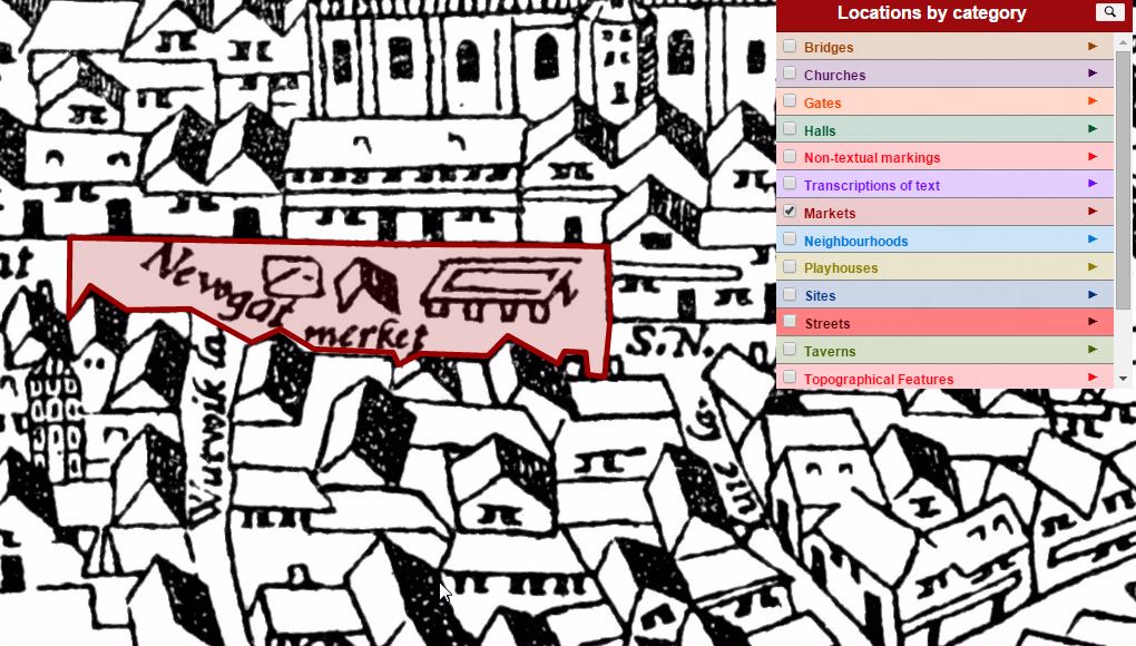
Enter The Agas Map of Early Modern London

According to a fine article on CityLab, The bird’s-eye view of London (also known as the “Agas” map) was first printed on woodblocks in 1561—right around the time of Shakespeare’s birth—then modified a century later. The intricate “Agas” map shows details such as monuments, institutions, businesses, marketplaces, and urban planning fixtures. Read More

See also more about the Early Map of London

[Tweet “Map Tips – Webmap of 16th Century London”]

Woah, very sweet! The Agas Map of Early Modern London http://t.co/51ZhT7nBoX pic.twitter.com/Fp1qZ0mwUz

— Glenn Letham (@gletham) April 9, 2015

Filed Under: Maps and Cartography, Tips, Top Press Tagged With: London, webmap

Editor’s Picks

FireWhat? Mobile GIS Lab, Emergency Incident Mapping and HP Mobile Workstations

Safe Software WEBINAR – Geospatial and Minecraft – Why You Should Care

Tripomatic – Custom Maps Built entirely with OpenSource Mapping Tools

Yellowstone’s Thermal Springs — Their Colors Unveiled

See More Editor's Picks...

Recent Industry News

The Drift Between Early Notes and Final Case Files in Abuse-Related Legal Support

April 29, 2026 By GISuser

Aerial Surveys Int’l and Global Marketing Insights to Present GEOINT 2026 Workshop on Multi-Domain Geospatial Fusion for Automated Infrastructure Monitoring

April 24, 2026 By GISuser

Why Timing Matters More Than You Think With Spray Seal (And Why People Often Get It Slightly Wrong)

April 22, 2026 By GISuser

The Quiet Planning Stage Most People Don’t See When Building a Pool in Brisbane

April 22, 2026 By GISuser

Hot News

State of Data Science Report – AI and Open Source at Work

HERE and AWS Collaborate on New HERE AI Mapping Solutions

Virtual Surveyor Adds Productivity Tools to Mid-Level Smart Drone Surveying Software Plan

Categories

Copyright gletham Communications 2015 - 2026

Go to mobile version