Tsukasa Consulting Co. in Japan uses the TatukGIS Developer Kernel (VCL edition) to develop its M System 3D GIS software solution that is used to manage radioactive decontamination work being performed in the vicinity of the site of 2011 Fukushima Daiichi nuclear power plant accident.
Canadian Municipal Government ERP Software Developed using TatukGIS SDK
TownSuite Municipal Software is an Enterprise Resource Planning solution developed specifically for municipal governments.
Swiss Use TatukGIS SDK for Road Infrastructure Management
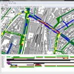
Switzerland based geologix AG has used the TatukGIS Developer Kernel to develop GIS functionality in its “Logo” information system for planning, managing, and maintaining road infrastructure.
Swiss Federal Railways Uses TatukGIS SDK for Infrastructure Asset Management
Swiss Federal Railways (SBB AG) has used the TatukGIS Developer Kernel for the development of its “DfA Reports” software application, which is used to manage a database of fixed railway asset installations across Switzerland.
Michigan State Police Use TatukGIS SDK for Traffic Crash Mapping System
The Michigan State Police (MSP) – Traffic Crash Reporting Unit (TCRU) uses the TatukGIS Developer Kernel to develop its Traffic Crash Mapping System (TCMS).
School District Administrative Planning GIS Developed with TatukGIS SDK
Wayne County (Michigan) Regional Educational Service Agency (RESA) developed the Polyplot© Mapping System, a client server application for school district administrative planning which is implemented in over 100 school districts throughout Michigan and Ohio. Polyplot is a unique, powerful tool designed for school districts to analyze student information interactively and graphically on a computerized map.