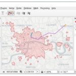
26/6/19 TravelTime platform launches a new QGIS plugin that enables users to create travel time polygons, also known as isochrones, using many modes of transport. For example, a pizza restaurant owner can use the plugin to discover pizza delivery areas, such as where’s reachable within a 30-minute drive from their restaurant.
Orbit GT launches 3D Mapping portfolio v19.5 and QGIS plugin update

Lokeren, Belgium, May 16th, 2019 – Orbit GT has launched version 19.5 for its full 3D Mapping portfolio, including a significant upgrade for the QGIS plugin.
Web-based GIS and Mapping Course with QGIS
Event Date: 17th – 28th July 2017.
QGIS 2.14.1 is Now Available
New Release Extends the Capability of the Leading Open Source Desktop GIS
Buy 1 QGIS Course and Get 5 FREE

Do you need to capture or update spatial data in the field? QGIS is a free and open source geographic information system, and Discover Spatial is hosting a new course that will take on how to set QGIS up for field use, and to make it as easy to use as possible.
Open Software – Exploring how QGIS works for visualization, cartography, GIS analysis, and editing
QGIS is open source, and similar to proprietary GIS software, runs on a variety of operating systems, and has been steadily improving since its debut in 2002. With easy-to-install packages, OpenGeo Suite integration, and reliable support offerings, QGIS is a viable alternative to proprietary desktop GIS software. Here, Gretchen Peterson of Boundless explores how QGIS […]
Self Paced Learning From Delmar College – Introduction to QGIS (MOOC)
EDU Tip – Introduction to Geospatial Technology Using QGIS – Canvas Network – Free online courses