Huntsville, AL – Exelon Clearsight, industry-leading robotics inspection company, recently acquired GeoCue Group Inc.’s True View 615 3D Imaging System, adding to their fleet of cutting-edge drone mapping technologies.
GeoCue Expands True View 3DIS® Line with True View 435

Huntsville, AL – GeoCue is excited to announce that we are, once again, expanding our line of True View 3D imaging sensors (3DIS®). The True View 435 is our next-generation topography/wire grade LIDAR/Imaging sensor. Featuring a 16 beam Hesai PandarXT LIDAR unit, world class Trimble Applanix APX-15 Position/Orientation System (POS) and dual GeoCue mapping cameras, […]
GeoCue Releases True View EVO Embedded Metashape
Huntsville, AL – GeoCue Group Inc. is pleased to announce an embedded version of Agisoft’s Metashape photogrammetric processing software. We have built interfaces directly into our LIDAR/Photogrammetric processing software, True View EVO, for driving both an embedded version of Metashape (Metashape for EVO, MfE) as well as the full GUI version of Metashape Professional. This […]
North Dakota Department of Transportation Selects GeoCue True View LIDAR/Imaging Technology for UAS Program
July 21, 2021 – HUNTSVILLE, AL – North Dakota Department of Transportation recently acquired a GeoCue True View 640 3D Imaging System (3DIS®) for their UAS program. GeoCue’s True View 3D Imaging Sensors allow for both drone LIDAR and imagery to be collected in a single flight on most UAS platforms.
North Dakota Department of Transportation Selects GeoCue True View LIDAR/Imaging Technology for UAS Program
July 21, 2021 – HUNTSVILLE, AL – North Dakota Department of Transportation recently acquired a GeoCue True View 640 3D Imaging System (3DIS®) for their UAS program. GeoCue’s True View 3D Imaging Sensors allow for both drone LIDAR and imagery to be collected in a single flight on most UAS platforms. The simultaneous data collection, […]
True View 515 Release Webinar
True View 515 3DIS® Release – February 24, 2021 l 10:00 AM CST
GeoCue Group Releases New Addition to 3D Imaging Systems Series: True View® 515

February 10, 2021 – HUNTSVILLE, AL – GeoCue Group announces the release of their latest addition to their 3D Imaging Systems (3DIS®) series, the True View® 515. This compact, affordable 3D Imaging System has significantly better sensitivity compared to other sensors in its class, resulting in remarkable analytic data. True View 515 will redefine LIDAR wire […]
Webinar: From Flight to Finish with True View & Pix4D

Join us for a partnered webinar with Pix4D as we overview our “From Flight to Finish” workflow featuring GeoCue’s True View 3DIS and Pix4Dmapper.
GeoCue’s True View Awarded ILMF “Outstanding Innovation in LIDAR”
July 22, 2020 – Huntsville, AL – The International LIDAR Mapping Forum (ILMF) and Geo Week hosted their 3rd annual 2020 Lidar Leader Awards presentation where the board recognized GeoCue Group’s True View® 410 3D Imaging System (3DIS™) as the 2020 Outstanding Innovation in LIDAR winner.
GeoCue Group Releases True View 615/620; RIEGL/Applanix-based UAS LIDAR System
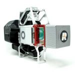
June 17, 2020 HUNTSVILLE, AL – GeoCue Group announces the release of their new True View® 615 and True View 620 UAS LIDAR/Imagery 3D imaging systems (3DIS). GeoCue’s True View 615 & 620 are equipped with RIEGL’s miniVUX-2UAV laser scanner integrated with dual photogrammetric cameras.