GIS user technology news

News, Business, AI, Technology, IOS, Android, Google, Mobile, GIS, Crypto Currency, Economics

  • Advertising & Sponsored Posts
    • Advertising & Sponsored Posts
    • Submit Press
  • PRESS
    • Submit PR
    • Top Press
    • Business
    • Software
    • Hardware
    • UAV News
    • Mobile Technology
  • FEATURES
    • Around the Web
    • Social Media Features
    • EXPERTS & Guests
    • Tips
    • Infographics
  • Blog
  • Events
  • Shop
  • Tradepubs
  • CAREERS
You are here: Home / * PRESS / Emergency Response / CoronavirusOutbreakMap.com COVID-19 Memorial Honoring Those Dead From COVID-19

CoronavirusOutbreakMap.com COVID-19 Memorial Honoring Those Dead From COVID-19

November 25, 2020 By Editor

NEW YORK, Nov. 25, 2020  — With the millions of people that have died from COVID-19, CoronavirusOutbreakMap.com is honoring everyone that has died from COVID-19. 

The COVID-19 pandemic has caused many deaths in the United States. Coronavirus Outbreak Map.com is helping surviving family members and friends remember and honor their loved ones lost due to COVID-19.

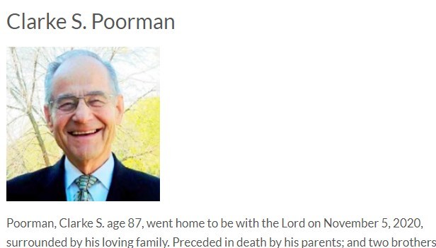
CoronavirusOutbreakMap.com
Poorman
Poorman

Coronavirus Outbreak Map memorial website is the place where the surviving family members and friends can honor the memory of those lost due to COVID-19.

Family members and friends can share their memories of their loved ones lost due to COVID-19 on Coronavirus Outbreak Map by sending an email to coronavirus outbreak map.

When you contact Coronavirus Outbreak Map by email at 259915@email4pr.com, please include your loved one or friend name and state of residence at time of death, you may attach a picture and any other information that you would like to have included on the Coronavirus Outbreak Map Memorial Page.

CoronavirusOutbreakMap.com Mission

– To honor those that have died from COVID-19

– To Report Coronavirus News

– To provide an agenda free news website and report only facts

– To provide a subscription free COVID-19 news website; as the CoronavirusOutbreakMap.com website does not charge fees and is completely free to the readers.

To learn more about Coronavirus Outbreak Map, visit our website.

Filed Under: Emergency Response, Maps and Cartography Tagged With: covid, COVID-19

About Editor

Glenn is a geographer and a GIS professional with over 20 years experience in the industry. He's the co-founder of GISuser and several other technology web publications.

Top Press

The Global Expansion of Aueshah: A New Era of High Jewelry

April 11, 2026 By GISuser

KARACHI, PAKISTAN. The international luxury market is experiencing a profound shift. Consumers are increasingly rejecting mass-produced goods in favor of rarity, authenticity, and emotional depth. … [Read More...]

State of Data Science Report – AI and Open Source at Work

September 10, 2025 By GISuser

AI and Open Source at Work … [Read More...]

Topcon Announces Landmark Expansion of Topnet Live Network Across USA

January 26, 2025 By GISuser

LIVERMORE, Calif.---Topcon Positioning Systems has announced a significant expansion of its Topnet Live reference station network, introducing 200 new geodetic stations strategically positioned across … [Read More...]

Space Flight Laboratory (SFL) Announces Launch and Deployment of NorSat-4 Maritime Monitoring Microsatellite

January 19, 2025 By GISuser

Seventh Satellite Developed by SFL for Norway … [Read More...]

HERE and BMW Group extend partnership on AI-powered mapping system

January 8, 2025 By GISuser

HERE and BMW Group extend partnership on AI-powered mapping system for automated driving and enhanced road safety … [Read More...]

Everest Base Camp Helicopter Tour, Helicopter Return Trek, and Manaslu Circuit Trek: Which Nepal Adventure Is Right for You?

November 6, 2026 By GISuser

Almost everyone planning a Nepal trip runs into the same wall. You want the big mountains, you have a fixed number of days, and every itinerary you read seems to promise something … [Read More...]

SFL Missions Inc. Confirms Successful Deployment of Six HawkEye 360 Radio Frequency Detection Satellites with Advanced Capabilities

October 27, 2026 By GISuser

MĀHIA, New Zealand, 26 October 2026 – SFL Missions Inc. today confirmed the successful deployment of six radio frequency (RF) detection and geolocation satellites for HawkEye 360 … [Read More...]

Canadian-Built RoadEng 12 Uses AI to Find the Best Location for New Resource and Rural Roads

October 17, 2026 By GISuser

Vancouver, BC, Canada, October 15, 2026 – North Vancouver-based Softree Technical Systems today released RoadEng Version 12, used in more than 75 countries to locate and design … [Read More...]

Beyond the Map: How AI Image and Video Generation Is Changing Geospatial Communication

October 14, 2026 By GISuser

Ask anyone who has shipped a GIS project what the hardest part was, and the answer is rarely the spatial analysis. It is almost always the communication. A site suitability … [Read More...]

From Maternity to Everyday Wear: Building a Wardrobe That Grows With You

October 14, 2026 By GISuser

When I think about maternity clothing, I feel the biggest mistake is buying too many things at once. During pregnancy, your body keeps changing, and something that fits well today … [Read More...]

Copyright gletham Communications 2015 - 2026

Go to mobile version