GIS user technology news

Mobile, Technology, and Business news

  • PRESS
    • Submit PR
    • Top Press
    • Business
    • Software
    • Hardware
    • UAV News
    • Mobile Technology
  • FEATURES
    • Around the Web
    • Social Media Features
    • EXPERTS & Guests
    • Tips
    • Infographics
  • Events
  • CAREERS
  • Advertise
    • Advertise
    • Meet the Editor
    • Submit Press
  • Shop
  • Tradepubs
  • facebook
  • Around the Web
You are here: Home / Archives for * PRESS / Webinars

Webinar Tip – Getting Started with D3.js for Data Visualization

January 26, 2021 By GISuser

Getting Started with D3.js for Data Visualization

Filed Under: Webinars Tagged With: Webinar

Webinar – Processing Large Drone Projects Webinar

January 18, 2021 By GISuser

The rapid processing of large drone projects (e.g. tens of thousands of images) presents significant challenges to the drone mapping industry.

Filed Under: Events, Top Text Lead Story, UAV/UAS, Webinars Tagged With: SimActive, UAV, Webinar

senseFly launches eBee e-learning platform and operator certification program to advance drone knowledge

January 12, 2021 By GISuser

CHESEAUX-SUR-LAUSANNE, Switzerland, 12th January 2021 – senseFly, the global leader in fixed-wing drones, today unveils the launch of its new e-learning platform and dedicated Certified senseFly Operator Program, developed to equip unmanned aerial vehicle (UAV) operators with the knowledge and skills required to carry out drone missions more accurately, safely and efficiently.

Filed Under: Business, EDU, UAV/UAS, Webinars Tagged With: senseFly, UAV

Enter the LIDAR Drone Mapping Arena at Minimal Risk

December 8, 2020 By Editor

When: Wednesday, December 9, 2020 – Time: 10AM – 11AM CDT

Filed Under: Events, Featured Webinar, GISuse HOT Event, LiDAR, Webinars Tagged With: lidar, Webinar

Webinar – How to Accurately Merge Imagery with LiDAR

December 1, 2020 By Editor

How to accurately merge imagery with LiDAR

Webinar – How to Accurately Merge Imagery with LiDAR,  Thursday, December 10th

Filed Under: Featured TOP PR, LiDAR, Webinars Tagged With: event, lidar, Webinar

UP42 Hosts Webinar on Fusion of Satellite Imagery, AIS Data, Machine Learning for Maritime Surveillance

November 30, 2020 By Editor

APIs connect UP42, geospatial data and processing capabilities, and the applications built with those

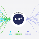
BERLIN, Germany, 30 November 2020 – UP42, creator of the leading developer platform for Earth observation data and analytics, will host a free webinar on maritime monitoring and surveillance on Dec. 9, 2020. Presentations will discuss the integration of optical and radar satellite imagery with Automatic Identification System (AIS) ship tracking data for analysis using machine […]

Filed Under: Earth Imaging - Remote Sensing, Featured Event, GISuse HOT Event, Webinars Tagged With: UP42

Webinar – Improving your Photogrammetric Workflow with New Version 8.6

November 2, 2020 By Editor

Improving your Photogrammetric Workflow with New Version 8.6

SimActive will release a new version of its photogrammetry software Correlator3D. The new version includes multiple new features, such as the use of intensity data from LAS files for image registration, the ability to improve mosaic seamlines with a DSM and the support of  DJI sun sensors.

Filed Under: Top Text Lead Story, Webinars Tagged With: SimActive, Webinar

Webinar: From Flight to Finish with True View & Pix4D

October 27, 2020 By Editor

pix4D

Join us for a partnered webinar with Pix4D as we overview our “From Flight to Finish” workflow featuring GeoCue’s True View 3DIS and Pix4Dmapper.

Filed Under: Hot Webinars, Webinars Tagged With: GeoCue, Pix4D, Webinar

Webinar – How to Quickly Generate High-Quality Orthomosaics

September 29, 2020 By Editor

Webinar - How to Quickly Generate High-Quality Orthomosaics

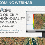
free webinar ‘How to Quickly Generate High-Quality Orthomosaics” – Learn about rapid image processing to produce accurate orthomosaics from SimActive.

Filed Under: Business, Featured TOP PR, Webinars Tagged With: SimActive, Webinar

Two Upcoming Webinars to Give Tips and Advice About Large Format Scanning

September 18, 2020 By Editor

Contex is pleased to announce two upcoming webinars that will give attendees tips and advice about large format scanning.

Filed Under: Business, Hardware, Webinars Tagged With: Contex, scanning, Webinar

« Previous Page
Next Page »


GIS jobs


Recent Features

Photographer Touch Reveal the Top Cameras, Lenses, and Photo Editing Tools of 2022

Digitalization and Simulation at the North Pole

Natural Gas District & GIS-Centric Asset Management

5 Ways Technology Is Affecting The Sharing Economy

Spotlight – Township Canada: Explore Canadian Legal Land Descriptions on a Map

More Posts from this Category


Post your link here!

Categories

Recent Posts

  • How You Can Use Technology to Make Online Deliveries Easier
  • Choosing the Right Mobile Phone in Nigeria
  • The Soaring Popularity of Online Gaming
  • VPN vs. Proxy: Which One Should You Choose for Online Privacy?
  • AI boom: don’t miss out, but avoid the frenzy

RSS Career Tips

  • Four Characteristics of the Best Virtual Employees
  • 28 Tools to Conquer the Social Media Recruiting World
  • 8 Questions Employers Should Ask About Coronavirus
  • Jobcase Launches Free Unemployment Resource Center for Workers Impacted by COVID-19
  • Must-Have Gadgets and Technology for the Remote Office Worker


shop for geogeek swag


RSS Tech pubs

  • Learn why Persistent was named a Leader in the Salesforce Ecosystem Partners 2023 ISG Provider Lens Study
  • Persistent Named a Leader in the Salesforce Ecosystem Partners 2023 ISG Provider Lens Study
  • HRIS Systems BattleCard--Workday HCM vs. ADP Workforce Now vs. Ultipro vs. Oracle HCM Cloud

RSS Computers

  • How the Cloud is Reshaping Virtual Desktops
  • Millennials as Brand Advocates - New Research Study Results
  • Vehicles Best Practices Installation Guide

RSS HR Tips

  • HRIS Systems BattleCard--Workday HCM vs. ADP Workforce Now vs. Ultipro vs. Oracle HCM Cloud
  • 7 Red Flags When Hiring a Window Security Vendor
  • The Role of CDP within HRI: Healthcare

RSS Gov Tech

  • The State of the CDP 2023
  • State of the CDP 2023
  • Read: 2023 State of the CDP

RSS UAV news

  • Liverpool welcomes Eurovision with record-breaking drone show by Celestial and Drone show Technology
  • Esri Partner Pollen Systems Provides Advanced Agriculture Analytics to Farms using PrecisionView™ Mobile
  • Draganfly Fulfills Delivery of First Situational Assessment Drone for DSNS Emergency Services Department Ukraine

RSS Geojobs

  • IT Endpoint Technician
  • Help Desk Technician
  • Systems Administrator
Copyright gletham Communications 2011-2022

Go to mobile version