GIS user technology news

News, Business, AI, Technology, IOS, Android, Google, Mobile, GIS, Crypto Currency, Economics

  • Advertising & Sponsored Posts
    • Advertising & Sponsored Posts
    • Submit Press
  • PRESS
    • Submit PR
    • Top Press
    • Business
    • Software
    • Hardware
    • UAV News
    • Mobile Technology
  • FEATURES
    • Around the Web
    • Social Media Features
    • EXPERTS & Guests
    • Tips
    • Infographics
  • Blog
  • Events
  • Shop
  • Tradepubs
  • CAREERS
You are here: Home / Archives for environment

Colorado Flooding and How to Help

September 13, 2013 By Editor

Colorado and the Colorado Front Range in Particular is in many ways the heartland of Geospatial technology in America, the corridor between Boulder and Fort Collins considered my many as “GIS Alley”. Wishes are going out to all in the area to stay dry and safe! Flooding in Longmont between 9th and Mt. View – […]

Filed Under: colorado, environment, THE EDITOR Tagged With: blog, Colorado

Chicago Real Time Bike Accident Map Identifies Hot Spots

August 2, 2013 By Editor

An interesting effort in Chicago by a law firm who have made available a pretty sweet map that enables cyclists to report accidents in order to define hot spots within the city.  This interactive map will allow users to report, not only bicycle accidents and doorings , but close calls or near misses as well, […]

Filed Under: conservation, Environment, environment

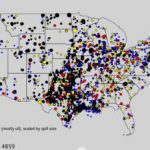
Map shows pipeline incidents in the US from 1986 to 2013
August 2, 2013 By Editor

A new time-lapse video from the Center for Biological Diversity brings frightening visualization to the 8,000 U.S. pipeline “incidents,” i.e. spills and explosions, since 1986 that have brought death and destruction to the US. According to the data, since 1986 there have been nearly 8,000 incidents (nearly 300 per year on average), resulting in more […]

Filed Under: environment

Research Shows Cities are safer than the Burbs

July 23, 2013 By Editor

If you were to check my College transcripts then you’d likely consider me to be an urban geographer… I guess that’s why I’ve always been fascinated with the makeup of cities and the complex, interactions between people and place.  Having lived through many years of people flocking to the suburbs, and now populations headed back […]

Filed Under: environment, GeoSocial Tagged With: urban

Spectral Transformer tool sets for Landsat-8 imagery from Geosage

June 17, 2013 By Editor

Landsat-8 captures more than 400 scenes per day, and as of early June 2013 more than 20,000 scenes are already available. New from Geosage, free tools for working with Landsat 8 imagery. GeoSage has released Spectral Transformer tool sets for Landsat-8 imagery to fill in this gap. The standalone tools are powerful and easy to […]

Filed Under: environment, imagery, Landsat

Colorado wildfires map: Black Forest fire, Royal Gorge, Big Meadows in ArcGIS.com

June 14, 2013 By Editor

Some interesting data being shared by the Denver Post as they track the devastation resulting from the wildfires near Colorado Springs, Colorado. Note, a KML file is available from HERE for use in Google Earth, Google maps, ArcGIS.com and other services that can ingest the data

Filed Under: arcgis, colorado, environment, THE EDITOR Tagged With: blog, Colorado

Colorado Wildfire information news map

June 13, 2013 By Editor

Sadly, another wildfire season is upon us and already we’ve seen some tragic events in California and now in Colorado.  A reminder that Esri has a useful news map that shares data and updates on wildfires including perimeter maps, social  media reports, and other data fed through various government agencies (NIFC, GeoMAC, NHSS, MODIS, METAR/TAF, […]

Filed Under: colorado, conservation, Environment, environment, ESRI, THE EDITOR Tagged With: blog, Colorado

Landsat 8, officially began its mission on May 30, 2013

June 13, 2013 By Editor

The latest in the Landsat series of Earth observation satellites, Landsat 8, officially began its mission on May 30. The purpose is to extend an unparalleled four-decade record of Earth’s land surface as seen from space.  NASA launched the Landsat Data Continuity Mission satellite on February 11. Since then, NASA mission engineers and scientists, with […]

Filed Under: environment, Landsat, nasa, satellite imagery, usgs

Imagery of Moore, Oklahoma before and after May 20 tornado

May 23, 2013 By Editor

The Pléiades satellites, operated and built by Astrium have captured images of Moore, Oklahoma, which clearly shows the devastation caused by the massive tornado that swept through the region on May 20, 2013.  By comparing today’s image with an image acquired on April 29, 2013, it is very easy to see that buildings, trees, cars […]

Filed Under: environment, imagery, weather

Data Basin – Free and open access supports learning

May 2, 2013 By Editor

Data Basin is a science-based mapping and analysis platform that supports learning, research, and sustainable environmental stewardship. Free membership is available to those looking for added networking, access to educational materials, tools, data and more. The core of Data Basin is free and provides open access to thousands of scientifically-grounded, biological, physical, and socio-economic datasets. […]

Filed Under: environment Tagged With: opendata

« Previous Page
Next Page »

Top Press

The Global Expansion of Aueshah: A New Era of High Jewelry

April 11, 2026 By GISuser

KARACHI, PAKISTAN. The international luxury market is experiencing a profound shift. Consumers are increasingly rejecting mass-produced goods in favor of rarity, authenticity, and emotional depth. … [Read More...]

State of Data Science Report – AI and Open Source at Work

September 10, 2025 By GISuser

AI and Open Source at Work … [Read More...]

Topcon Announces Landmark Expansion of Topnet Live Network Across USA

January 26, 2025 By GISuser

LIVERMORE, Calif.---Topcon Positioning Systems has announced a significant expansion of its Topnet Live reference station network, introducing 200 new geodetic stations strategically positioned across … [Read More...]

Space Flight Laboratory (SFL) Announces Launch and Deployment of NorSat-4 Maritime Monitoring Microsatellite

January 19, 2025 By GISuser

Seventh Satellite Developed by SFL for Norway … [Read More...]

HERE and BMW Group extend partnership on AI-powered mapping system

January 8, 2025 By GISuser

HERE and BMW Group extend partnership on AI-powered mapping system for automated driving and enhanced road safety … [Read More...]

Everest Base Camp Helicopter Tour, Helicopter Return Trek, and Manaslu Circuit Trek: Which Nepal Adventure Is Right for You?

November 6, 2026 By GISuser

Almost everyone planning a Nepal trip runs into the same wall. You want the big mountains, you have a fixed number of days, and every itinerary you read seems to promise something … [Read More...]

SFL Missions Inc. Confirms Successful Deployment of Six HawkEye 360 Radio Frequency Detection Satellites with Advanced Capabilities

October 27, 2026 By GISuser

MĀHIA, New Zealand, 26 October 2026 – SFL Missions Inc. today confirmed the successful deployment of six radio frequency (RF) detection and geolocation satellites for HawkEye 360 … [Read More...]

Canadian-Built RoadEng 12 Uses AI to Find the Best Location for New Resource and Rural Roads

October 17, 2026 By GISuser

Vancouver, BC, Canada, October 15, 2026 – North Vancouver-based Softree Technical Systems today released RoadEng Version 12, used in more than 75 countries to locate and design … [Read More...]

Beyond the Map: How AI Image and Video Generation Is Changing Geospatial Communication

October 14, 2026 By GISuser

Ask anyone who has shipped a GIS project what the hardest part was, and the answer is rarely the spatial analysis. It is almost always the communication. A site suitability … [Read More...]

From Maternity to Everyday Wear: Building a Wardrobe That Grows With You

October 14, 2026 By GISuser

When I think about maternity clothing, I feel the biggest mistake is buying too many things at once. During pregnancy, your body keeps changing, and something that fits well today … [Read More...]

Copyright gletham Communications 2015 - 2026

Go to mobile version