GIS user technology news

News, Business, AI, Technology, IOS, Android, Google, Mobile, GIS, Crypto Currency, Economics

  • Advertising & Sponsored Posts
    • Advertising & Sponsored Posts
    • Submit Press
  • PRESS
    • Submit PR
    • Top Press
    • Business
    • Software
    • Hardware
    • UAV News
    • Mobile Technology
  • FEATURES
    • Around the Web
    • Social Media Features
    • EXPERTS & Guests
    • Tips
    • Infographics
  • Blog
  • Events
  • Shop
  • Tradepubs
  • CAREERS
You are here: Home / *BLOG / Explaining Open Source Geotech and OpenGeo Components

Explaining Open Source Geotech and OpenGeo Components

March 26, 2015 By GISuser

Some great questions have been answered in a recent blog post from the OpenGeo crew. The meaty article takes a close look at the OpenGeo Suite as well as a look at the individual, OpenGeo Components. For the non-developer type like yours truly, this is an excellent and must read if you think there’s any chance you might be considering  a move to open source solutions in your mapping workflows.
Explaining Open Source Geotech and OpenGeo Components

Explaining Open Source Geotech and OpenGeo Components

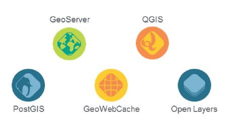
From the article… all of the components of the OpenGeo suite are open-source software projects with a community of developers behind them.

  • PostGIS – a spatial database extender for the PostgreSQL object-relational database. It adds support for geographic objects allowing location queries to be run in SQL (http://postgis.net/). TIP – see this video
  • GeoServer – GeoServer is an open source server for sharing geospatial data (http://geoserver.org/).
  • GeoWebCache – a Java web application used to cache map tiles coming from a variety of sources such as OGC Web Map Service (http://geowebcache.org/).
  • QGIS – a free and open source desktop Geographic Information System (http://www2.qgis.org/en/site/) TIP – see this how to video
  • OpenLayers – A high-performance, feature-packed library for all your web mapping needs (http://openlayers.org/)

While the specific open-source license for each varies slightly, they are all considered Free and Open Source Software (FOSS) applications without any license fees or royalties.

Great stuff! Continue reading the entire post HERE

More reading:

  • See also this video playlist from FOSS4GNA for some valuable tips!
  • A quick guide for new developers

[Tweet “Explaining Open Source Geotech and OpenGeo Components”]


Filed Under: *BLOG, Around the Web, Government & OpenGov, THE EDITOR, Tips, Top Press Tagged With: Open Source, OpenGeo, tip

Editor’s Picks

OpenAerialMap – The open collection of aerial imagery

Microsoft unveils the future of Windows

Event Review, Commercial Drone Expo

ArcGIS 10.3 and ArcGIS Pro Now Available – Modernize GIS for Organizations and Enterprises

See More Editor's Picks...

Recent Industry News

Bird Netting Installation in Dubai for Property Care 

July 11, 2026 By GISuser

How AI Helps Identify Crystals From Photos

July 10, 2026 By GISuser

The Future of Competitive Gaming: Why DMA Technology is the Ultimate Performance Edge

June 24, 2026 By GISuser

Milwaukee M18FHZ-0 Hackzall Reciprocating Saw – For hardcore cutting in a compact size

June 19, 2026 By GISuser

Hot News

State of Data Science Report – AI and Open Source at Work

HERE and AWS Collaborate on New HERE AI Mapping Solutions

Virtual Surveyor Adds Productivity Tools to Mid-Level Smart Drone Surveying Software Plan

Categories

Copyright gletham Communications 2015 - 2026

Go to mobile version