Many of us in the field of GIS believe that spatial analysis needs to be spread throughout a wide variety of disciplines.
In other words, our philosophy is that the geographic way of viewing the world and geospatial tools are too valuable and useful to be confined to one discipline, whether it is geography or computer science or other single discipline. Rather, GIS needs to be embedded into business, planning, environmental science, mathematics, engineering, history, language arts, biology, chemistry, archaeology, and many others. We also believe that GIS needs to be spread throughout different levels of education, from primary to university level. Finally, we believe that GIS needs to be included in every person’s formal education as well as offered in informal educational settings such as libraries, museums, and in clubs from 4H to Boy’s Clubs; to Girl Scouts and beyond. Who will undertake the task of making all of this happen? Educators committed to the value of GIS, who understand its capabilities, and are equipped to train and present the GIS method and framework to a wide variety of audiences and settings, that’s who.
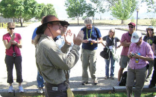
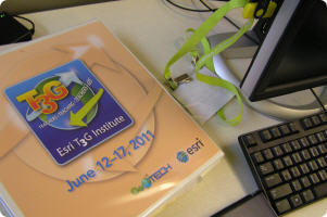
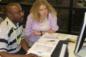
Empowering educators to spread GIS throughout education was the focus of the recent Teachers Teaching Teachers GIS (T3G) institute, held 12 to 17 June 2011 at Esri headquarters in Redlands, California. This third annual institute, co-sponsored by Esri and GeoTechCenter, enabled participants to promote and support GIS in other departments of their own institution, their local community, and in their professional networks. Unlike events that focus on "learning how to do more with GIS," the T3G institute focuses on "helping other educators use GIS effectively." Participants worked through a series of hands-on activities in the lab to improve their technical skills in online and desktop ArcGIS tools. This included work with geoprocessing, spatial statistics, Landsat imagery, 2D and 3D raster work, and ArcGIS Online maps and presentations. Yet the institute went far beyond the improvement of GIS skills. Discussion focused on how to best teach with and teach about GIS in different educational settings, from online courses to semester-long face-to-face courses to two-hour or one-week workshops. Participants also collected spatial and attribute data at the Gilman Historical Ranch and created a project where they analyzed their field data using GIS technologies. These projects included studies on elevation, weather, invasive species, bird nests, historical wildfires, tree health, and much more, and were presented with ArcGIS Explorer, ArcGIS Online, and ArcGIS desktop.
The 30 attendees ranged from 4-H coordinators to university professors and librarians to secondary school instructors from the USA, Norway, and Nigeria. The institute teaching team was comprised of educational consultant Kathryn Keranen, Amy Work from the Institute for the Application of Geospatial Technology, Anita Palmer and Roger Palmer from GIS ETC, and Esri education staff Charlie Fitzpatrick, Joseph Kerski, and Laura Bowden. The teaching team modeled different instructional methods, including gallery walks, instructor-led training, independent investigations, group projects, a "geo-news" broadcast, a game show competition, and others.
Applicants interested in applying for the 2012 T3G institute should have a strong interest in training other educators in the use of GIS in instruction, developing curricular materials that help educators and students use GIS, and promoting GIS to educational administrators and policymakers. Preference will be given to educators from various settings who have demonstrated experience in three areas: Using GIS, teaching with computers, and providing professional development for educators. For more information including the upcoming announcement about the 2012 institute, see http://edcommunity.esri.com/t3g