GIS user technology news

News, Business, AI, Technology, IOS, Android, Google, Mobile, GIS, Crypto Currency, Economics

  • Advertising & Sponsored Posts
    • Advertising & Sponsored Posts
    • Submit Press
  • PRESS
    • Submit PR
    • Top Press
    • Business
    • Software
    • Hardware
    • UAV News
    • Mobile Technology
  • FEATURES
    • Around the Web
    • Social Media Features
    • EXPERTS & Guests
    • Tips
    • Infographics
  • Blog
  • Events
  • Shop
  • Tradepubs
  • CAREERS
You are here: Home / News / GIS, Geo Tech Software / SuperGIS Server 3.1a Supports REST Architecture

SuperGIS Server 3.1a Supports REST Architecture

October 2, 2013 By Editor

SuperGIS Server 3.1a, service server software developed by Supergeo, now supports REST architecture, allowing developers to get the service contents published by SuperGIS Server 3.1a through URL.

SuperGIS Server 3.1a enables enterprises to create, manage, integrate and publish a variety of GIS services with the centrally-managed server structure, and has the spatial data, images and GIS functions to be deployed on applications on desktop, mobile and web browsers as GIS services through Internet connection. Therefore, an ideal work flow can be formed to enhance the working performance and decision-making.   

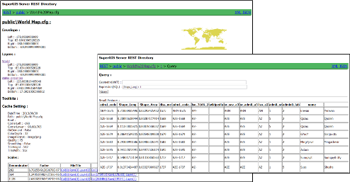
SuperGIS Server 3.1a supports REST architecture that allows administrators to provide developers with the ability to get the service contents, such as service list, layer information, searching specific feature, access of images or tiles, etc. through URL as the service has been distributed. Thus, developers are able to get the required map information through URL and straightly apply it on front-end applications, such as web, mobile end, etc.

SuperGIS Server 3.1a is available with three editions, Value, Standard and Advanced; each edition provides analysis functions of different levels. SuperGIS Server 3.1a Advanced is going to be launched in the near future; please visit Supergeo website  for the detailed information and the trial software.


Filed Under: GIS, Geo Tech Software Tagged With: Geo Tech Software, GIS, News, SuperGIS Server 3.1a Supports REST Architecture

Editor’s Picks

Esri Story Map Reveals Where Your Thanksgiving Dinner Comes From

Infographic – The History of the iPhone

Have Infographics and Data Visualizations Ruined Good Map Design?

Tripomatic – Custom Maps Built entirely with OpenSource Mapping Tools

See More Editor's Picks...

About Editor

Glenn is a geographer and a GIS professional with over 20 years experience in the industry. He's the co-founder of GISuser and several other technology web publications.

Recent Industry News

How to Choose the Best Office Interior Designers in Delhi for End-to-End Projects

June 3, 2026 By GISuser

Why Bathroom Renovation Services Often Change More Than Just the Bathroom

May 20, 2026 By GISuser

The Drift Between Early Notes and Final Case Files in Abuse-Related Legal Support

April 29, 2026 By GISuser

Aerial Surveys Int’l and Global Marketing Insights to Present GEOINT 2026 Workshop on Multi-Domain Geospatial Fusion for Automated Infrastructure Monitoring

April 24, 2026 By GISuser

Hot News

State of Data Science Report – AI and Open Source at Work

HERE and AWS Collaborate on New HERE AI Mapping Solutions

Virtual Surveyor Adds Productivity Tools to Mid-Level Smart Drone Surveying Software Plan

Categories

Copyright gletham Communications 2015 - 2026

Go to mobile version