SGS and Lawrence Berkeley National Laboratory Department of Energy release database and interactive map of all large-scale solar energy facilities in the U.S.
Nearly 3,700 facilities and their attributes can be seen on and downloaded from the interactive map
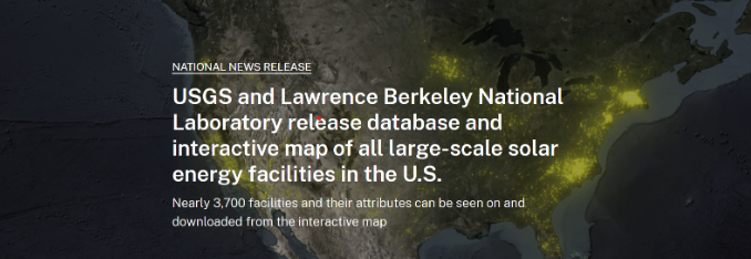
RESTON, Va. All large-scale solar energy facilities can now be found on a single map, thanks to the U.S. Geological Survey and the U.S. Department of Energy’s Lawrence Berkeley National Laboratory. The interactive map is based on the United States Large-Scale Solar Photovoltaic Database (USPVDB).
“With the release of the database, data that were previously scattered across several datasets—and in some cases unavailable to the public—have been released to the public in a single package via the new viewer that we’re launching,” said USGS scientist Jay Diffendorfer, who co-led the effort. “With the release of this public version, we hope researchers and other interested parties around the world will use the data to further their efforts.”
“This effort continues LBNL and DOE’s tradition of preparing high-quality data that we share with the public,” says research scientist Ben Hoen, the LBNL principal investigator on the project. “Having these data in this form and via this interface will allows greater data use and accessibility.”
The database is anticipated to be used by government agencies, scientists, private companies, and other stakeholders for a variety of analyses. Examples of uses include operational impact analyses related to the role of solar energy in the U.S. electric grid, interactions between photovoltaic facilities and the natural environment, and investments in photovoltaic infrastructure.
This new, large-scale solar database contains all ground-mounted commercial U.S. solar photovoltaic facilities with capacities of one megawatt or greater. The U.S. Energy Information Administration (EIA) classifies all solar facilities with capacities of one megawatt or greater as large-scale and those with capacities of less than one megawatt as small-scale.
The database currently contains data for nearly 3,700 U.S. large-scale solar facilities across 47 states plus Washington, D.C. that became operational between 1986 and the end of 2021. The database contains nearly 100% of this category of facilities installed during that period.
The USPVDB contains energy facility locations and their attributes, including the size of the solar panel array area, panel technology type, axis type, year of installation and rated capacity to produce electricity.
Solar energy is a growing source of energy for the country. As of January 2023, 73.5 gigawatts of utility-scale solar capacity were operating in the United States, comprising about 6% of the U.S. total, according to the EIA. In addition, just over half of the new U.S. generating capacity expected in 2023 is solar power.
“The USPVDB Viewer allows stakeholders to visualize, interact with and explore the database through a dynamic web application, without the need for specialized software,” said USGS scientist Chris Garrity, who served as developer and co-lead on the project. “Users can interact with the data using a variety of filters and data visualization tools, allowing solar facility attribute information to be rapidly queried and analyzed. Much like our popular U.S. Wind Turbine Database, the USPVDB will not be a static product. We anticipate the database will be continually updated as new projects come online.”
The full dataset can be downloaded in a variety of formats, and users can connect to the underlying data and incorporate data services into their own software and applications.
The United States Large-Scale Solar Photovoltaic Database can be accessed here or through the USPVDB Viewer. To learn more about USGS energy research, please visit the USGS Energy Resources Program website, the USGS Land Change Science Program or the USGS Geology, Energy & Minerals Science Center, sign-up for our newsletter and follow us on Twitter.
To learn more about DOE’s research in solar energy technologies, please visit https://www.energy.gov/eere/solar.
# # #
The USGS provides science for a changing world. Learn more at www.usgs.gov or follow us on Facebook @USGeologicalSurvey, YouTube @USGS, Instagram @USGS, or Twitter @USGS.