Technology is advancing at a rapid rate and has helped to encourage safer driving. In this post, we’ll explore how mapping technology is contributing to the reduction in speeding offences.

According to encyclopaedia.com, mapping technology is a broad term that describes the equipment and techniques used to prepare, analyse, and distribute maps of all kinds. There are several different types of mapping technology, including GIS (Geographic Information System) Software, GPS (Global Positioning System), Global Surveillance and Satellites.
As travel technologies have developed, so has the awareness of safer driving and road safety laws concerning speeding. Consequently, several driving offence solicitors have applauded the reduction in the number of speeding offences in comparison to other motoring-related crimes.
In this article, we’re going to be focus specifically on the use of traffic technology apps to find out how they have helped to tackle speeding problems around the world.
Worldwide Speeding Statistics
Sadly, speeding is a major factor in traffic deaths and injuries. In the US, speeding was a factor in a quarter of traffic fatalities in 2019, killing an average of over 25 people per day. Though these figures are shocking, the number of speeding-related deaths has slowly decreased; in 2010, almost a third of traffic fatalities were speeding-related.
In 2020, the number of drivers with convictions fell even more, despite claims that speeding offences were soaring throughout lockdown and during the COVID-19 pandemic. So, what factors have led to a decrease in offences if it wasn’t the pandemic? Has mapping technology played a role? And if so, what types of technologies have helped?
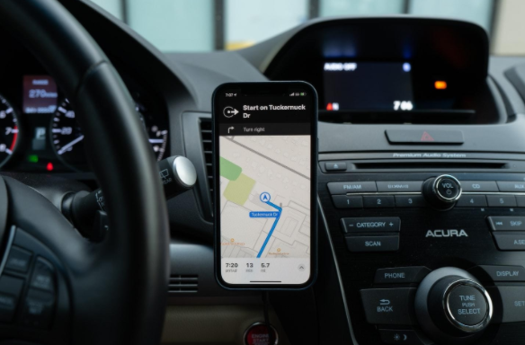
Google Maps
In 2019, Google incorporated some features that were previously only available on its app – Waze. The company confirmed it was rolling out the ability for Google Maps users to see speed limits, speed cameras, and mobile speed cameras, in more than 40 countries worldwide.
Nowadays, Google Maps display the speed limits of the road you are driving on in the corner of the phone screen which is using the app. It also allows users to spot incident reports as well as crash and speed trap reports, helping to warn drivers of the dangers.
To bring up the speed limit when you use Google Maps, simply:
- Open Google Maps on your device, press your profile icon at the top-right corner, then Settings.
- Tap Navigation settings, scroll down to ‘Driving options,’ then switch the slider to ‘On’.
- For extra guidance, you can also switch on the Speedometer option to save you from having to look between your dashboard and your phone screen all the time.
Waze
Created in 2006, Waze is a subsidiary of Google and has many of the functions that Google Maps has, with Google Maps not actually updating its speed monitoring features until 2019. As well as informing users of speed limits using GPS signals, Waze uses data from app users to provide quicker navigation routes and report the community on traffic, accidents, police traps, blocked roads, weather conditions and much more.
Though the app has been heavily applauded over the years, one disadvantage that’s been noted is that the app can be distracting. Between ads popping up, conversations among friends, and suggested route diversions, it may not be the best app to use while on the go if you’re trying to stay concentrated on the road ahead.
Here Technologies
More recently, HERE Technologies – a digital mapping provider – launched an ‘ISA map’ specifically designed to help vehicle manufacturers deliver accurate Intelligent Speed Assistance systems.
Here Technologies maps use traffic sign recognition and digital speed limit maps, linked to a vehicle’s GPS location, to help the driver stick to the local speed limit. Arguably, these types of technologies are necessary in several situations including when speed limits are not signposted, speed limits are concealed, and instances where conditional speed limits change due to external factors such as time of day or weather conditions.
TomTom
TomTom’s ADAS map is another proven technology that has helped to increase vehicle and passenger safety. Its ADAS (advanced driver-assistance systems) map informs drivers of the current speed limit and, when needed, acts as a speed limiter – automatically reducing a vehicle’s speed by limiting engine power.
On TomTom’s website, the company state: ‘ADAS Map speed limits are collected by TomTom survey vehicles and maintained with crowdsourced data. We attach these speed limits to specific road segments, also indicating specific validity if it is a conditional speed limit. Internal TomTom audits and benchmarks against competition confirm the leading quality of our speed limit data.’
Do You Think Mapping Technology Has Helped to Reduce Speeding Offences?
In this article, we’ve discussed some worldwide statistics surrounding traffic fatalities and provided some examples of studies that show a reduction in speeding offences. In addition to this, we’ve referred to a few tech companies that have developed mapping technologies and contributed to the fight for road safety.
Drivers should never rely on Google Maps or other apps for speed camera locations and should, of course, always drive within the speed limits regardless of camera positions. That being said, new technologies have definitely helped to reinforce the need for drivers to slow down and stick to traffic laws.
Do you know of any other companies that are using mapping technologies to help fight crime? Or do you think the reduction in speeding offences is down to other factors other than tech? If so, let us know in the comments below! We’d love to hear your thoughts.
Photo credits:
Photo 1: benjamin lehman via Unsplash
Photo 2: Ravi Palwe via Unsplash
Photo 3: Joshua Hoehne via Unsplash
