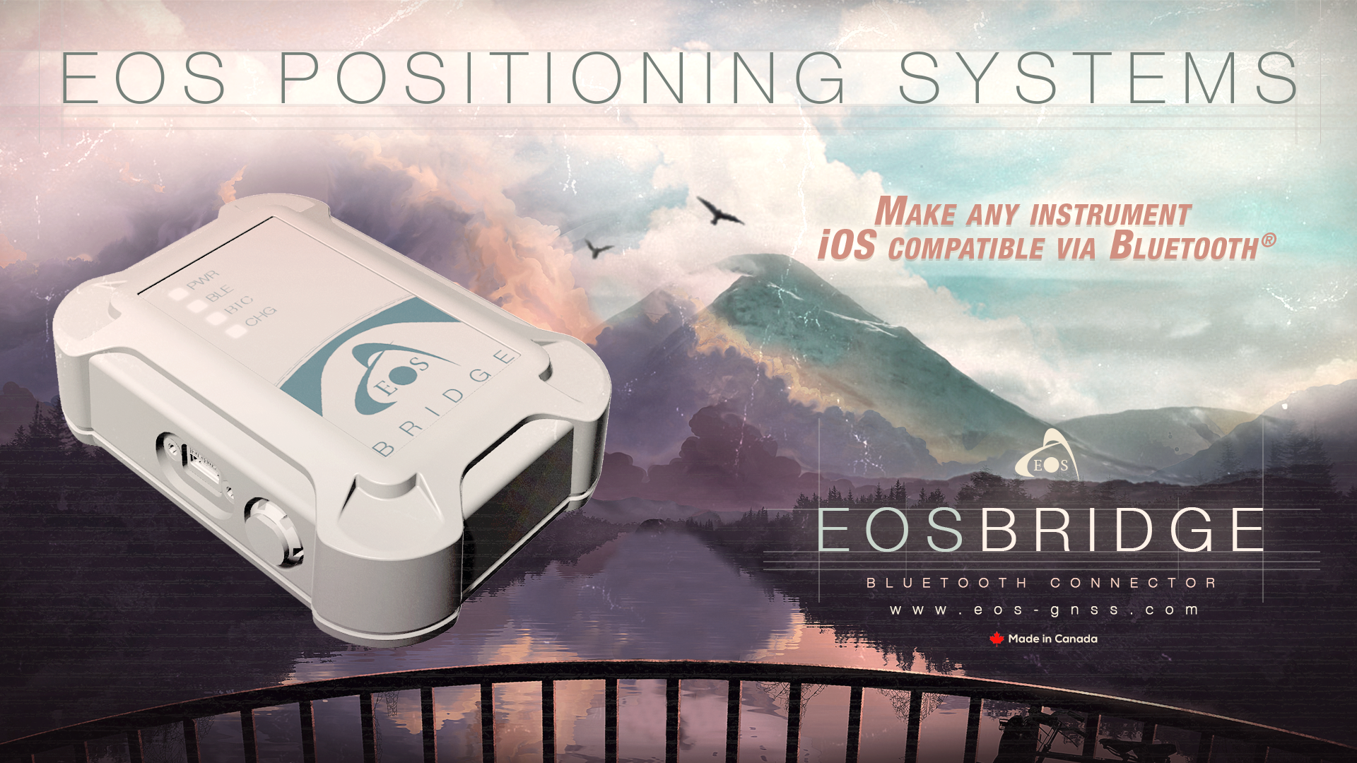
The Eos Bridge™ adds Bluetooth® connectivity to instruments not previously iOS compatible
MONTREAL, Canada—June 2021—Eos Positioning Systems® (Eos), the global manufacturer of Arrow Series® GNSS receivers, announced today the release of a new product called the Eos Bridge™. The Eos Bridge™ enables almost any instrument to become iOS Bluetooth compatible.
The Eos Bridge™ is a small, pocket-sized device that connects to instruments via Bluetooth Classic or serial port, and transmits data from them to any Apple iOS device, such as iPhone or iPad, Android device or Windows mobile device.
The Eos Bridge™ offers two connectivity methods to virtually hundreds of instruments:
First Method: Bluetooth Classic to Apple iOS Bluetooth
Instruments that are equipped with non-iOS Bluetooth are now able to connect to Apple iOS devices using the Eos Bridge™. This includes laser rangefinders and utility-locating instruments, for example.
Second Method: Serial port to iOS, Android, and Windows devices
With the Eos Bridge™, instruments whose only connectivity option is a serial port may now be connected to any iOS, Android, or Windows device via Bluetooth. This includes any instrument or sensor with an RS-232 serial port, for example.
The Eos Bridge™ is lightweight, at approximately 150 grams (about 5.3 ounces). It can be worn inconspicuously by being clipped to a belt, stored in a pocket, or mounted to an instrument or sensor. The Eos Bridge™ battery lasts 48 to 72 hours.
The Eos Bridge™ expands the potential pairings of legacy instruments and sensors by making them Bluetooth compatible with modern mobile devices and Arrow GNSS receivers. Two immediate applications for current Arrow GNSS users include Eos Laser Mapping™ for ArcGIS offset data-collection, and Eos Locate™ for ArcGIS for underground utility mapping. Both solutions are available on iOS.
To find your nearest authorized reseller, contact Eos online.
About Eos Positioning Systems®
Eos Positioning Systems (Eos) is the award-winning North American manufacturer of Arrow Series® GNSS receivers. Arrow receivers are device- and app-agnostic, designed to make high-accuracy mobile mapping simple and affordable for every mobile crew. Arrow GNSS receivers support consumer and professional mobile devices including iOS, Android and Windows. They also support leading desktop and mobile mapping software applications, such as Esri’s ArcGIS. Arrow receivers support a variety of GNSS constellations, channels, frequencies, accuracy thresholds, and differential-correction sources. Learn more at www.eos-gnss.com.