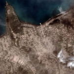
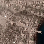
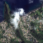
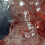
Maxar collected new satellite imagery today of the Caribbean island of St. Vincent and the ongoing eruption of the La Soufriere volcano. In spite of heavy cloud cover (including ash clouds) in the area, today’s satellite view provides the first high-resolution look at the northwest coast of St Vincent and the large amount of ash that has fallen over the region, blanketing the vegetation and all of the homes and building in the area.


Satellite image ©2021 Maxar Technologies