GISuser.com

GIS and Technology news for mapping professionals

  • PRESS
    • Submit PR
    • Top Press
    • Business
    • GIS, Geo Tech Software
    • Hardware
    • UAV News
    • Mobile Technology
    • Editor’s Top Picks
    • Get TOP Listing!
  • FEATURES
    • GeoGeeksinCars
    • 10 Question Q&A
    • FROM THE EDITOR
    • SPATIAL MEDIA AUTHORS
    • Social Media Features
    • EXPERTS & Guests
    • Listicles and Top 10 Lists
    • Infographics
    • VIDEOS
  • Events
    • Webinars
    • Submit event
    • Event Media Partner
  • CAREERS
    • Career Help Articles
    • People and Career News
    • Work from Home
    • About GeoJobs.BIZ
  • About
    • Advertise
      • Advertise wth GISuser
      • Media Kit Request Form
      • Directory
      • Submit Press
    • Contact GISuser
    • Meet the Editor
    • Social Media
      • AnyGeo Blog
      • GeoGeeks Podcast
      • Social Media Features
      • Like Us
    • SpatialMedia
      • LBSzone
      • LiDAR Magazine
      • Amerisurv
      • SymbianOne
    • RSS feed
  • Blog
  • Shop
  • Cloud Hosting
    • Amazon Cloud Hosting
    • WordPress cloud hosting
    • Dedicated servers USA
    • Linux Shared Hosting
    • Windows Shared Hosting
    • Web Development
    • SSL Certificate
  • Tradepubs
You are here: Home / * PRESS / Business / Esri Canada – Five Steps to Understanding the COVID-19 Impact on Your Organization

Esri Canada – Five Steps to Understanding the COVID-19 Impact on Your Organization

May 6, 2020 By GISuser

Esri Canada recently offered Cdn businesses this help to weather the pandemic.

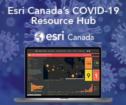
Esri Canada’s COVID-19 Resource Hub is a free collection of data, maps, applications and other resources available to assist organizations in monitoring, preparing for and responding to the rapidly changing situation caused by the coronavirus.

These free resources can be used by your organization. Take these steps to understand the COVID-19 impact to your business and community:


  1. Map the cases—Map confirmed and active cases, deaths, and recoveries to identify where COVID‑19 infections exist and have occurred.


  1. Map the spread—Time-enabled maps can reveal how infections spread over time and where you may want to target interventions.


  1. Map vulnerable populations—COVID‑19 disproportionally impacts certain demographics such as the elderly and those with underlying health conditions. Mapping social vulnerability, age, and other factors help you monitor at-risk groups and regions you serve.


  1. Map your capability to respond—Map facilities, employees or citizens, medical resources, equipment, goods, and services to understand and respond to current and potential impacts of COVID‑19.


  1. Communicate with maps—Use interactive Web maps, dashboard apps, and StoryMaps to help rapidly communicate your situation.

Esri Canada can help you customize and develop a similar hub. For questions or assistance, please contact us.

Esri Canada is a leader in geographic information system (GIS) solutions that empower people in business, government and education to make informed and timely decisions by leveraging the power of mapping and spatial analytics.


Related Articles on GISuser:

  • Wildfires in British Columbia (Story Map) – How many are caused by Humans?Wildfires in British Columbia (Story Map) – How many are caused by Humans?
  • Mapping the Spread of #Coronavirus COVID-19 – Trusted Maps and DataMapping the Spread of #Coronavirus COVID-19 – Trusted Maps and Data
  • The ArcGIS Online Implementation Guide from Esri CanadaThe ArcGIS Online Implementation Guide from Esri Canada
  • City of Coquitlam Recognized for GIS InnovationCity of Coquitlam Recognized for GIS Innovation
  • County of Simcoe Honoured for Excellence in GISCounty of Simcoe Honoured for Excellence in GIS
  • B.C, Canada Wildfires Map, 2016 – How many fires are started by humans?B.C, Canada Wildfires Map, 2016 – How many fires are started by humans?

Filed Under: Business, Emergency Response, Environment, Top Text Lead Story Tagged With: canada, covid19, ESRI


Editor’s Picks

Data Tip - The US Interagency Elevation Inventory

Data Tip – The US Interagency Elevation Inventory

A Milestone in the Digital Mapping Industry: Avenza’s PDF Maps App Surpasses One Million Downloads

Esri Partners Acknowledged for Best Practices in GIS

First Look – Los Angeles Opens the GeoHub – #OpenData for Citizens and Developers

See More Editor's Picks...

Connect with GISuser

  • Facebook
  • Google+
  • LinkedIn
  • RSS
  • Twitter


GIS jobs

Recent Features

Digitalization and Simulation at the North Pole

Natural Gas District & GIS-Centric Asset Management

5 Ways Technology Is Affecting The Sharing Economy

Spotlight – Township Canada: Explore Canadian Legal Land Descriptions on a Map

GeoGeeksinCars – The one in “Tippy” the right-hand drive Mitsubishi, at DevSummit

More Posts from this Category

Categories


Recent Posts

  • Best Gaming Phones for 2021
  • Everything You Need to Know About Selling on Amazon
  • Trimble Announces Rugged, Lightweight Field Data Controller for Land and Construction Surveying
  • Webinar – How to Solve Algal Blooms in Municipal Water
  • Concept3D Offers Virtual Tour and Mapping Software to Hospitality and Tourism Industry at No Cost

RSS Career Tips

  • Four Characteristics of the Best Virtual Employees
  • Jobcase Launches Free Unemployment Resource Center for Workers Impacted by COVID-19
  • 8 Questions Employers Should Ask About Coronavirus
  • Must-Have Gadgets and Technology for the Remote Office Worker
  • Must-Have Gadgets and Technology for the Remote Office Worker


shop for geogeek swag

RSS Tech pubs

  • The Human Resources Management Kit - 2021 Edition
  • The Essentials for CEOs - 2021 Kit
  • The Essentials of Cloud - 2021 Kit

RSS Computers

  • iPad CTO Kit - including the iPad Tips and Tricks Guide for IT Executives and Managers
  • The Essentials of Information Security Kit: Includes a Free PC Security Handbook - 2nd Edition eBook
  • Windows... On Speed

RSS HR Tips

  • The Human Resources Management Kit - 2021 Edition
  • A Better Alternative to the Antiquated EAPs
  • The Mental Health Pandemic: 2021's Top Employer Trend

RSS Gov Tech

  • Cyberwarfare Requires Speed, Adaptability and Visibility to Win: Enterprises Must Close the IT Operations and Security Gap
  • The New American Workplace Research Kit - Includes a Free $8.50 Book Summary
  • Next-generation Situational Awareness - How Skydio's autonomous drone solutions protect first responders

RSS UAV news

  • Global Commercial Drone Market Expected to Exceed $8.5 Billion By 2027
  • Down to Earth – Drone Lidar Surveying Reality Series Returns
  • Florida Signs Participating Addendum with DroneUp Providing Public Sector Agencies Access to Drone Services

RSS Geojobs

  • An error has occurred, which probably means the feed is down. Try again later.
Copyright Spatial Media LLC 2003 - 2015