March 8th, Maxar Technologies collected satellite imagery of Nashville, Tennessee, and the aftermath of the tornado that recently struck the area.

Overview of nashville_ after tornado_8march2020
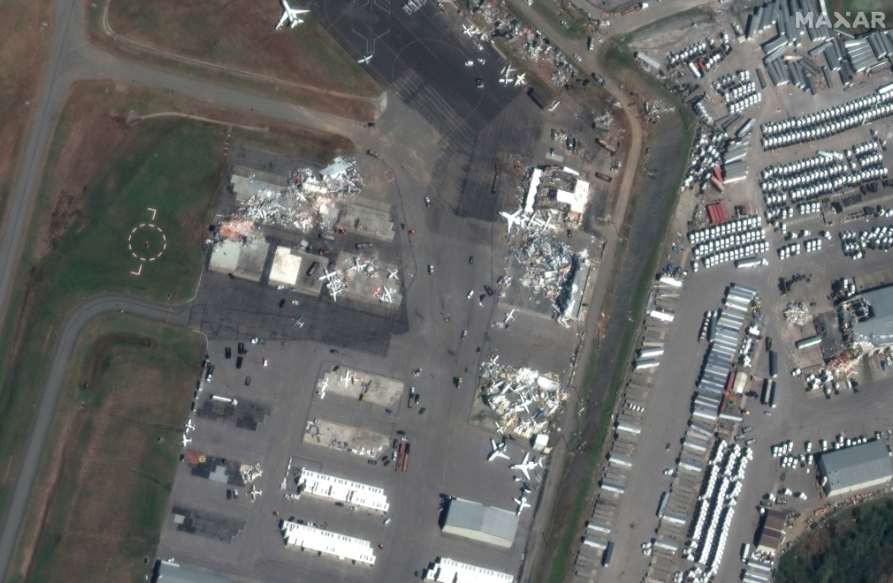
john c tune airport_hangars after tornado_8march2020

damage to the Old Tennessee State prison, which was featured in the movies “The Green Mile” and “Walk the Line.”
satellite images ©2020 Maxar Technologies.
