On November 14, Maxar’s GeoEye-1 satellite collected new imagery of Venice, Italy. Floodwaters can be seen across sections of the city, including most notably at St. Mark’s Square (Piazza San Marco) and around the Basilica (Basilica di San Marco).
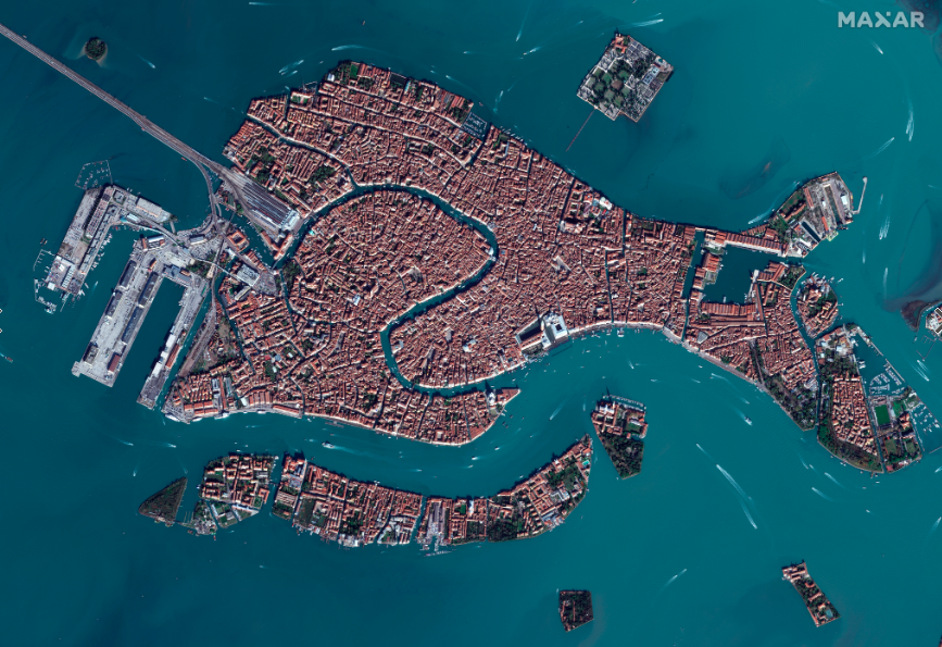
overview of venice_14nov2019
Satellite image ©2019 Maxar Technologies
