GIS user technology news

News, Business, Technology, Mobile, GIS, Crypto Currency, AI, Economics

  • PRESS
    • Submit PR
    • Top Press
    • Business
    • Software
    • Hardware
    • UAV News
    • Mobile Technology
  • FEATURES
    • Around the Web
    • Social Media Features
    • EXPERTS & Guests
    • Tips
    • Infographics
  • Events
  • CAREERS
  • Advertising and Sponsored Posts
    • Advertising and Sponsored Posts
    • Submit Press
  • Shop
  • Tradepubs
  • Around the Web
  • Cool Links
You are here: Home / * PRESS / Business / Orbit GT and Viametris, France, sign Reseller Agreement

Orbit GT and Viametris, France, sign Reseller Agreement

October 11, 2019 By GISuser

Lokeren, Belgium, October 11th, 2019 – Orbit GT is pleased to announce that Viametris, France, has joined as Authorized Reseller of Orbit GT 3D Mapping products.

“We’re very excited to announce our co-operation with Viametris”, says Peter Bonne, CEO of Orbit GT.
“Viametris has been frontrunner in 3D Reality Capture for many years, with excellent reputation across the globe.  Together we will be able bring our joint customers to the next level.”

“We’re happy to announce our co-operation with Orbit GT”, says Jérôme Ninot, CEO of Viametris. “We have been technology partners for years, and we have always secured compatibility between our solutions. Together we will be able to bring our joint customers to a flawless production workflow.”

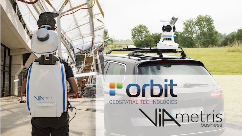
In this Image : Viametris Backpack and Mobile Mapping products

About Viametris

For over ten years, Viametris has been developing innovative mobile scanning technologies in response to the complex challenges posed by 3D scanning. The French company offers precise, added-value solutions to improve acquisition processes and data management for Lidar-based mapping, management of point clouds and integration of the subsequent data collection.

Always in search of new technological approaches, Viametris has now become a key player in mapping, offering a full range of indoor and outdoor mobile mapping systems: portable indoor and outdoor 3D system (bMS3D), outdoor mobile vehicle scanner (vMS3D) and continuous 3D indoor mobile scanner (iMS3D). Viametris also offers a range of post-processing (PPiMMS) and automatic data recognition (MaGeLAAn) software, specially adapted for surveying, architecture and BIM projects.

About Orbit GeoSpatial Technologies

Orbit Geospatial Technologies is world leader in solutions for exploiting 3D Mapping content in managing, viewing, extracting, publishing, sharing and embedding in workflows, either desktop or cloud based. Orbit GT specializes in 3D Mapping solutions for Mobile Mapping, UAS Mapping, Indoor Mapping and Aerial Oblique Mapping, replacing the big data dilemma with ease of use. Orbit GT is headquartered in Lokeren, Belgium, and enjoys a global business network.

As we experience many of Orbit GT customers are using several techniques of reality capture, such as Mobile Mapping, Terrestrial scanning, Aerial Oblique and UAS Mapping, we worked towards an integration of our portfolio to offer a single product line covering the needs for each of these domains.  This native integration is a sure win for every customer and user.

For more information, please contact 

www.orbitgt.com

Filed Under: Business Tagged With: Orbit GT, partner, reseller

Editor’s Picks

geojobs

GeoJobs.BIZ Employment and Career Resource for GIS, Surveying, and Mapping Professionals

HERE Beta Will Challenge Your Google Maps Loyalty

Feature – GIS and the NFL: Sustainability and Millennial Fans

Salary Guide, Tips for Fastest Growing Industries & Top Technology Positions in Demand

See More Editor's Picks...


featured podcast

Recent Features

Space Flight Laboratory (SFL) Announces Successful Launch & Deployment of HawkEye 360’s Cluster 11

FOSS4G NA 2024: The Premier Open Source Geospatial Conference Returns to St. Louis, September 9-11

Photographer Touch Reveal the Top Cameras, Lenses, and Photo Editing Tools of 2022

Digitalization and Simulation at the North Pole

Natural Gas District & GIS-Centric Asset Management

More Posts from this Category

Categories

Recent Posts

  • Teledyne Geospatial to Participate in SeaSEC Challenge Weeks in the Netherlands
  • Juniper® Systems Adds RTK Precision to Archer™ 4 GNSS Expansion Pod
  • Slot Game Story Segments Unlocked by Spin Count
  • Top 5 Mistakes to Avoid in Your Personal Injury Case in Salem 
  • Risk Management Strategies in Mining Financing

RSS Career Tips

  • Four Characteristics of the Best Virtual Employees
  • 28 Tools to Conquer the Social Media Recruiting World
  • 8 Questions Employers Should Ask About Coronavirus
  • Jobcase Launches Free Unemployment Resource Center for Workers Impacted by COVID-19
  • Must-Have Gadgets and Technology for the Remote Office Worker

RSS Tech pubs

  • Mastering Revenue Forecasting in K-12 Education.
  • The Essential Outpatient Center Checklist
  • Delivering more affordable outpatient care to more patients

RSS Computers

  • How the Cloud is Reshaping Virtual Desktops
  • Millennials as Brand Advocates - New Research Study Results
  • Vehicles Best Practices Installation Guide

RSS HR Tips

  • Future of Work: The APAC View
  • What Is an Agile Workspace?
  • Public Works & Utilities

RSS Gov Tech

  • Government Procurement: Technology: Solving Problems for Government
  • IWCE News Desk: Public Safety Communications
  • IWCE News Desk: Nemergent, Frequentis

RSS UAV news

  • DJI Matrice 4 Series Brings Intelligence to Aerial Operations
  • Virtual Surveyor Adds Productivity Tools to Mid-Level Smart Drone Surveying Software Plan
  • Nokia and Swisscom Broadcast to deploy largest Drones-as-a-Service network

RSS Geojobs

  • Senior Systems Administrator
Copyright gletham Communications 2011-2022

Go to mobile version