GISuser.com

GIS and Technology news for mapping professionals

  • PRESS
    • Submit PR
    • Top Press
    • Business
    • Software
    • Hardware
    • UAV News
    • Mobile Technology
  • FEATURES
    • Around the Web
    • Social Media Features
    • EXPERTS & Guests
    • Tips
    • Infographics
  • Events
  • CAREERS
  • Advertise
    • Advertise
  • Blog
  • Shop
  • Tradepubs
You are here: Home / * PRESS / DATA / Ordnance Survey Ireland Launches GeoHive

Ordnance Survey Ireland Launches GeoHive

November 19, 2015 By GISuser

New platform will provide a deeper understanding of topics that impact on our lives

Ordnance Survey Ireland Launches GeoHive

Ordnance Survey Ireland Launches GeoHive

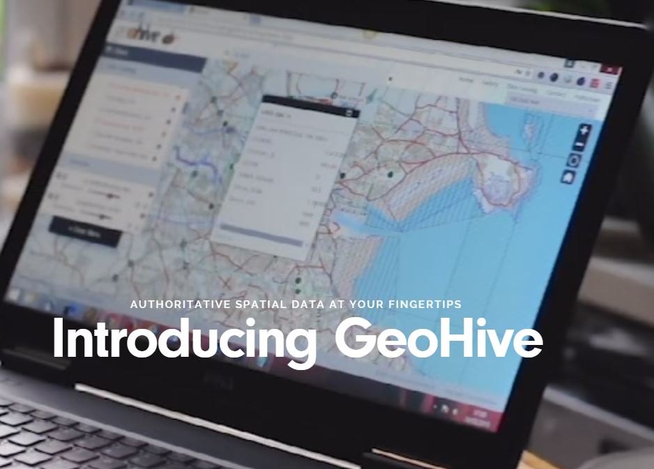
Tuesday, 3rd November 2015: GeoHive, a free platform which enables people to combine and layer location-based information from a range of public sector bodies has today been launched by Minister for Communications, Energy and Natural Resources, Alex White TD.

An initiative of Ordnance Survey Ireland (OSi), GeoHive provides easy access to definitive, trusted and maintained spatial data services from a range of public sector bodies.

The ‘Economic assessment of Ireland’s Geospatial Industry’ report commissioned by OSi, estimated that the use of geospatial or location-based information accrues annual savings of €82m in the public sector, time savings with an economic value of €279m, and competition benefits of €104m.

According to OSi Chief Executive Colin Bray, “Accurate information helps us all to make better decisions. GeoHive will allow citizens, the public service and business to realise the benefits which we know can be derived from using geospatial information”.

Mr Bray explained that “GeoHive is designed to allow users to join or ‘mash-up’ information on a map, providing a deeper understanding of topics that impact our lives. For example, one of the stories we tell with GeoHive – called Buying a Property in Ireland – gathers together data from many different sources to enable people to view that information in a single site to assist with the evaluation of one location to another. The information presented includes property prices, transport, education and planning”.

“GeoHive is an important development for OSi. The portal replaces the existing map viewer on the OSi website which has attracted over 1.5m unique visitors a year. It represents the first time OSi has developed a collaborative service to meet the needs of its user community”, added Mr Bray.

Minister White welcomed the launch of GeoHive saying that “ GeoHive is going to help us modernise public service delivery by providing a free and accessible portal where it’s easy to find, share and use the State’s location data. With data on education, population, travel times, commuting patterns, and the labour force in specific towns and cities, it will also provide businesses with information that will help them make investment decisions. This will add to our competitive advantage and help us to further promote Ireland as a good place to create jobs and do business. GeoHive showcases the innovation at the heart of the Irish public service.”

GeoHive can be accessed on all platforms – PC, tablet and smart phone. Users will be able to create and share access to web maps that they have created via social platforms such as email, Facebook, Twitter, LinkedIn and more.

eoHive is an initiative by Ordnance Survey Ireland to provide easy access to publically available spatial data

eoHive is an initiative by Ordnance Survey Ireland to provide easy access to publically available spatial data

GeoHive can be accessed at www.geohive.ie

Related Articles on GISuser:

  • Get started and and break things! US Open Data – Dat Goes BetaGet started and and break things! US Open Data – Dat Goes Beta
  • Data Visualization Recognizes Canada’s Open Data Portals and a Move Towards #OpenGovData Visualization Recognizes Canada’s Open Data Portals and a Move Towards #OpenGov
  • #OpenGov Tip – The Province of BC on GitHub#OpenGov Tip – The Province of BC on GitHub
  • City of Durham and Durham County Governments (N.C.) Choose Paris-Based OpenDataSoft to Power Emerging Open Data InitiativeCity of Durham and Durham County Governments (N.C.) Choose Paris-Based OpenDataSoft to Power Emerging Open Data Initiative
  • Improved Search and QuickFacts Enhance Census Bureau’s WebsiteImproved Search and QuickFacts Enhance Census Bureau’s Website
  • Poll – Share Your Comments on OpenGov and OpenData Poll – Share Your Comments on OpenGov and OpenData

Filed Under: DATA, DATA FEATURES, Government & OpenGov Tagged With: GeoHive, opendata, OpenGov


Editor’s Picks

Data Tip - The US Interagency Elevation Inventory

Data Tip – The US Interagency Elevation Inventory

Microsoft unveils the future of Windows

Global Mapper 17.2 Released with New Map Book Creation Tool and Cutaway Terrain View

47th Annual Magnet States Report — Where Did America Move in 2014?

See More Editor's Picks...

Feed

  • RSS


GIS jobs


Recent Features

Digitalization and Simulation at the North Pole

Natural Gas District & GIS-Centric Asset Management

5 Ways Technology Is Affecting The Sharing Economy

Spotlight – Township Canada: Explore Canadian Legal Land Descriptions on a Map

GeoGeeksinCars – The one in “Tippy” the right-hand drive Mitsubishi, at DevSummit

More Posts from this Category

Categories

Recent Posts

  • The ICC Cricket World Cup Betting – Facts and Betting Tips
  • Blog Title: How eGov Platform Automating Citizen Services
  • A treadmill is one of the most popular fitness equipment
  • 3 Things to Help You Become a Software Engineer
  • Esri Announces Winners of the 2022 ArcGIS Online Competition

RSS Career Tips

  • Four Characteristics of the Best Virtual Employees
  • 8 Questions Employers Should Ask About Coronavirus
  • Jobcase Launches Free Unemployment Resource Center for Workers Impacted by COVID-19
  • Must-Have Gadgets and Technology for the Remote Office Worker
  • Must-Have Gadgets and Technology for the Remote Office Worker


shop for geogeek swag

RSS Tech pubs

  • Top Tips and Tricks: Windows 11
  • The 2022 State of the Data Center Report
  • What is Network Security?

RSS Computers

  • The Essentials of Information Security Kit: Includes a Free PC Security Handbook - 2nd Edition eBook
  • The Idiot's Ultimate Guide to Build Your Own PC
  • Windows... On Speed

RSS HR Tips

  • Measuring and Managing Employee Experience
  • At Work: The 2022 Workplace Trends Report
  • The 2022 Guide To Creating A Great Visitor Experience

RSS Gov Tech

  • The Bipartisan Infrastructure Bill: How you can win more bids
  • How Connected Vehicle Data Can Transform Public Sector Decision-Making
  • Getting started with personalization at scale

RSS UAV news

  • Draganfly Deploys Versatile Situational Assessment Drones to Ukraine
  • Ocean Specialists Inc. Launches “USVs as a Service” Business Line
  • UAS Drone Subsidiary, Duke Robotics’, Sniper Drone showcased at a leading International Airshow in the Asia Pacific Region

RSS Geojobs

  • IT Endpoint Lead
Copyright Spatial Media LLC 2003 - 2015