GIS user technology news

News, Business, AI, Technology, IOS, Android, Google, Mobile, GIS, Crypto Currency, Economics

  • Advertising & Sponsored Posts
    • Advertising & Sponsored Posts
    • Submit Press
  • PRESS
    • Submit PR
    • Top Press
    • Business
    • Software
    • Hardware
    • UAV News
    • Mobile Technology
  • FEATURES
    • Around the Web
    • Social Media Features
    • EXPERTS & Guests
    • Tips
    • Infographics
  • Blog
  • Events
  • Shop
  • Tradepubs
  • CAREERS
You are here: Home / * PRESS / DATA / Data Tip – The US Interagency Elevation Inventory

Data Tip – The US Interagency Elevation Inventory

September 11, 2015 By GISuser

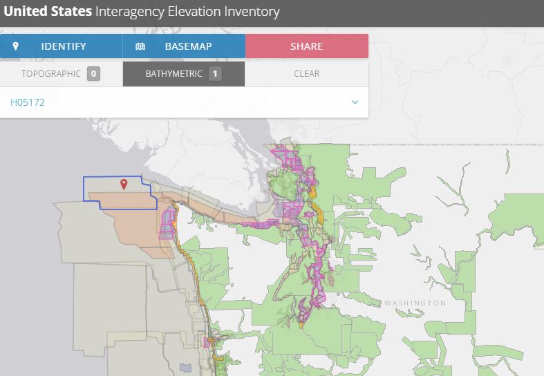
The USGS liaisons are updating the United States Interagency Elevation Inventory (https://coast.noaa.gov/inventory/#).  This resource also provides a wealth of information and data

Data Tip - The US Interagency Elevation Inventory

Data Tip – The US Interagency Elevation Inventory

This web service provides users with access to data including: topo LiDAR, shoreline data, bathymetric LiDAR, hydrographic surveys and much more – see the resource HERE

About the service:

The U.S. Interagency Elevation Inventory displays high-accuracy topographic and bathymetric data for the United States and its territories. The project is a collaborative effort of NOAA and the U.S. Geological Survey, with contributions from the Federal Emergency Management Agency, U.S. Department of Agriculture, and U.S. Army Corps of Engineers. This resource is a comprehensive, nationwide listing of known high-accuracy topographic data, including lidar and IfSAR, and bathymetric data, including NOAA hydrographic surveys, multibeam data, and bathymetric lidar.

The information provided for each elevation dataset includes many attributes such as vertical accuracy, point spacing, and date of collection. The last comprehensive update to the topographic portion of the inventory was completed in March 2015. However, many corrections and additions are made between comprehensive updates. Bathymetric data are current as of November 2012. These data are static snapshots of availability that will soon be replaced with a dynamic map service.

For more data see also the DigitalCoast

Filed Under: DATA, DATA FEATURES, GISuser Promotion, Government & OpenGov, Tips, Top Press Tagged With: bathymetry, elevation, lidar, NOAA

Editor’s Picks

FireWhat? Mobile GIS Lab, Emergency Incident Mapping and HP Mobile Workstations

Social Guide – The Definitive Starting Point for Mastering your Twitter Analytics

CoreLogic Data Reveals Wildfires Pose Big Risk to Nearly 900,000 Western US Homes in 2015

Tripomatic – Custom Maps Built entirely with OpenSource Mapping Tools

See More Editor's Picks...

Recent Industry News

Increase Rev vs. Google AdSense: Unlocking 50%–200% Higher Earnings

August 17, 2026 By GISuser

From Simulator to Open Air: A Practical Start to FPV Flying Safely

August 14, 2026 By GISuser

Pop-Up Card Wallets vs Traditional Slim Wallets: Which Is Better?

August 11, 2026 By GISuser

Comment les PME et commerçants du Québec optimisent la livraison du dernier kilomètre pour fidéliser leurs clients

August 8, 2026 By GISuser

Hot News

State of Data Science Report – AI and Open Source at Work

HERE and AWS Collaborate on New HERE AI Mapping Solutions

Virtual Surveyor Adds Productivity Tools to Mid-Level Smart Drone Surveying Software Plan

Categories

Copyright gletham Communications 2015 - 2026

Go to mobile version