GIS user technology news

News, Business, AI, Technology, IOS, Android, Google, Mobile, GIS, Crypto Currency, Economics

  • Advertising & Sponsored Posts
    • Advertising & Sponsored Posts
    • Submit Press
  • PRESS
    • Submit PR
    • Top Press
    • Business
    • Software
    • Hardware
    • UAV News
    • Mobile Technology
  • FEATURES
    • Around the Web
    • Social Media Features
    • EXPERTS & Guests
    • Tips
    • Infographics
  • Around the Web
  • Events
  • Shop
  • Tradepubs
  • CAREERS
You are here: Home / * PRESS / People, Hires, Career Tips / Dr. Mark Whorton to manage US operations as President of Teledyne Optech, Inc

Dr. Mark Whorton to manage US operations as President of Teledyne Optech, Inc

August 18, 2015 By GISuser

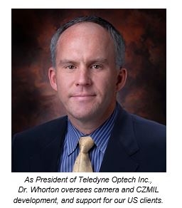
August 18, 2015 — Teledyne Optech is pleased to announce that Dr. Mark Whorton has assumed the role of President of the US organization Teledyne Optech, Inc. In this role, Dr. Whorton will oversee US operations and apply his expertise to the development of the Optech Coastal Zone Mapping and Imaging Lidar (CZMIL) and our line of digital aerial cameras.

Dr. Mark Whorton to manage US operations as President of Teledyne Optech, Inc.

Dr. Whorton has been serving Teledyne Brown Engineering (TBE) as Chief Technology Officer since October 2014 and previously as Director, Commercial Earth Imaging. He is the Principal Investigator for the Multiple User System for Earth Sensing (MUSES) instrument pointing system for the International Space Station (ISS) and led the origination of Teledyne’s efforts in commercial Earth imaging. Dr. Whorton earned a Ph.D. in Aerospace Engineering from the Georgia Institute of Technology, and prior to joining Teledyne in 2009 he served as Chief of the Guidance, Navigation, and Mission Analysis Branch at the NASA Marshall Space Flight Center where he was a subject matter expert in dynamics and control of space systems. Dr. Whorton will continue his work on MUSES as CTO at TBE while he joins Teledyne Optech.

“We are excited to have Dr. Whorton applying his leadership skills at Teledyne Optech,” said Don Carswell. “His expertise in passive sensors from the MUSES project will benefit the CS line of cameras developed at our New York office and the Optech CZMIL lidar/hyperspectral bathymeter developed at our Mississippi office.”

“I am extremely excited about the opportunity to join Teledyne Optech and help continue the technical excellence that makes Teledyne Optech such an important part of the broader Teledyne family of companies,” said Dr. Whorton. “We at Teledyne Optech have a talented team and unique products, which I look forward to further developing in the US marketplace.”

Find out more at www.teledyneoptech.com.

About Teledyne Optech

Teledyne Optech is the world leader in high-accuracy lidar 3D survey systems, integrated cameras, and productivity-enhancing workflows. With operations and staff worldwide, Teledyne Optech offers both standalone and fully integrated lidar and camera solutions for airborne mapping, airborne lidar bathymetry, mobile mapping, terrestrial laser scanning, mine cavity monitoring, and industrial process control, as well as space-proven sensors. Teledyne Optech systems are also fully warrantied, with extended warranty packages offered by Optech Technical Solutions. Accuracy and productivity matter!

www.teledyneoptech.com

Filed Under: People, Hires, Career Tips Tagged With: Inc., Teledyne Optech

Editor’s Picks

Free Data from USGS Proves Its Worth for Observing Earth

Reading – Reduce Your Open Source Security Risk

Twitter feed and map provide real-time water, weather and flood forecasting for Texas

Tripomatic – Custom Maps Built entirely with OpenSource Mapping Tools

See More Editor's Picks...

Recent Posts

  • EzRemove’s Background Remover vs Transparent Background Maker — AI Tools for Effortless Image Editing in 2025
  • Top Luxury Tours in Ghana for a Unique Travel Experience
  • How to Monitor Performance of GIS and Mapping Apps Across Different Regions and Network Conditions
  • 5 Compliance Risks Your EMR Audit Tool Can Catch Before an External Audit
  • Apartment Movers in Abu Dhabi | Reliable Moving Services
  • 11 Best Ways to Farm Rare Brainrots in Steal a Brainrot
  • Navigating the Digital Casino: A Modern Guide to Security and Responsibility in Online Slots
  • Decode the Hidden Value of Your Old Vehicle and Turn It from Scrap to Cash
  • 8 Live Dealer Game Formats You’ll Find in Malaysia
  • The Complete Guide to the UK ETA Application for First-Time Travelers

Recent Features

Space Flight Laboratory (SFL) Announces Successful Launch & Deployment of HawkEye 360’s Cluster 11

FOSS4G NA 2024: The Premier Open Source Geospatial Conference Returns to St. Louis, September 9-11

Photographer Touch Reveal the Top Cameras, Lenses, and Photo Editing Tools of 2022

Digitalization and Simulation at the North Pole

Natural Gas District & GIS-Centric Asset Management

More Posts from this Category

Categories

RSS Career Tips

  • Four Characteristics of the Best Virtual Employees
  • 28 Tools to Conquer the Social Media Recruiting World
  • 8 Questions Employers Should Ask About Coronavirus
  • Jobcase Launches Free Unemployment Resource Center for Workers Impacted by COVID-19
  • Must-Have Gadgets and Technology for the Remote Office Worker


featured podcast

RSS Tech pubs

  • The Four Critical Pillars of Intent-aware FinOps
  • 4 Common FinOps Mistakes and How to Avoid Them
  • O'Reilly Cloud FinOps, 2nd Edition

RSS Computers

  • How the Cloud is Reshaping Virtual Desktops
  • Millennials as Brand Advocates - New Research Study Results
  • Vehicles Best Practices Installation Guide

RSS HR Tips

  • AWS GovCloud (US) Celebrates 10th Anniversary and a Decade of Digital Transformation in the Federal Government
  • Exploring the Impact of COVID-19 on Customer Behavior
  • The Pivot to 100% Remote Training in the Contact Center

RSS Gov Tech

  • 10 Legal Jobs You Can Get Without a Law Degree
  • J.D. Power Examines How the Inflation Reduction Act Reshapes EV Landscape
  • Making Telehealth Work for You: The Ultimate Guide

Copyright Spatial Media LLC 2003 - 2015

Go to mobile version